Alipur, Jhalokati: Difference between revisions
Appearance
Content deleted Content added
m BOT: Checking dead links; Added 1 archived Wayback link |
No edit summary |
||
| (4 intermediate revisions by 4 users not shown) | |||
| Line 1: | Line 1: | ||
| ⚫ | |||
{{Orphan|date=February 2009}} |
|||
| ⚫ | |||
| ⚫ | |||
| ⚫ | |||
<!-- Basic info ----------------> |
<!-- Basic info ----------------> |
||
|official_name = Alipur, Jhalokati District |
|official_name = Alipur, Jhalokati District |
||
| Line 15: | Line 14: | ||
|image_flag = |
|image_flag = |
||
|flag_size = |
|flag_size = |
||
|image_seal = |
|||
|seal_size = |
|||
|image_shield = |
|||
|shield_size = |
|||
|image_blank_emblem = |
|||
|blank_emblem_type = |
|||
|blank_emblem_size = |
|||
|image_map = |
|image_map = |
||
|mapsize = |
|mapsize = |
||
| Line 37: | Line 29: | ||
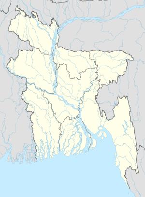
|pushpin_map_caption =Location in Bangladesh |
|pushpin_map_caption =Location in Bangladesh |
||
<!-- Location ------------------> |
<!-- Location ------------------> |
||
|coordinates_display = inline,title |
|||
|coordinates_region = BD |
|||
|subdivision_type = Country |
|subdivision_type = Country |
||
|subdivision_name = {{flag|Bangladesh}} |
|subdivision_name = {{flag|Bangladesh}} |
||
| Line 104: | Line 94: | ||
|population_blank2 = |
|population_blank2 = |
||
|population_density_blank1_km2 = |
|population_density_blank1_km2 = |
||
|population_density_blank1_sq_mi = |
|||
<!-- General information ---------------> |
<!-- General information ---------------> |
||
|timezone = [[Bangladesh Standard Time|Bangladesh Time]] |
|timezone = [[Bangladesh Standard Time|Bangladesh Time]] |
||
|utc_offset = +6 |
|utc_offset = +6 |
||
|coordinates = {{coord|22|41|N|90|12|E|region:BD|display=inline,title}} |
|||
|timezone_DST = |
|||
|utc_offset_DST = |
|||
|latd=22 |latm=41|lats= |latNS=N |
|||
|longd=90|longm=12|longs=|longEW=E |
|||
|elevation_footnotes = <!--for references: use <ref> </ref> tags--> |
|elevation_footnotes = <!--for references: use <ref> </ref> tags--> |
||
|elevation_m = |
|elevation_m = |
||
| Line 126: | Line 112: | ||
|footnotes = |
|footnotes = |
||
}} |
}} |
||
''' |
'''Alipur, Jhalokati''' is a village in [[Jhalokati District]] in the [[Barisal Division]] of southern-central [[Bangladesh]].<ref>{{cite web| url=http://geonames.nga.mil/ggmagaz/ |title=NGA GeoNames Database |publisher=[[National Geospatial-Intelligence Agency]] |accessdate=2008-07-14}}</ref> |
||
==References== |
==References== |
||
| Line 133: | Line 118: | ||
==External links== |
==External links== |
||
*[http://www.maplandia.com/bangladesh/barisal-div/jhalakati-zl/alipur/ Satellite map at Maplandia.com] |
* [http://www.maplandia.com/bangladesh/barisal-div/jhalakati-zl/alipur/ Satellite map at Maplandia.com] |
||
| ⚫ | |||
| ⚫ | |||
| ⚫ | |||
| ⚫ | |||
Latest revision as of 00:14, 17 November 2017
Alipur, Jhalokati District | |
|---|---|
| Coordinates: 22°41′N 90°12′E / 22.683°N 90.200°E | |
| Country | |
| Division | Barisal Division |
| District | Jhalokati District |
| Time zone | UTC+6 (Bangladesh Time) |
Alipur, Jhalokati is a village in Jhalokati District in the Barisal Division of southern-central Bangladesh.[1]
References
[edit]- ^ "NGA GeoNames Database". National Geospatial-Intelligence Agency. Retrieved 2008-07-14.
External links
[edit]

