Unión, Guanacaste: Difference between revisions
Appearance
Content deleted Content added
m WP:CHECKWIKI error fixes / special characters in pagetitle using AWB (9485) |
No edit summary |
||
| (4 intermediate revisions by 4 users not shown) | |||
| Line 1: | Line 1: | ||
{{Infobox |
{{Infobox settlement |
||
<!--See |
<!-- See Template:Infobox settlement for additional fields and descriptions --> |
||
<!-- Basic info ----------------> |
<!-- Basic info ----------------> |
||
|official_name =Unión |
|official_name =Unión |
||
| Line 61: | Line 61: | ||
|timezone_DST = |
|timezone_DST = |
||
|utc_offset_DST = |
|utc_offset_DST = |
||
|coordinates = {{coord|10|30|N|84|51|W|region:CR_type:city|display=inline,title}} |
|||
|latd=10|latm=30|lats=|latNS=N |
|||
|longd=84|longm=51|longs=|longEW=W |
|||
|coordinates_type = region:CR_type:city |
|||
|coordinates_display = display=inline,title |
|||
|elevation_footnotes = <!--for references: use <ref> </ref> tags--> |
|elevation_footnotes = <!--for references: use <ref> </ref> tags--> |
||
|elevation_m = |
|elevation_m = |
||
| Line 83: | Line 80: | ||
==References== |
==References== |
||
{{reflist}} |
{{reflist}} |
||
==External links== |
|||
*[http://www.maplandia.com/costa-rica/lag-arenal/lag-arenal/union/ Maplandia] |
|||
{{DEFAULTSORT:Union, Guanacaste}} |
{{DEFAULTSORT:Union, Guanacaste}} |
||
| ⚫ | |||
[[Category:Lake Arenal]] |
[[Category:Lake Arenal]] |
||
| ⚫ | |||
Latest revision as of 05:45, 20 November 2017
Unión | |
|---|---|
| Coordinates: 10°30′N 84°51′W / 10.500°N 84.850°W | |
| Country | |
| Province | Guanacaste Province |
| Canton | Tilaran |
| Time zone | UTC-6 (UTC -6) |
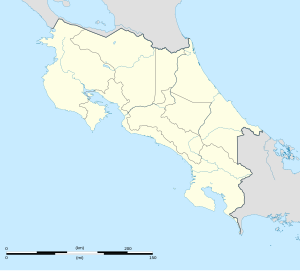
Unión is a village in the Guanacaste Province, Costa Rica. It is located on the east shore of Lake Arenal. Nearby, to the north of the village are the Arenal Botanical Gardens.[1]
References
[edit]- ^ Baker, C.P. (2005). Costa Rica. Dorling Kindersley Eye Witness Travel Guides. pp. 150–1.

