Pico de Tenerife: Difference between revisions
Appearance
Content deleted Content added
m Bot: Migrating 1 interwiki links, now provided by Wikidata on d:Q16618839 |
No edit summary |
||
| (3 intermediate revisions by 2 users not shown) | |||
| Line 6: | Line 6: | ||
| prominence_m = |
| prominence_m = |
||
| prominence_ref = |
| prominence_ref = |
||
| map = |
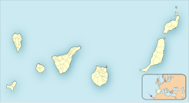
| map =Spain Canary Islands |
||
| map_caption = |
| map_caption = |
||
| map_size = |
| map_size = |
||
| Line 12: | Line 12: | ||
| location = [[El Hierro]], [[Spain]] |
| location = [[El Hierro]], [[Spain]] |
||
| range = |
| range = |
||
| |
| coordinates = |
||
| long_d = |
|||
| region_code = |
|||
| coordinates_ref = |
| coordinates_ref = |
||
| topo = |
| topo = |
||
Latest revision as of 19:15, 23 April 2019
| Pico de Tenerife | |
|---|---|
| Highest point | |
| Elevation | 1,253 m (4,111 ft) |
| Prominence | 1,253 m (4,111 ft) |
| Geography | |
| Location | El Hierro, Spain |
The Pico de Tenerife is 1,253 meters, the second highest altitude of the island of El Hierro, Canary Islands, Spain, after the Pico de Malpaso with 1,501 meters in height.[1]

