Alberbury with Cardeston: Difference between revisions
Appearance
Content deleted Content added
No edit summary |
m Date formats |
||
| (31 intermediate revisions by 23 users not shown) | |||
| Line 1: | Line 1: | ||
{{Use dmy dates|date=September 2019}} |
|||
| ⚫ | '''Alberbury with Cardeston''' is a [[ |
||
{{Infobox UK place |
|||
|country = England |
|||
|static_image_name = Bend In The Lane - geograph.org.uk - 666978.jpg |
|||
|static_image_caption = Near [[Wollaston, Shropshire|Wollaston]] and the Welsh border in the parish of Alberbury with Cardeston. |
|||
|coordinates = {{coord|52.715|-2.901|display=inline,title}} |
|||
|official_name = Alberbury with Cardeston |
|||
|population = 1,011 |
|||
|population_ref = (2011) |
|||
|civil_parish = Alberbury with Cardeston |
|||
|shire_district = |
|||
|shire_county = [[Shropshire]] |
|||
|region = West Midlands |
|||
|constituency_westminster= [[Shrewsbury and Atcham (UK Parliament constituency)|Shrewsbury and Atcham]] |
|||
|post_town = Shrewsbury |
|||
|postcode_district = SY5 |
|||
|postcode_area = SY |
|||
|dial_code = |
|||
|os_grid_reference = SJ391134 |
|||
}} |
|||
| ⚫ | '''Alberbury with Cardeston''' is a [[Civil parishes in England|civil parish]] in [[Shropshire]], [[England]]. According to the 2001 census it had a population of 645 (though in 2005 the parish expanded with the annexation of half of the former Wollaston parish), increasing to 1,011 at the 2011 Census.<ref>{{cite web|url=http://www.neighbourhood.statistics.gov.uk/dissemination/LeadKeyFigures.do?a=7&b=11119868&c=SY5+9EL&d=16&e=62&g=6460927&i=1001x1003x1032x1004&m=0&r=0&s=1447326907375&enc=1|title=Civil Parish population 2011|accessdate=12 November 2015}}</ref> It includes the villages and hamlets of [[Alberbury]], [[Cardeston]], [[Little Shrawardine]], [[Wollaston, Shropshire|Wollaston]], [[Halfway House, Shropshire|Halfway House]], [[Wattlesborough Heath]] and [[Rowton, Shropshire|Rowton]], and has [[Alberbury Castle]] and [[Wattlesborough Castle]] within its borders. To the west the parish borders [[Wales]], whilst to the north it is bounded by the [[River Severn]]. |
||
| ⚫ | |||
[http://www.shrewsbury.gov.uk/Public/Parish/AlberburyWithCardeston/ Parish Information] |
|||
==See also== |
|||
*[[Listed buildings in Alberbury with Cardeston]] |
|||
==References== |
|||
| ⚫ | |||
{{Reflist}} |
|||
| ⚫ | |||
| ⚫ | |||
* [http://www.alberburywithcardeston.co.uk/1.html Parish Council Website] |
|||
{{Shropshire}} |
|||
| ⚫ | |||
[[Category:Shrewsbury and Atcham]] |
|||
| ⚫ | |||
Latest revision as of 17:36, 13 September 2019
| Alberbury with Cardeston | |
|---|---|
 Near Wollaston and the Welsh border in the parish of Alberbury with Cardeston. | |
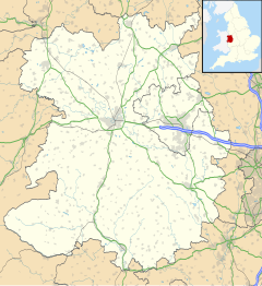
Location within Shropshire | |
| Population | 1,011 (2011) |
| OS grid reference | SJ391134 |
| Civil parish |
|
| Shire county | |
| Region | |
| Country | England |
| Sovereign state | United Kingdom |
| Post town | Shrewsbury |
| Postcode district | SY5 |
| Police | West Mercia |
| Fire | Shropshire |
| Ambulance | West Midlands |
| UK Parliament | |
Alberbury with Cardeston is a civil parish in Shropshire, England. According to the 2001 census it had a population of 645 (though in 2005 the parish expanded with the annexation of half of the former Wollaston parish), increasing to 1,011 at the 2011 Census.[1] It includes the villages and hamlets of Alberbury, Cardeston, Little Shrawardine, Wollaston, Halfway House, Wattlesborough Heath and Rowton, and has Alberbury Castle and Wattlesborough Castle within its borders. To the west the parish borders Wales, whilst to the north it is bounded by the River Severn.
See also
[edit]References
[edit]- ^ "Civil Parish population 2011". Retrieved 12 November 2015.
External links
[edit]

