San Hilarion District: Difference between revisions
Appearance
Content deleted Content added
KylieTastic (talk | contribs) m Fixed broken (red-linked) image |
|||
| (4 intermediate revisions by 4 users not shown) | |||
| Line 1: | Line 1: | ||
{{Infobox |
{{Infobox settlement |
||
<!-- See Template:Infobox |
<!-- See Template:Infobox settlement for additional fields and descriptions --> |
||
| name = San Hilarion |
| name = San Hilarion |
||
| native_name = |
| native_name = |
||
| Line 16: | Line 16: | ||
| mapsize = frameless |
| mapsize = frameless |
||
| map_alt = |
| map_alt = |
||
| map_caption = Location of San Hilarion in the [[Picota Province |
| map_caption = Location of San Hilarion in the [[Picota Province]] |
||
| latd = |latm = |lats = |latNS = |
|||
| longd = |longm = |longs = |longEW = |
|||
| coor_pinpoint = |
| coor_pinpoint = |
||
| |
| coordinates = |
||
| coordinates_display = inline,title |
|||
| coordinates_footnotes = |
| coordinates_footnotes = |
||
| coordinates_region = PE |
|||
| subdivision_type = [[List of sovereign states|Country]] |
| subdivision_type = [[List of sovereign states|Country]] |
||
| subdivision_name = {{flag|Peru}} |
| subdivision_name = {{flag|Peru}} |
||
| Line 59: | Line 55: | ||
}} |
}} |
||
'''San Hilarion District''' is one of ten [[Districts of Peru|districts]] of the province [[Picota Province|Picota]] in [[Peru]].<ref>{{ |
'''San Hilarion District''' is one of ten [[Districts of Peru|districts]] of the province [[Picota Province|Picota]] in [[Peru]].<ref>{{in lang|es}} [[Instituto Nacional de Estadística e Informática]]. ''[http://desa.inei.gob.pe/mapas/bid/ Banco de Información Distrital] {{webarchive|url=https://web.archive.org/web/20080423164200/http://desa.inei.gob.pe/mapas/bid/ |date=2008-04-23 }}''. Retrieved April 11, 2008.</ref> |
||
==References== |
==References== |
||
| Line 65: | Line 61: | ||
{{Districts of Picota Province}} |
{{Districts of Picota Province}} |
||
{{coord missing|Peru}} |
|||
{{SanMartín-geo-stub}} |
{{SanMartín-geo-stub}} |
||
{{coord|6.9993|S|76.4420|W|source:wikidata|display=title}} |
|||
Latest revision as of 02:31, 3 January 2020
San Hilarion | |
|---|---|
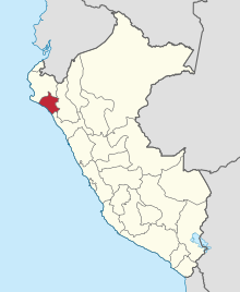
 Location of San Hilarion in the Picota Province | |
| Country | |
| Region | San Martín |
| Province | Picota |
| Founded | August 28, 1859 |
| Capital | San Cristóbal de Sisa |
| Government | |
| • Mayor | David Michael Melgar Manrique |
| Area | |
• Total | 96.55 km2 (37.28 sq mi) |
| Elevation | 195 m (640 ft) |
| Population | |
• Total | 4,242 |
| • Density | 44/km2 (110/sq mi) |
| Time zone | UTC-5 (PET) |
| UBIGEO | 220707 |
San Hilarion District is one of ten districts of the province Picota in Peru.[1]
References
[edit]- ^ (in Spanish) Instituto Nacional de Estadística e Informática. Banco de Información Distrital Archived 2008-04-23 at the Wayback Machine. Retrieved April 11, 2008.
