Barkerville Airport: Difference between revisions
Appearance
Content deleted Content added
No edit summary |
Rescuing 1 sources and tagging 0 as dead.) #IABot (v2.0.1 |
||
| (30 intermediate revisions by 16 users not shown) | |||
| Line 1: | Line 1: | ||
{{Infobox airport |
|||
{{Airport frame}} |
|||
| name = Barkerville Airport |
|||
| ⚫ | |||
{{Airport infobox| |
|||
| ICAO = |
|||
| ⚫ | |||
| TC = |
|||
ICAO=CAS3| |
|||
type=Public |
| type = Public |
||
| owner = |
|||
run by=Ministry of Community, Aboriginal & Women's Services| |
|||
| operator = Province of BC - Heritage Branch |
|||
| ⚫ | |||
| city-served = |
|||
elevation_ft=4,060| |
|||
| ⚫ | |||
elevation_m=1,237| |
|||
| timezone = [[Pacific Time Zone|PST]] |
|||
| ⚫ | |||
| utc = [[UTC−08:00]] |
|||
| summer = PDT |
|||
| utcs = [[UTC−07:00]] |
|||
| elevation-f = 4,060 |
|||
| ⚫ | |||
| pushpin_map = Canada British Columbia#Canada |
|||
| pushpin_label = CAS3 |
|||
| pushpin_map_caption = Location in British Columbia |
|||
| website = |
|||
| r1-number = 11/29 |
|||
| r1-length-f = 2,700 |
|||
| r1-surface = Asphalt |
|||
| footnotes = Source: [[Canada Flight Supplement]]<ref name="CFS">{{CFS}}</ref> |
|||
}} |
}} |
||
{{Runway title}} |
|||
{{Runway| |
|||
runway_angle=11/29| |
|||
runway_length_f=2,700| |
|||
runway_length_m=823| |
|||
runway_surface=[[Asphalt]]| |
|||
}} |
|||
{{Airport end frame}} |
|||
'''Barkerville Airport''', {{Airport codes| |
'''Barkerville Airport''', formerly {{Airport codes||||CAS3|p=n}}, was located {{convert|1.2|NM|lk=in}} north of [[Barkerville, British Columbia|Barkerville]], [[British Columbia]], Canada. |
||
==References== |
==References== |
||
{{reflist}} |
|||
==External links== |
|||
*[https://web.archive.org/web/20120309003819/http://archive.copanational.org/PlacesToFly/airport_view.php?pr_id=3&ap_id=832 Page about the Barkerville aerodrome on COPA's ''Places to Fly'' airport directory] |
|||
{{List of airports in Canada}} |
|||
{{authority control}} |
|||
[[Category: |
[[Category:Defunct airports in British Columbia]] |
||
[[Category:Cariboo Regional District]] |
|||
Latest revision as of 02:54, 27 June 2020
Barkerville Airport | |||||||||||
|---|---|---|---|---|---|---|---|---|---|---|---|
| Summary | |||||||||||
| Airport type | Public | ||||||||||
| Operator | Province of BC - Heritage Branch | ||||||||||
| Location | Barkerville, British Columbia | ||||||||||
| Time zone | PST (UTC−08:00) | ||||||||||
| • Summer (DST) | PDT (UTC−07:00) | ||||||||||
| Elevation AMSL | 4,060 ft / 1,237 m | ||||||||||
| Coordinates | 53°05′17″N 121°30′55″W / 53.08806°N 121.51528°W | ||||||||||
| Map | |||||||||||
 | |||||||||||
| Runways | |||||||||||
| |||||||||||
Source: Canada Flight Supplement[1] | |||||||||||
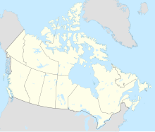
Barkerville Airport, formerly TC LID: CAS3, was located 1.2 nautical miles (2.2 km; 1.4 mi) north of Barkerville, British Columbia, Canada.
References
[edit]External links
[edit]


