Kologo: Difference between revisions
Appearance
Content deleted Content added
GreenC bot (talk | contribs) |
m Task 18 (cosmetic): eval 1 template: hyphenate params (2×); |
||
| (4 intermediate revisions by 4 users not shown) | |||
| Line 1: | Line 1: | ||
{{about| the village in Mali|the two-stringed lute instrument|Kologo (instrument)}} |
{{about| the village in Mali|the two-stringed lute instrument|Kologo (instrument)}} |
||
{{Infobox |
{{Infobox settlement |
||
<!--See the Table at Infobox Settlement for all fields and descriptions of usage--> |
|||
<!-- Basic info ----------------> |
<!-- Basic info ----------------> |
||
|name = Kologo |
|name = Kologo |
||
| Line 69: | Line 68: | ||
|timezone_DST = |
|timezone_DST = |
||
|utc_offset_DST = |
|utc_offset_DST = |
||
|coordinates = {{coord|11.223|N|7.491|W|region:ML_type:city|display=inline,title}} |
|||
|latd=11.223|latm=|lats= |latNS=N |
|||
|longd=7.491|longm=|longs=|longEW=W |
|||
|coordinates_type = region:ML_type:city |
|||
|coordinates_display = display=inline,title |
|||
|elevation_footnotes = <!--for references: use <ref> </ref> tags--> |
|elevation_footnotes = <!--for references: use <ref> </ref> tags--> |
||
|elevation_m = |
|elevation_m = |
||
| Line 87: | Line 83: | ||
|footnotes = |
|footnotes = |
||
}} |
}} |
||
'''Kologo''' is a village and seat of the [[Tiémala-Banimonotié|commune of Tiémala-Banimonotié]] in the [[Bougouni Cercle|Cercle of Bougouni]] in the [[Sikasso Region]] of southern [[Mali]].<ref>{{cite web|url=http://mali-reforme-telecom.mctmtl.com/previsions.pdf |title=Previsions de desserte des communes pour la periode de 2001-2005 |publisher=Mali Reforme Telecom | |
'''Kologo''' is a village and seat of the [[Tiémala-Banimonotié|commune of Tiémala-Banimonotié]] in the [[Bougouni Cercle|Cercle of Bougouni]] in the [[Sikasso Region]] of southern [[Mali]].<ref>{{cite web|url=http://mali-reforme-telecom.mctmtl.com/previsions.pdf |title=Previsions de desserte des communes pour la periode de 2001-2005 |publisher=Mali Reforme Telecom |access-date=February 12, 2009 |url-status=dead |archive-url=https://web.archive.org/web/20040829024117/http://mali-reforme-telecom.mctmtl.com/previsions.pdf |archive-date=August 29, 2004 }}</ref> The village is 25 km south of the town of [[Bougouni]], the administrative center for the cercle. |
||
==References== |
==References== |
||
| Line 94: | Line 90: | ||
{{Communes of the Sikasso Region}} |
{{Communes of the Sikasso Region}} |
||
[[Category:Populated places in |
[[Category:Populated places in Sikasso Region]] |
||
Latest revision as of 23:58, 2 January 2021
Kologo | |
|---|---|
Village | |
| Coordinates: 11°13′23″N 7°29′28″W / 11.223°N 7.491°W | |
| Country | |
| Region | Sikasso Region |
| Cercle | Bougouni Cercle |
| Commune | Tiémala-Banimonotié |
| Time zone | UTC+0 (GMT) |
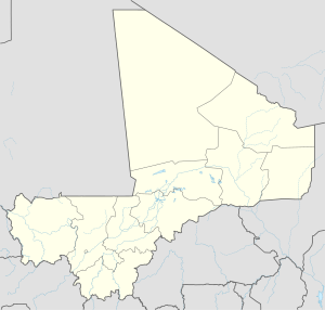
Kologo is a village and seat of the commune of Tiémala-Banimonotié in the Cercle of Bougouni in the Sikasso Region of southern Mali.[1] The village is 25 km south of the town of Bougouni, the administrative center for the cercle.
References
[edit]- ^ "Previsions de desserte des communes pour la periode de 2001-2005" (PDF). Mali Reforme Telecom. Archived from the original (PDF) on August 29, 2004. Retrieved February 12, 2009.


