Blackbird Caye Airstrip: Difference between revisions
Appearance
Content deleted Content added
removed redundant external links and trivia Tag: references removed |
m Adding short description: "Airstrip serving Turneffe Atoll, Belize" (Shortdesc helper) |
||
| Line 1: | Line 1: | ||
{{Short description|Airstrip serving Turneffe Atoll, Belize}} |
|||
{{Infobox airport |
{{Infobox airport |
||
| name = Blackbird Caye Airstrip |
| name = Blackbird Caye Airstrip |
||
Latest revision as of 13:03, 2 February 2022
Blackbird Caye Airstrip | |||||||||||
|---|---|---|---|---|---|---|---|---|---|---|---|
| Summary | |||||||||||
| Airport type | Private | ||||||||||
| Serves | Turneffe Atoll, Belize | ||||||||||
| Elevation AMSL | 10 ft / 3 m | ||||||||||
| Coordinates | 17°19′05″N 87°47′53″W / 17.31806°N 87.79806°W | ||||||||||
| Map | |||||||||||
 | |||||||||||
| Runways | |||||||||||
| |||||||||||
Source: GCM[1] | |||||||||||
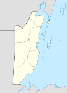
Blackbird Caye Airstrip (ICAO: MZBB) is an airstrip serving Turneffe Atoll, an atoll 38 kilometres (24 mi) off the coast of Belize. Blackbird Caye is on the eastern side of the atoll, and the airstrip runs along the shore. Approach and departure are over the water.
See also
[edit]References
[edit]- ^ Airport information for Blackbird Caye Airstrip at Great Circle Mapper.
External links
[edit]- Aerodromes in Belize - pdf

