Zimmersheim: Difference between revisions
Appearance
Content deleted Content added
rm presidential election results |
m replace {lang-??} templates with {langx|??} ‹See Tfd› (Replaced 1); |
||
| (5 intermediate revisions by one other user not shown) | |||
| Line 8: | Line 8: | ||
|image coat of arms = Blason de la ville de Zimmersheim (68).svg |
|image coat of arms = Blason de la ville de Zimmersheim (68).svg |
||
|arrondissement = Mulhouse |
|arrondissement = Mulhouse |
||
|canton = Brunstatt |
|canton = Brunstatt-Didenheim |
||
|INSEE = 68386 |
|INSEE = 68386 |
||
|postal code = 68440 |
|postal code = 68440 |
||
|mayor = Philippe Sturchler<ref>{{cite web|title=Répertoire national des élus: les maires|url=https://www.data.gouv.fr/fr/datasets/r/2876a346-d50c-4911-934e-19ee07b0e503|publisher=data.gouv.fr, Plateforme ouverte des données publiques françaises|date=13 September 2022|language=fr}}</ref> |
|||
|mayor = Philippe Sturchler |
|||
|term = 2020 |
|term = 2020–2026 |
||
|intercommunality = [[Mulhouse Alsace Agglomération]] |
|intercommunality = [[Mulhouse Alsace Agglomération]] |
||
|coordinates = {{coord|47.7203|7.3889|format=dms|display=inline,title}} |
|coordinates = {{coord|47.7203|7.3889|format=dms|display=inline,title}} |
||
| Line 25: | Line 25: | ||
}} |
}} |
||
'''Zimmersheim''' ({{ |
'''Zimmersheim''' ({{langx|gsw|Zímmersche}}) is a [[Communes of France|''commune'']] in the [[Haut-Rhin]] [[Departments of France|''department'']] of [[Alsace]] in eastern [[France]]. It forms part of the [[Mulhouse Alsace Agglomération]], the inter-communal local government body for the [[Mulhouse]] conurbation.<ref name=maahome>{{cite web | url = http://www.mulhouse-alsace.fr/ | title = Mulhouse Alsace Agglomération | publisher = Mulhouse Alsace Agglomération | access-date = 2011-04-07}}</ref> |
||
<gallery widths="160px" heights="200px"> |
<gallery widths="160px" heights="200px"> |
||
| Line 37: | Line 37: | ||
| cols = 2 |
| cols = 2 |
||
| percentages = pagr |
| percentages = pagr |
||
| source = EHESS (1793- |
| source = EHESS (1793-1999)<ref name=ehess>{{Cassini-Ehess|41458|Zimmersheim}}</ref> and INSEE<ref name=pophist>[https://www.insee.fr/fr/statistiques/7633058?geo=COM-68386#ancre-POP_T1 Population en historique depuis 1968], INSEE</ref> |
||
| graph-pos = bottom |
|||
|1793 |406 |
|1793 |406 |
||
|1800 |430 |
|1800 |430 |
||
| Line 51: | Line 50: | ||
|1861 |601 |
|1861 |601 |
||
|1866 |618 |
|1866 |618 |
||
| |
|1871 |605 |
||
| |
|1875 |555 |
||
| |
|1880 |578 |
||
| |
|1885 |550 |
||
| |
|1890 |523 |
||
| |
|1895 |523 |
||
| |
|1900 |509 |
||
| |
|1905 |488 |
||
| |
|1910 |435 |
||
|1921 |444 |
|1921 |444 |
||
|1926 |414 |
|1926 |414 |
||
| Line 72: | Line 71: | ||
|1990 |931 |
|1990 |931 |
||
|1999 |1024 |
|1999 |1024 |
||
|2005 |996 |
|||
|2006 |1006 |
|||
|2007 |1010 |
|||
|2008 |1051 |
|||
|2009 |1093 |
|2009 |1093 |
||
|2010 |1135 |
|||
|2011 |1122 |
|||
|2012 |1114 |
|||
|2013 |1090 |
|||
|2014 |1066 |
|2014 |1066 |
||
| |
|2020 |1053 |
||
|2016 |1026 |
|||
|2017 |1016 |
|||
|2018 |1028 |
|||
|2019 |1041 |
|||
}} |
}} |
||
Latest revision as of 17:46, 29 October 2024
Zimmersheim
Zímmersche | |
|---|---|
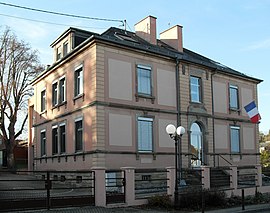
 The town hall and school in Zimmersheim | |
| Coordinates: 47°43′13″N 7°23′20″E / 47.7203°N 7.3889°E | |
| Country | France |
| Region | Grand Est |
| Department | Haut-Rhin |
| Arrondissement | Mulhouse |
| Canton | Brunstatt-Didenheim |
| Intercommunality | Mulhouse Alsace Agglomération |
| Government | |
| • Mayor (2020–2026) | Philippe Sturchler[1] |
Area 1 | 3.15 km2 (1.22 sq mi) |
| Population (2021)[2] | 1,059 |
| • Density | 340/km2 (870/sq mi) |
| Demonym(s) | Zimmersheimois, Zimmersheimoises |
| Time zone | UTC+01:00 (CET) |
| • Summer (DST) | UTC+02:00 (CEST) |
| INSEE/Postal code | 68386 /68440 |
| Elevation | 255–360 m (837–1,181 ft) (avg. 268 m or 879 ft) |
| 1 French Land Register data, which excludes lakes, ponds, glaciers > 1 km2 (0.386 sq mi or 247 acres) and river estuaries. | |
Zimmersheim (Alemannic German: Zímmersche) is a commune in the Haut-Rhin department of Alsace in eastern France. It forms part of the Mulhouse Alsace Agglomération, the inter-communal local government body for the Mulhouse conurbation.[3]
-
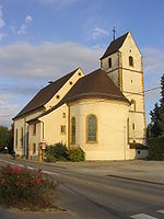
Church
Population
[edit]
|
| ||||||||||||||||||||||||||||||||||||||||||||||||||||||||||||||||||||||||||||||||||||||||||||||||||||||||||||||||||
| Source: EHESS (1793-1999)[4] and INSEE[5] | |||||||||||||||||||||||||||||||||||||||||||||||||||||||||||||||||||||||||||||||||||||||||||||||||||||||||||||||||||
See also
[edit]References
[edit]- ^ "Répertoire national des élus: les maires" (in French). data.gouv.fr, Plateforme ouverte des données publiques françaises. 13 September 2022.
- ^ "Populations légales 2021" (in French). The National Institute of Statistics and Economic Studies. 28 December 2023.
- ^ "Mulhouse Alsace Agglomération". Mulhouse Alsace Agglomération. Retrieved 2011-04-07.
- ^ Des villages de Cassini aux communes d'aujourd'hui: Commune data sheet Zimmersheim, EHESS (in French).
- ^ Population en historique depuis 1968, INSEE
Wikimedia Commons has media related to Zimmersheim.


