Chequamegon–Nicolet National Forest: Difference between revisions
Tags: Mobile edit Mobile app edit Android app edit |
SimLibrarian (talk | contribs) m Updated short description Tags: Mobile edit Mobile app edit iOS app edit App description change |
||
| (9 intermediate revisions by 9 users not shown) | |||
| Line 1: | Line 1: | ||
{{short description|Nature preserve in Wisconsin, U.S.}} |
|||
{{Infobox protected area |
{{Infobox protected area |
||
| iucn_category = VI |
| iucn_category = VI |
||
| name = Chequamegon–Nicolet National Forest |
| name = Chequamegon–Nicolet National Forest |
||
| photo = |
| photo = BlackjackSpringsWilderness.jpg |
||
| photo_caption = |
| photo_caption = [[Blackjack Springs Wilderness]] in the Nicolet National Forest |
||
| location = [[Wisconsin]], United States |
| location = [[Wisconsin]], United States |
||
| area_acre = 1534225 |
| area_acre = 1534225 |
||
| Line 14: | Line 15: | ||
}} |
}} |
||
The '''Chequamegon–Nicolet National Forest''' ({{IPAc-en|ʃ|ᵻ|ˈ|w|ɑː|m|ᵻ|ɡ|ən|_|ˌ|n|ɪ|k|ə|ˈ|l|eɪ}}; the ''q'' is silent)<ref>[http://www.misspronouncer.com/ Miss Pronouncer: Hear how to pronounce; The Wisconsin pronunciation guide for cities, counties, Indians & lawmakers<!-- Bot generated title -->]</ref> is a {{convert|1,530,647|acre|km2|adj=on}} [[U.S. National Forest]] in northern [[Wisconsin]] in the United States. |
The '''Chequamegon–Nicolet National Forest''' ({{IPAc-en|ʃ|ᵻ|ˈ|w|ɑː|m|ᵻ|ɡ|ən|_|ˌ|n|ɪ|k|ə|ˈ|l|eɪ}}; the ''q'' is silent)<ref>[http://www.misspronouncer.com/ Miss Pronouncer: Hear how to pronounce; The Wisconsin pronunciation guide for cities, counties, Indians & lawmakers<!-- Bot generated title -->]</ref> is a {{convert|1,530,647|acre|km2|adj=on}} [[U.S. National Forest]] in northern [[Wisconsin]] in the United States. Due to [[logging]] in the early part of the 20th century, very little [[old growth forest]] remains. Some of the trees there were planted by the [[Civilian Conservation Corps]] in the 1930s. The national forest land trees and vegetation are part of the [[Laurentian Mixed Forest Province|North Woods]] [[Ecoregion]] that prevails throughout the upper [[Great Lakes]] region. |
||
Legally two separate national forests—the '''Chequamegon National Forest''' and the '''Nicolet National Forest'''—the areas were established by presidential proclamations in 1933 and have been managed as one unit since 1998.<ref>{{cite web|title=United States Department of Agriculture Forest Service |url=https://www.fs.usda.gov/main/cnnf/about-forest |access-date=September 2, 2021}}</ref> |
Legally two separate national forests—the '''Chequamegon National Forest''' and the '''Nicolet National Forest'''—the areas were established by presidential proclamations in 1933 and have been managed as one unit since 1998.<ref>{{cite web|title=United States Department of Agriculture Forest Service |url=https://www.fs.usda.gov/main/cnnf/about-forest |access-date=September 2, 2021}}</ref> |
||
| Line 20: | Line 21: | ||
The Chequamegon National Forest comprises three units in the north-central part of the state totaling {{convert|865825|acre|km2}}. In descending order of forestland area, it is located in parts of [[Bayfield County, Wisconsin|Bayfield]], [[Ashland County, Wisconsin|Ashland]], [[Price County, Wisconsin|Price]], [[Sawyer County, Wisconsin|Sawyer]], [[Taylor County, Wisconsin|Taylor]], and [[Vilas County, Wisconsin|Vilas]] counties. Forest headquarters are in [[Rhinelander, Wisconsin|Park Falls]]. There are local [[National Park Ranger|ranger]] district offices in [[Glidden, Wisconsin|Glidden]], [[Hayward, Wisconsin|Hayward]], [[Medford, Wisconsin|Medford]], [[Park Falls, Wisconsin|Park Falls]], and [[Washburn, Wisconsin|Washburn]].<ref>{{Cite web |url=http://www.ufwda.org/pdfs/USDAForestServiceRangerDistricts.pdf |title=USFS Ranger Districts by State |access-date=2009-05-20 |archive-date=2012-01-19 |archive-url=https://web.archive.org/web/20120119235755/http://www.ufwda.org/pdfs/USDAForestServiceRangerDistricts.pdf |url-status=dead }}</ref> [[Moquah Barrens Research Natural Area]] is located with the Chequamegon.<ref>[http://www.nature.nps.gov/nnl/site.cfm?Site=MOBA-WI Moquah Barrens Research Natural Area]</ref> Lying within the Chequamegon are two officially designated wilderness areas of the [[National Wilderness Preservation System]]. These are the [[Porcupine Lake Wilderness]] and the [[Rainbow Lake Wilderness]]. |
The Chequamegon National Forest comprises three units in the north-central part of the state totaling {{convert|865825|acre|km2}}. In descending order of forestland area, it is located in parts of [[Bayfield County, Wisconsin|Bayfield]], [[Ashland County, Wisconsin|Ashland]], [[Price County, Wisconsin|Price]], [[Sawyer County, Wisconsin|Sawyer]], [[Taylor County, Wisconsin|Taylor]], and [[Vilas County, Wisconsin|Vilas]] counties. Forest headquarters are in [[Rhinelander, Wisconsin|Park Falls]]. There are local [[National Park Ranger|ranger]] district offices in [[Glidden, Wisconsin|Glidden]], [[Hayward, Wisconsin|Hayward]], [[Medford, Wisconsin|Medford]], [[Park Falls, Wisconsin|Park Falls]], and [[Washburn, Wisconsin|Washburn]].<ref>{{Cite web |url=http://www.ufwda.org/pdfs/USDAForestServiceRangerDistricts.pdf |title=USFS Ranger Districts by State |access-date=2009-05-20 |archive-date=2012-01-19 |archive-url=https://web.archive.org/web/20120119235755/http://www.ufwda.org/pdfs/USDAForestServiceRangerDistricts.pdf |url-status=dead }}</ref> [[Moquah Barrens Research Natural Area]] is located with the Chequamegon.<ref>[http://www.nature.nps.gov/nnl/site.cfm?Site=MOBA-WI Moquah Barrens Research Natural Area]</ref> Lying within the Chequamegon are two officially designated wilderness areas of the [[National Wilderness Preservation System]]. These are the [[Porcupine Lake Wilderness]] and the [[Rainbow Lake Wilderness]]. |
||
The Nicolet National Forest covers {{convert|664822|acre|km2}} of northeastern Wisconsin. It is located in parts of [[Forest County, Wisconsin|Forest]], [[Oconto County, Wisconsin|Oconto]], [[Florence County, Wisconsin|Florence]], [[Vilas County, Wisconsin|Vilas]], [[Langlade County, Wisconsin|Langlade]], and [[Oneida County, Wisconsin|Oneida]] counties. The forest headquarters are in [[Rhinelander, Wisconsin|Rhinelander]]. There are local ranger district offices in [[Eagle River, Wisconsin|Eagle River]], [[Florence (CDP), Wisconsin|Florence]], [[Lakewood, Wisconsin|Lakewood]], and [[Laona, Wisconsin|Laona]]. [[Bose Lake Hemlock Hardwoods]] and the [[Franklin Lake Campground]] are located in the Nicolet.<ref> |
The Nicolet National Forest covers {{convert|664822|acre|km2}} of northeastern Wisconsin. It is located in parts of [[Forest County, Wisconsin|Forest]], [[Oconto County, Wisconsin|Oconto]], [[Florence County, Wisconsin|Florence]], [[Vilas County, Wisconsin|Vilas]], [[Langlade County, Wisconsin|Langlade]], and [[Oneida County, Wisconsin|Oneida]] counties. The forest headquarters are in [[Rhinelander, Wisconsin|Rhinelander]]. There are local ranger district offices in [[Eagle River, Wisconsin|Eagle River]], [[Florence (CDP), Wisconsin|Florence]], [[Lakewood, Wisconsin|Lakewood]], and [[Laona, Wisconsin|Laona]]. [[Bose Lake Hemlock Hardwoods]] and the [[Franklin Lake Campground]] are located in the Nicolet.<ref>{{Cite web |url=http://www.nature.nps.gov/nnl/site.cfm?Site=BOLA-WI |title=Bose Lake Hemlock Hardwoods |access-date=2012-01-19 |archive-date=2016-03-05 |archive-url=https://web.archive.org/web/20160305012322/http://www.nature.nps.gov/nnl/site.cfm?Site=BOLA-WI |url-status=dead }}</ref><ref>{{Cite web |url=http://www.wisconsinhistory.org/hp/register/viewSummary.asp?refnum=88001573 |title=Franklin Lake Campground |access-date=2012-02-16 |archive-date=2016-03-04 |archive-url=https://web.archive.org/web/20160304211012/http://www.wisconsinhistory.org/hp/register/viewSummary.asp?refnum=88001573 |url-status=dead }}</ref> Lying within the Nicolet are three wildernesses—the [[Blackjack Springs Wilderness]], the [[Headwaters Wilderness]], and the [[Whisker Lake Wilderness]]. |
||
==Flora and |
==Flora, fauna, and funga== |
||
[[Image:Chequamegon.jpg |
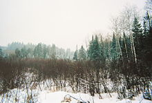
[[Image:Chequamegon.jpg|thumb|A wintry scene in Chequamegon–Nicolet National Forest]] |
||
[[Image:BarredOwl.jpg |
[[Image:BarredOwl.jpg|thumb|A [[barred owl]] along a highway in the Nicolet National Forest]] |
||
Remote areas of uplands, [[bog]]s, wetlands, [[muskeg]]s, rivers, streams, pine savannas, meadows and many glacial lakes are found throughout these forests. Native tree species include ''[[Acer saccharum]]'' (sugar maple), ''[[Acer rubrum]]'' (red maple), and ''[[Acer spicatum]]'' (mountain maple), [[Quercus alba|white]], [[Erythrobalanus|red]], and [[Quercus velutina|black oak]]s, [[aspen]], [[beech]], [[basswood]], [[sumac]], and [[Paper birch|paper]], [[Yellow birch|yellow]], and [[river birch]]. [[Coniferous trees]], including [[Red pine|red]], [[Eastern white pine|white]], and [[jack pine]], [[white spruce]] and [[balsam fir]] are abundant due to a dense second growth. [[Eastern hemlock]] are also present as this is the westernmost limit of its distribution. [[Tamarack]]/[[black spruce]] bogs, [[Eastern white cedar|cedar]] swamps and [[alder]] thickets are common. [[Blueberry|Blueberries]], [[Raspberry|raspberries]], [[Blackberry|blackberries]], [[Cranberry|cranberries]], [[Serviceberry|serviceberries]], [[fern]]s, [[moss]]es, [[cattail]]s, and [[mushroom]]s also grow here, as well as many more shrubs and wildflowers. |
Remote areas of uplands, [[bog]]s, wetlands, [[muskeg]]s, rivers, streams, pine savannas, meadows and many glacial lakes are found throughout these forests. Native tree species include ''[[Acer saccharum]]'' (sugar maple), ''[[Acer rubrum]]'' (red maple), and ''[[Acer spicatum]]'' (mountain maple), [[Quercus alba|white]], [[Erythrobalanus|red]], and [[Quercus velutina|black oak]]s, [[aspen]], [[beech]], [[basswood]], [[sumac]], and [[Paper birch|paper]], [[Yellow birch|yellow]], and [[river birch]]. [[Coniferous trees]], including [[Red pine|red]], [[Eastern white pine|white]], and [[jack pine]], [[white spruce]] and [[balsam fir]] are abundant due to a dense second growth. [[Eastern hemlock]] are also present as this is the westernmost limit of its distribution. [[Tamarack]]/[[black spruce]] bogs, [[Eastern white cedar|cedar]] swamps and [[alder]] thickets are common. [[Blueberry|Blueberries]], [[Raspberry|raspberries]], [[Blackberry|blackberries]], [[Cranberry|cranberries]], [[Serviceberry|serviceberries]], [[fern]]s, [[moss]]es, [[cattail]]s, and [[mushroom]]s also grow here, as well as many more shrubs and wildflowers. |
||
| Line 36: | Line 37: | ||
<gallery widths="180px" heights="120px"> |
<gallery widths="180px" heights="120px"> |
||
Image:P1000125.JPG|Early spring scene, near Clam Lake |
Image:P1000125.JPG|Early spring scene, near Clam Lake |
||
Image:BlackjackSpringsWilderness.jpg|[[Blackjack Springs Wilderness]] in the Nicolet National Forest |
|||
Image:Headwaters Wilderness.jpg|[[Headwaters Wilderness]] in the Nicolet National Forest, the Pine River |
Image:Headwaters Wilderness.jpg|[[Headwaters Wilderness]] in the Nicolet National Forest, the Pine River |
||
Image:Hidden Lakes Trail.jpg|Hidden Lakes Trail in the forest, about 10 miles (16 km) east of Eagle River |
Image:Hidden Lakes Trail.jpg|Hidden Lakes Trail in the forest, about 10 miles (16 km) east of Eagle River |
||
| Line 44: | Line 44: | ||
== See also == |
== See also == |
||
* [[List of national forests of the United States]] |
|||
* [[Lake Namakagon]] |
* [[Lake Namakagon]] |
||
| Line 58: | Line 59: | ||
{{DEFAULTSORT:Chequamegon-Nicolet National Forest}} |
{{DEFAULTSORT:Chequamegon-Nicolet National Forest}} |
||
[[Category:National |
[[Category:National forests of Wisconsin]] |
||
[[Category:Parks in Wisconsin]] |
[[Category:Parks in Wisconsin]] |
||
[[Category:Old-growth forests]] |
[[Category:Old-growth forests]] |
||
Latest revision as of 22:09, 17 October 2024
| Chequamegon–Nicolet National Forest | |
|---|---|
IUCN category VI (protected area with sustainable use of natural resources) | |
 Blackjack Springs Wilderness in the Nicolet National Forest | |
 | |
| Location | Wisconsin, United States |
| Area | 1,534,225 acres (6,208.79 km2)[1] |
| Established | 1933[2] |
| Governing body | U.S. Forest Service |
| Website | Chequamegon–Nicolet National Forest |
The Chequamegon–Nicolet National Forest (/ʃɪˈwɑːmɪɡən ˌnɪkəˈleɪ/; the q is silent)[3] is a 1,530,647-acre (6,194.31 km2) U.S. National Forest in northern Wisconsin in the United States. Due to logging in the early part of the 20th century, very little old growth forest remains. Some of the trees there were planted by the Civilian Conservation Corps in the 1930s. The national forest land trees and vegetation are part of the North Woods Ecoregion that prevails throughout the upper Great Lakes region.
Legally two separate national forests—the Chequamegon National Forest and the Nicolet National Forest—the areas were established by presidential proclamations in 1933 and have been managed as one unit since 1998.[4]
The Chequamegon National Forest comprises three units in the north-central part of the state totaling 865,825 acres (3,503.87 km2). In descending order of forestland area, it is located in parts of Bayfield, Ashland, Price, Sawyer, Taylor, and Vilas counties. Forest headquarters are in Park Falls. There are local ranger district offices in Glidden, Hayward, Medford, Park Falls, and Washburn.[5] Moquah Barrens Research Natural Area is located with the Chequamegon.[6] Lying within the Chequamegon are two officially designated wilderness areas of the National Wilderness Preservation System. These are the Porcupine Lake Wilderness and the Rainbow Lake Wilderness.
The Nicolet National Forest covers 664,822 acres (2,690.44 km2) of northeastern Wisconsin. It is located in parts of Forest, Oconto, Florence, Vilas, Langlade, and Oneida counties. The forest headquarters are in Rhinelander. There are local ranger district offices in Eagle River, Florence, Lakewood, and Laona. Bose Lake Hemlock Hardwoods and the Franklin Lake Campground are located in the Nicolet.[7][8] Lying within the Nicolet are three wildernesses—the Blackjack Springs Wilderness, the Headwaters Wilderness, and the Whisker Lake Wilderness.
Flora, fauna, and funga
[edit]

Remote areas of uplands, bogs, wetlands, muskegs, rivers, streams, pine savannas, meadows and many glacial lakes are found throughout these forests. Native tree species include Acer saccharum (sugar maple), Acer rubrum (red maple), and Acer spicatum (mountain maple), white, red, and black oaks, aspen, beech, basswood, sumac, and paper, yellow, and river birch. Coniferous trees, including red, white, and jack pine, white spruce and balsam fir are abundant due to a dense second growth. Eastern hemlock are also present as this is the westernmost limit of its distribution. Tamarack/black spruce bogs, cedar swamps and alder thickets are common. Blueberries, raspberries, blackberries, cranberries, serviceberries, ferns, mosses, cattails, and mushrooms also grow here, as well as many more shrubs and wildflowers.
White-tailed deer are numerous and are hit by motorists on roads in northern Wisconsin year-round. Black bears, foxes, raccoons, rabbits, beavers, river otters, squirrels, chipmunks, pheasants, grouse and wild turkeys are popular game in the woods. Elk and wolves have been reintroduced and there have been sightings of moose and pine marten.[9] Bird species include northern cardinal, blue jay, Canada jay, common raven, boreal and black-capped chickadees, black-backed and pileated woodpeckers, red-winged blackbirds, owls, ducks, common loons, bald eagles, evening grosbeaks, red and white-winged crossbills and many species of thrushes, sparrows and warblers. Brook trout, rainbow trout, and brown trout are found in many miles of excellent streams. Walleye, small and largemouth bass, crappie, northern pike, and many species of panfish make the area's lakes famous for freshwater fishing. A record making muskellunge, Wisconsin's state fish, was caught in these waters. The beauty, heritage, and recreational opportunities of these forests draw thousands of tourists to the Chequamegon–Nicolet area every year.
These national forests are best known for recreation, including camping, hiking, fishing, cross country skiing, and snowmobiling.
Clam Lake in Chequamegon National Forest was also home to one of the two extremely low frequency antennae in the United States.
Gallery
[edit]-
Early spring scene, near Clam Lake
-
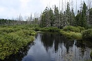
Headwaters Wilderness in the Nicolet National Forest, the Pine River
-
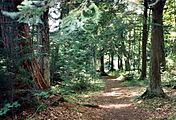
Hidden Lakes Trail in the forest, about 10 miles (16 km) east of Eagle River
-
Welcome sign greeting visitors to the forest
-
Ranger station in Washburn
See also
[edit]References
[edit]- ^ "Land Areas of the National Forest System" (PDF). U.S. Forest Service. January 2012. Retrieved June 30, 2012.
- ^ "The National Forests of the United States" (PDF). ForestHistory.org. Retrieved July 30, 2012.
- ^ Miss Pronouncer: Hear how to pronounce; The Wisconsin pronunciation guide for cities, counties, Indians & lawmakers
- ^ "United States Department of Agriculture Forest Service". Retrieved September 2, 2021.
- ^ "USFS Ranger Districts by State" (PDF). Archived from the original (PDF) on 2012-01-19. Retrieved 2009-05-20.
- ^ Moquah Barrens Research Natural Area
- ^ "Bose Lake Hemlock Hardwoods". Archived from the original on 2016-03-05. Retrieved 2012-01-19.
- ^ "Franklin Lake Campground". Archived from the original on 2016-03-04. Retrieved 2012-02-16.
- ^ "Archived copy" (PDF). Archived from the original (PDF) on 2006-10-01. Retrieved 2007-02-20.
{{cite web}}: CS1 maint: archived copy as title (link)
External links
[edit]![]() Media related to Chequamegon-Nicolet National Forest at Wikimedia Commons
Media related to Chequamegon-Nicolet National Forest at Wikimedia Commons
- IUCN Category VI
- National forests of Wisconsin
- Parks in Wisconsin
- Old-growth forests
- Civilian Conservation Corps in Wisconsin
- Protected areas of Ashland County, Wisconsin
- Protected areas of Bayfield County, Wisconsin
- Protected areas of Price County, Wisconsin
- Protected areas of Sawyer County, Wisconsin
- Protected areas of Taylor County, Wisconsin
- Protected areas of Vilas County, Wisconsin
- Protected areas of Florence County, Wisconsin
- Protected areas of Forest County, Wisconsin
- Protected areas of Oconto County, Wisconsin
- Protected areas of Langlade County, Wisconsin
- Protected areas of Oneida County, Wisconsin
- 1933 establishments in Wisconsin
- Protected areas established in 1933


