Sutton Common BT Tower: Difference between revisions
→Channels available from this site: Fixed grammar Tags: canned edit summary Mobile edit Mobile app edit Android app edit |
|||
| (3 intermediate revisions by 2 users not shown) | |||
| Line 20: | Line 20: | ||
The tower stands near the summit of [[Croker Hill]] on the western edge of the [[Peak District]] national park. Sutton relays signals to [[Heaton Park BT Tower|Heaton Park]] in the north and [[Pye Green BT Tower|Pye Green]] to the south. For survivability during a nuclear war, the Backbone towers are some of the few communication towers in the United Kingdom built of reinforced concrete. |
The tower stands near the summit of [[Croker Hill]] on the western edge of the [[Peak District]] national park. Sutton relays signals to [[Heaton Park BT Tower|Heaton Park]] in the north and [[Pye Green BT Tower|Pye Green]] to the south. For survivability during a nuclear war, the Backbone towers are some of the few communication towers in the United Kingdom built of reinforced concrete. |
||
A wind farm was proposed on land adjacent to the transmitter but was objected to for various reasons, including the possible effects of turbine blades on the fixed link.<ref>{{ |
A wind farm was proposed on land adjacent to the transmitter but was objected to for various reasons, including the possible effects of turbine blades on the fixed link.<ref>{{cite web |title=Planning Application Details |url=https://planning.cheshireeast.gov.uk/applicationdetails.aspx?pr=12/3438M |website=[[Cheshire East Council]] |access-date=27 July 2023 |archive-url=https://web.archive.org/web/20230409124754/https://planning.cheshireeast.gov.uk/applicationdetails.aspx?pr=12/3438M |archive-date=Apr 9, 2023 |language=en |date=5 Sep 2012}}</ref> |
||
== Channels available from this site == |
== Channels available from this site == |
||
| Line 32: | Line 32: | ||
|96.4 [[MHz]] |
|96.4 [[MHz]] |
||
|0.250 |
|0.250 |
||
|[[Greatest Hits Radio]] |
|[[Greatest Hits Radio Staffordshire & Cheshire]] |
||
|- |
|- |
||
|106.9 MHz |
|106.9 MHz |
||
|0.300 |
|0.300 |
||
|[[Silk 106.9]] |
|[[Silk 106.9|Silk Radio]] |
||
|} |
|} |
||
| Line 47: | Line 47: | ||
|- |
|- |
||
|220.352 MHz |
|220.352 MHz |
||
| |
|12C |
||
|0.5 |
|0.5 |
||
|[[CE Digital|Manchester]] |
|[[CE Digital|Manchester]] |
||
Latest revision as of 13:36, 29 October 2023
 Sutton Common BT Tower | |
| Location | Macclesfield, Cheshire |
|---|---|
| Coordinates | 53°12′22″N 2°06′03″W / 53.206129°N 2.100728°W |
| Grid reference | SJ9327467710 |
| Built | 1960s |
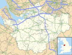
Sutton Common BT Tower is a 72-metre (238-foot)[citation needed] radio tower built of reinforced concrete at Macclesfield, Cheshire, England. Sutton Common was originally conceived as part of the 1950s 'Backbone' chain designed to provide the UK and NATO with survivable communications during nuclear war.[1]
The tower stands near the summit of Croker Hill on the western edge of the Peak District national park. Sutton relays signals to Heaton Park in the north and Pye Green to the south. For survivability during a nuclear war, the Backbone towers are some of the few communication towers in the United Kingdom built of reinforced concrete.
A wind farm was proposed on land adjacent to the transmitter but was objected to for various reasons, including the possible effects of turbine blades on the fixed link.[2]
Channels available from this site
[edit]Analogue radio
[edit]| Frequency | kW [3] | Service |
|---|---|---|
| 96.4 MHz | 0.250 | Greatest Hits Radio Staffordshire & Cheshire |
| 106.9 MHz | 0.300 | Silk Radio |
Digital radio
[edit]| Frequency | Block | kW | Operator |
|---|---|---|---|
| 220.352 MHz | 12C | 0.5 | Manchester |
| 229.072 MHz | 12D | 0.5 | Stoke & Stafford |
See also
[edit]References
[edit]- ^ Backbone radio link and radio standby to line links for safeguarding vital communications. GPO paper for the Official Committee on Civil Defence, July 1956. The National Archives (UK) CAB 134/1207
- ^ "Planning Application Details". Cheshire East Council. 5 September 2012. Archived from the original on 9 April 2023. Retrieved 27 July 2023.
- ^ Radio Listeners Guide 2010
External links
[edit]- Map sources for Sutton Common BT Tower
- Sutton Common's entry at mb21


