Divisions of Khyber Pakhtunkhwa: Difference between revisions
Appearance
Content deleted Content added
mNo edit summary Tags: Visual edit Mobile edit Mobile web edit |
ce, rem tag |
||
| (21 intermediate revisions by 15 users not shown) | |||
| Line 1: | Line 1: | ||
{{Short description|Second-level administrative regions of Pakistan}}{{More citations needed|date=November 2024}}{{Infobox subdivision type |
|||
{{short description|Divisions of Khyber Pakhtunkhwa}} |
|||
{{Infobox subdivision type |
|||
| name = Divisions of Khyber Pakhtunkhwa |
| name = Divisions of Khyber Pakhtunkhwa |
||
| map = Districts of Khyber Pakhtunkhwa, Pakistan with district names.png |
|||
| alt_name = |
|||
| alt_name1 = |
|||
| alt_name2 = |
|||
| alt_name3 = |
|||
| map = File:Districts of Khyber Pakhtunkhwa, Pakistan with district names.png |
|||
| caption = Colors correspond to divisions of Khyber Pakhtunkhwa |
| caption = Colors correspond to divisions of Khyber Pakhtunkhwa |
||
| category = [[ |
| category = [[Administrative division]] |
||
| territory = [[Pakistan]] |
| territory = [[Pakistan]] |
||
| upper_unit = [[Khyber Pakhtunkhwa]] |
| upper_unit = [[Khyber Pakhtunkhwa]] |
||
| start_date = |
|||
| start_date1 = |
|||
| start_date2 = |
|||
| legislation_begin = |
|||
| legislation_begin1 = |
|||
| legislation_begin2 = |
|||
| legislation_end = |
|||
| legislation_end1 = |
|||
| legislation_end2 = |
|||
| end_date = |
|||
| end_date1 = |
|||
| end_date2 = |
|||
| current_number = 7 |
| current_number = 7 |
||
| number_date = 2023 |
|||
| number_date = 2017<ref>{{Cite web|url=http://www.pakinformation.com/khyber-pakhtunkhwa/divisions.html|title=Name of All Divisions of KPK Administrative Division Information KPK|website=www.pakinformation.com|access-date=2019-04-05}}</ref> |
|||
| population_range = Greatest: [[Peshawar Division|Peshawar]] — 10,035,171 (2023 census)<br />Least: [[Bannu Division|Bannu]] — 3,092,078 (2023 census) |
|||
| type = |
|||
| area_range = Largest: [[Malakand Division|Malakand]] — {{convert|31,162|km2|sqmi|abbr=on}}<br />Smallest: [[Mardan Division|Mardan]] —{{convert|3,175|km2|sqmi|abbr=on}} |
|||
| type1 = |
|||
| type2 = |
|||
| type3 = |
|||
| type4 = |
|||
| status = |
|||
| status1 = |
|||
| status2 = |
|||
| status3 = |
|||
| status4 = |
|||
| exofficio = |
|||
| exofficio1 = |
|||
| exofficio2 = |
|||
| exofficio3 = |
|||
| exofficio4 = |
|||
| population_range = Greatest: [[Peshawar Division|Peshawar]] — 9,581,281 (2017 census)<br/>Least: [[Bannu Division|Bannu]] — 2,656,801 (2017 census) |
|||
| area_range = Largest: [[Malakand Division|Malakand]] — {{convert|31,162|km2|sqmi|abbr=on}}<br/>Smallest: [[Mardan Division|Mardan]] —{{convert|3,175|km2|sqmi|abbr=on}} |
|||
| government = Divisional Administration |
| government = Divisional Administration |
||
| subdivision = [[Districts of Khyber Pakhtunkhwa|Districts]] |
| subdivision = [[Districts of Khyber Pakhtunkhwa|Districts]] |
||
| Line 48: | Line 16: | ||
}} |
}} |
||
The '''divisions of Khyber Pakhtunkhwa''' ({{ |
The '''divisions of Khyber Pakhtunkhwa''' ({{langx|ur|{{nq|خیبرپختونخوا کےڈویژن }}}}), are the first-order [[administrative divisions|administrative bodies]] of the [[Khyber Pakhtunkhwa|Khyber Pakhtunkhwa Province]] of Pakistan. The 7 divisions are further divided into [[Districts of Khyber Pakhtunkhwa|districts]] ranging from two to nine per division. Divisions are governed by [[Commissioner]]s while districts are governed by [[Deputy Commissioner (Pakistan)|Deputy Commissioner]]s. |
||
==List of divisions== |
==List of divisions== |
||
In Pakistan, the [[Divisions of Pakistan|division]] is the administrative unit which is higher |
In Pakistan, the [[Divisions of Pakistan|division]] is the administrative unit which is higher than a district, but lower than a [[Administrative units of Pakistan|province]]. Divisions and are separated by color on the map. |
||
{| class="sortable wikitable |
{| class="sortable wikitable" |
||
! style="background:#99ff99;"| Division |
|||
!style="background:#99ff99;"| Division<ref name="Population2017">{{cite web |title=PROVINCE WISE PROVISIONAL RESULTS OF CENSUS - 2017 |url=http://www.pbs.gov.pk/sites/default/files/PAKISTAN%20TEHSIL%20WISE%20FOR%20WEB%20CENSUS_2017.pdf |website=PAKISTAN TEHSIL WISE FOR WEB CENSUS_2017.pdf |publisher=Pakistan Bureau of Statistics |access-date=16 June 2020 |archive-url=https://web.archive.org/web/20200616161839/http://www.pbs.gov.pk/sites/default/files/PAKISTAN%20TEHSIL%20WISE%20FOR%20WEB%20CENSUS_2017.pdf |archive-date=16 June 2020}}</ref> |
|||
!style="background:#99ff99;"| Districts<ref name=" |
! style="background:#99ff99;"| Districts<ref name=":0">https://www.pbs.gov.pk/sites/default/files/population/2023/tables/table_12_kp_province.pdf</ref><ref name="DistrictMakeUp">{{cite web |date=20 July 2018 |title=KP govt notifies new divisions following FATA merger |url=https://www.pakistantoday.com.pk/2018/07/20/kp-govt-notifies-new-divisions-following-fata-merger/ |url-status=live |archive-url=https://web.archive.org/web/20200702132759/https://www.pakistantoday.com.pk/2018/07/20/kp-govt-notifies-new-divisions-following-fata-merger/ |archive-date=2 July 2020 |access-date=2 July 2020 |website=[[Pakistan Today]] |publisher=}}</ref><ref>{{Cite web |title=KP Districts |url=https://kp.gov.pk/page/kp_towns_places |access-date=2022-05-13 |website=kp.gov.pk}}</ref> |
||
!style="background:#99ff99;" data-sort-type=number| Population ( |
! style="background:#99ff99;" data-sort-type=number| Population (2023)<ref name=":0" /> |
||
! style="background:#99ff99;" data-sort-type=number| Total Area<ref name=":0" /> |
|||
!style="background:#99ff99;" data-sort-type=number| Total Area<ref name="1998Data">{{cite web |title=1951 - 1998 POPULATION OF ADMINISTRATIVE UNITS (AS ON 1st MARCH 1998) |url=http://www.irispunjab.gov.pk/StatisticalReport/Population%20Census/1998/1951-98%20Population%20of%20Administrative%20Units%20(As%20on%201st%20March,%201998).pdf |website=1951-98 Population of Administrative Units (As on 1 March 1998).pdf |publisher=POPULATION CENSUS ORGANIZATION STATISTICS DIVISION GOVERNMENT OF PAKISTAN |access-date=25 August 2020 |archive-url=https://web.archive.org/web/20200823211928/http://www.irispunjab.gov.pk/StatisticalReport/Population%20Census/1998/1951-98%20Population%20of%20Administrative%20Units%20(As%20on%201st%20March,%201998).pdf |archive-date=23 August 2020 |date=January 2002 |url-status=live}}</ref> |
|||
!style="background:#99ff99;" data-sort-type=number| Population Density ( |
! style="background:#99ff99;" data-sort-type=number| Population Density (2023)<ref name=":0" /> |
||
!style="background:#99ff99;"| |
! style="background:#99ff99;" data-sort-type=number| Literacy (2023)<ref name=":0" /> |
||
! style="background:#99ff99;" | Map |
|||
|- |
|- |
||
! [[Bannu Division]] |
! [[Bannu Division]] |
||
| |
| |
||
*[[Bannu District]] |
* [[Bannu District]] |
||
*[[Lakki Marwat District]] |
* [[Lakki Marwat District]] |
||
*[[North Waziristan District]] |
* [[North Waziristan District]] |
||
| |
|3,092,078 |
||
|{{convert|9975|km2|sqmi|abbr=on}} |
|{{convert|9975|km2|sqmi|abbr=on}} |
||
|309.98/km<sup>2</sup> |
|||
|{{convert|266.35|/km2|/sqmi|abbr=on}} |
|||
|42.11% |
|||
|[[File:Bannu Division, Khyber Pakhtunkhwa.png|200px|center]] |
|||
|[[File:Bannu Division Locator.png|File:{{wikidata|property|raw|Q3307082|P242}}|200x200px]] |
|||
|- |
|- |
||
! [[Dera Ismail Khan Division]] |
! [[Dera Ismail Khan Division]] |
||
| |
| |
||
*[[Dera Ismail Khan District]] |
* [[Dera Ismail Khan District]] |
||
*[[Upper South Waziristan District]] |
* [[Upper South Waziristan District]] |
||
*[[Lower South Waziristan District]] |
* [[Lower South Waziristan District]] |
||
*[[Tank District]] |
* [[Tank District]] |
||
| |
|3,188,779 |
||
|{{convert|18854|km2|sqmi|abbr=on}} |
|{{convert|18854|km2|sqmi|abbr=on}} |
||
|169.13/km<sup>2</sup> |
|||
|{{convert|148.68|/km2|/sqmi|abbr=on}} |
|||
|41.73% |
|||
|[[File:Dera Ismail Khan Division, Khyber Pakhtunkhwa.png|200px|center]] |
|||
|[[File:Dera Ismail Khan Division Locator.png|File:{{wikidata|property|raw|Q3307112|P242}}|200x200px]] |
|||
|- |
|- |
||
! [[Hazara Division]] |
! [[Hazara Division]] |
||
| |
| |
||
*[[Abbottabad District]] |
* [[Abbottabad District]] |
||
*[[ |
* [[Allai District]] |
||
*[[ |
* [[Batagram District]] |
||
*[[ |
* [[Haripur District]] |
||
*[[ |
* [[Kolai-Palas District]] |
||
*[[ |
* [[Lower Kohistan District]] |
||
*[[ |
* [[Mansehra District]] |
||
*[[ |
* [[Tor Ghar District]] |
||
* [[Upper Kohistan District]] |
|||
|5,325,121 |
|||
|6,188,736 |
|||
|{{convert|17064|km2|sqmi|abbr=on}} |
|{{convert|17064|km2|sqmi|abbr=on}} |
||
|362.68/km<sup>2</sup> |
|||
|{{convert|312.07|/km2|/sqmi|abbr=on}} |
|||
|60.95% |
|||
|[[File:Hazara Division, Khyber Pakhtunkhwa.png|200px|center]] |
|||
|[[File:Hazara Division Locator.png|File:{{wikidata|property|raw|Q3246880|P242}}|200x200px]] |
|||
|- |
|- |
||
! [[Kohat Division]] |
! [[Kohat Division]] |
||
| |
| |
||
*[[Hangu District, Khyber Pakhtunkhwa|Hangu District]] |
* [[Hangu District, Khyber Pakhtunkhwa|Hangu District]] |
||
*[[Karak District]] |
* [[Karak District]] |
||
*[[Kohat District]] |
* [[Kohat District]] |
||
*[[Kurram District]] |
* [[Kurram District]] |
||
*[[Orakzai District]] |
* [[Orakzai District]] |
||
|3, |
|3,752,436 |
||
|{{convert|12377|km2|sqmi|abbr=on}} |
|{{convert|12377|km2|sqmi|abbr=on}} |
||
|303.18/km<sup>2</sup> |
|||
|{{convert|259.47|/km2|/sqmi|abbr=on}} |
|||
|50.89% |
|||
|[[File:Kohat Division, Khyber Pakhtunkhwa.png|200px|center]] |
|||
|[[File:Kohat Division Locator.png|File:{{wikidata|property|raw|Q3307006|P242}}|200x200px]] |
|||
|- |
|- |
||
! [[Malakand Division]] |
! [[Malakand Division]] |
||
| |
| |
||
*[[Bajaur District]] |
* [[Bajaur District]] |
||
*[[Buner District]] |
* [[Buner District]] |
||
*[[Central Dir District]] |
* [[Central Dir District]] |
||
*[[Lower Chitral District]] |
* [[Lower Chitral District]] |
||
*[[Lower Dir District]] |
* [[Lower Dir District]] |
||
*[[Malakand District]] |
* [[Malakand District]] |
||
*[[Shangla District]] |
* [[Shangla District]] |
||
*[[Swat District]] |
* [[Swat District]] |
||
*[[Upper Chitral District]] |
* [[Upper Chitral District]] |
||
*[[Upper Dir District]] |
* [[Upper Dir District]] |
||
| |
|9,959,399 |
||
|{{convert|31162|km2|sqmi|abbr=on}} |
|{{convert|31162|km2|sqmi|abbr=on}} |
||
|319.6/km<sup>2</sup> |
|||
|{{convert|276.25|/km2|/sqmi|abbr=on}} |
|||
|47.51% |
|||
|[[File:Malakand Division, Khyber Pakhtunkhwa.png|200px|center]] |
|||
|[[File:Malakand Division Locator.png|File:{{wikidata|property|raw|Q3247127|P242}}|200x200px]] |
|||
|- |
|- |
||
! [[Mardan Division]] |
! [[Mardan Division]] |
||
| |
| |
||
*[[Mardan District]] |
* [[Mardan District]] |
||
*[[Swabi District]] |
* [[Swabi District]] |
||
| |
|4,639,498 |
||
|{{convert|3175|km2|sqmi|abbr=on}} |
|{{convert|3175|km2|sqmi|abbr=on}} |
||
|1461.26/km<sup>2</sup> |
|||
|{{convert|1259.11|/km2|/sqmi|abbr=on}} |
|||
|56.90% |
|||
|[[File:Mardan Division, Khyber Pakhtunkhwa.png|200px|center]] |
|||
|[[File:Mardan Division Locator.png|File:{{wikidata|property|raw|Q3307064|P242}}|200x200px]] |
|||
|- |
|- |
||
! [[Peshawar Division]] |
! [[Peshawar Division]] |
||
| |
| |
||
*[[Charsadda District, Pakistan|Charsadda District]] |
* [[Charsadda District, Pakistan|Charsadda District]] |
||
*[[Khyber District]] |
* [[Khyber District]] |
||
*[[Mohmand District]] |
* [[Mohmand District]] |
||
*[[Nowshera District]] |
* [[Nowshera District]] |
||
*[[Peshawar District]] |
* [[Peshawar District]] |
||
| |
|10,035,171 |
||
|{{convert|9134|km2|sqmi|abbr=on}} |
|{{convert|9134|km2|sqmi|abbr=on}} |
||
|1098.66/km<sup>2</sup> |
|||
|{{convert|976.84|/km2|/sqmi|abbr=on}} |
|||
|51.32% |
|||
|[[File:Peshawar Division, Khyber Pakhtunkhwa.png|200px|center]] |
|||
|[[File:Peshawar Division Locator.png|File:{{wikidata|property|raw|Q3246884|P242}}|200x200px]] |
|||
|- |
|||
![[Abaseen Division]] |
|||
| |
|||
* Upper Kohistan |
|||
* Lower Kohistan |
|||
* Kolai Palas |
|||
* Shangla |
|||
* Batagram |
|||
* Allai |
|||
* Torghar |
|||
|Purposed Division |
|||
(Rejeceted by [[Indus Kohistani|Kohistanis]]<ref>{{Cite web |date=2021-12-05 |title=Elders say Kohistan districts won’t be part of Abaseen division |url=https://www.thenews.com.pk/print/914266-elders-say-kohistan-districts-won-t-be-part-of-abaseen-division |access-date=2023-12-16 |website=The News International |language=en}}</ref>) |
|||
|Purposed Division |
|||
|Purposed Division |
|||
|Purposed Division to spelt |
|||
[[Hazara Division]] |
|||
|- |
|||
!'''Dir or [[Panjkora Division]]''' |
|||
| |
|||
* Lower Dir |
|||
* Upper Dir |
|||
* Central Dir |
|||
* Lower Chitral |
|||
* Upper Chitral |
|||
* Bajaur |
|||
|Purposed Division |
|||
|Purposed Division |
|||
|Purposed Division |
|||
|Purposed Division to spelt |
|||
[[Malakand Division|Malakhand Division]] announced by CM Mehmood Khan on August 13, 2022 |
|||
|} |
|} |
||
==See also== |
==See also== |
||
* [[Divisions of Pakistan]] |
* [[Divisions of Pakistan]] |
||
* [[Panjkora Division]] new purposed |
|||
==References== |
==References== |
||
{{reflist}}{{Khyber Pakhtunkhwa topics}} |
{{reflist}}{{Khyber Pakhtunkhwa topics}} |
||
{{Pakistan topics}} |
{{Pakistan topics}} |
||
[[Category:Divisions of Pakistan| |
[[Category:Divisions of Pakistan|Khyber]] |
||
[[Category:Divisions of Khyber Pakhtunkhwa|*]] |
[[Category:Divisions of Khyber Pakhtunkhwa|*]] |
||
Latest revision as of 00:45, 5 January 2025
This article needs additional citations for verification. (November 2024) |
| Divisions of Khyber Pakhtunkhwa | |
|---|---|
 Colors correspond to divisions of Khyber Pakhtunkhwa | |
| Category | Administrative division |
| Location | Pakistan |
| Found in | Khyber Pakhtunkhwa |
| Number | 7 (as of 2023) |
| Populations | Greatest: Peshawar — 10,035,171 (2023 census) Least: Bannu — 3,092,078 (2023 census) |
| Areas | Largest: Malakand — 31,162 km2 (12,032 sq mi) Smallest: Mardan —3,175 km2 (1,226 sq mi) |
| Government |
|
| Subdivisions | |
The divisions of Khyber Pakhtunkhwa (Urdu: خیبرپختونخوا کےڈویژن ), are the first-order administrative bodies of the Khyber Pakhtunkhwa Province of Pakistan. The 7 divisions are further divided into districts ranging from two to nine per division. Divisions are governed by Commissioners while districts are governed by Deputy Commissioners.
List of divisions
[edit]In Pakistan, the division is the administrative unit which is higher than a district, but lower than a province. Divisions and are separated by color on the map.
| Division | Districts[1][2][3] | Population (2023)[1] | Total Area[1] | Population Density (2023)[1] | Literacy (2023)[1] | Map |
|---|---|---|---|---|---|---|
| Bannu Division | 3,092,078 | 9,975 km2 (3,851 sq mi) | 309.98/km2 | 42.11% | 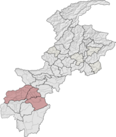
| |
| Dera Ismail Khan Division | 3,188,779 | 18,854 km2 (7,280 sq mi) | 169.13/km2 | 41.73% | 
| |
| Hazara Division | 6,188,736 | 17,064 km2 (6,588 sq mi) | 362.68/km2 | 60.95% | 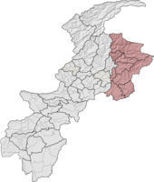
| |
| Kohat Division | 3,752,436 | 12,377 km2 (4,779 sq mi) | 303.18/km2 | 50.89% | 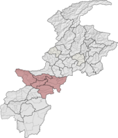
| |
| Malakand Division | 9,959,399 | 31,162 km2 (12,032 sq mi) | 319.6/km2 | 47.51% | 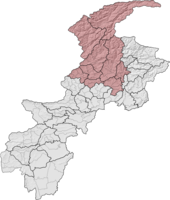
| |
| Mardan Division | 4,639,498 | 3,175 km2 (1,226 sq mi) | 1461.26/km2 | 56.90% | 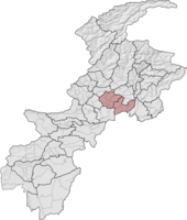
| |
| Peshawar Division | 10,035,171 | 9,134 km2 (3,527 sq mi) | 1098.66/km2 | 51.32% | 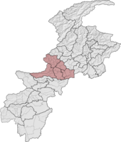
|
See also
[edit]- Divisions of Pakistan
- Panjkora Division new purposed
References
[edit]- ^ a b c d e https://www.pbs.gov.pk/sites/default/files/population/2023/tables/table_12_kp_province.pdf
- ^ "KP govt notifies new divisions following FATA merger". Pakistan Today. 20 July 2018. Archived from the original on 2 July 2020. Retrieved 2 July 2020.
- ^ "KP Districts". kp.gov.pk. Retrieved 2022-05-13.
