Zoewatta: Difference between revisions
Appearance
Content deleted Content added
m Don't include </ref> in the comments, then we can simply check if an article has refs without so many false positives. , Replaced: <!--for references: use <ref> </ref> tags--> → <!--for references: us |
mNo edit summary |
||
| (16 intermediate revisions by 12 users not shown) | |||
| Line 1: | Line 1: | ||
{{Infobox |
{{Infobox settlement |
||
<!--See the Table at Infobox Settlement for all fields and descriptions of usage--> |
<!--See the Table at Infobox Settlement for all fields and descriptions of usage--> |
||
<!-- Basic info ----------------> |
<!-- Basic info ----------------> |
||
| Line 38: | Line 38: | ||
|subdivision_name = [[Image:Flag of Suriname.svg|25px]] [[Suriname]] |
|subdivision_name = [[Image:Flag of Suriname.svg|25px]] [[Suriname]] |
||
|subdivision_type1 = [[Districts of Suriname|District]] |
|subdivision_type1 = [[Districts of Suriname|District]] |
||
|subdivision_name1 = [[ |
|subdivision_name1 = [[Sipaliwini District|Sipaliwini]] |
||
|subdivision_type2 = Resort (municipality) |
|subdivision_type2 = [[Resorts of Suriname|Resort (municipality)]] |
||
|subdivision_name2 = |
|subdivision_name2 = [[Boven Suriname]] |
||
|subdivision_type3 = |
|subdivision_type3 = |
||
|subdivision_name3 = |
|subdivision_name3 = |
||
| Line 106: | Line 106: | ||
|timezone_DST = |
|timezone_DST = |
||
|utc_offset_DST = |
|utc_offset_DST = |
||
|coordinates = {{coord|4|31|32|N|55|18|49|W|region:SR|display=inline,title}} |
|||
|latd=4|latm=32 |lats=60 |latNS=N |
|||
|longd=55 |longm=17|longs= 60|longEW=W |
|||
|elevation_footnotes = <!--for references: use <ref> tags--> |
|elevation_footnotes = <!--for references: use <ref> tags--> |
||
|elevation_m = |
|elevation_m = |
||
| Line 121: | Line 120: | ||
|website = |
|website = |
||
|footnotes = |
|footnotes = |
||
}} |
}} |
||
'''Zoewatta''' is a [[village]] in |
'''Zoewatta''' is a [[village]] in the [[Boven Suriname]] municipality (resort) in [[Sipaliwini District]] in [[Suriname]]. It is located on [[Brokopondo Reservoir]]. |
||
Nearby towns and villages include [[Wittikamba]] (3.6 |
Nearby towns and villages include [[Wittikamba]] (3.6 nm), [[Baikutu]] (1.0 nm) Adawai (7.3 nm) and [[Abenaston]] (7.2 nm). |
||
{{Surinamese District Sipaliwini}} |
|||
==External links== |
|||
*[http://www.maplandia.com/suriname/brokopondo/sarakreek/zoewatta/ Satellite map at Maplandia.com] |
|||
[[Category:Populated places in Sipaliwini District]] |
|||
*[http://encarta.msn.com/encnet/features/mapcenter/map.aspx?TextLatitude=15.4165155982842&TextLongitude=37.6003484752711&TextAltitude=7&TextSelectedEntity=9397806&MapStyle=Comprehensive&MapSize=Large&MapStyleSelectedIndex=0&searchTextMap=Zoewatta&MapStylesList=Comprehensive&ZoomOnMapClickCheck=on&ResultsListbox=15.4165155982842%3B37.6003484752711%3B7%3B9397806%3BAbaredda%2C+Eritrea%3BLarge%3BComprehensive Location on MSN encarta map] |
|||
[[Category:Cities, towns and villages in Suriname]] |
|||
{{Suriname-geo-stub}} |
{{Suriname-geo-stub}} |
||
Latest revision as of 13:19, 24 June 2023
Zoewatta | |
|---|---|
| Coordinates: 4°31′32″N 55°18′49″W / 4.52556°N 55.31361°W | |
| Country | |
| District | Sipaliwini |
| Resort (municipality) | Boven Suriname |
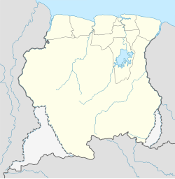
Zoewatta is a village in the Boven Suriname municipality (resort) in Sipaliwini District in Suriname. It is located on Brokopondo Reservoir.
Nearby towns and villages include Wittikamba (3.6 nm), Baikutu (1.0 nm) Adawai (7.3 nm) and Abenaston (7.2 nm).

