Cape Dorset Airport: Difference between revisions
Appearance
Content deleted Content added
No edit summary |
m Add {{Redirect|YTE|an Australian bi-monthly magazine|Your Trading Edge Magazine}} |
||
| (38 intermediate revisions by 17 users not shown) | |||
| Line 1: | Line 1: | ||
{{Short description|Airport in Kinngait, Nunavut, Canada}} |
|||
| ⚫ | |||
{{Redirect|YTE|an Australian bi-monthly magazine|Your Trading Edge Magazine}} |
|||
| ⚫ | |||
| name = Cape Dorset Airport |
| name = Cape Dorset Airport |
||
| image =capedorset-airport.jpg |
| image =capedorset-airport.jpg |
||
| IATA = YTE |
| IATA = YTE |
||
| ICAO = CYTE |
| ICAO = CYTE |
||
| WMO = 71910 |
|||
| type = Public |
| type = Public |
||
| owner = |
| owner = |
||
| operator = Government of Nunavut |
| operator = Government of Nunavut |
||
| city-served = |
| city-served = |
||
| location = [[ |
| location = [[Kinngait]], [[Nunavut]] |
||
| timezone = [[Eastern Time Zone|EST]] |
|||
| ⚫ | |||
| utc = [[UTC−05:00]] |
|||
| elevation-m = 50 |
|||
| summer = EDT |
|||
| ⚫ | |||
| utcs = [[UTC−04:00]] |
|||
| ⚫ | |||
| ⚫ | |||
| pushpin_map = Canada Nunavut#Canada |
|||
| pushpin_label = CYTE |
|||
| pushpin_map_caption = Location in Nunavut |
|||
| website = |
| website = |
||
| r1-number = |
| r1-number = 13/31 |
||
| r1-length-f = |
| r1-length-f = 3,988 |
||
| r1- |
| r1-surface = Gravel |
||
| |
| stat-year = 2010 |
||
| stat1-header = Aircraft movements |
|||
| stat-year = 2007 |
|||
| stat1- |
| stat1-data = 1,016 |
||
| footnotes = Sources: [[Canada Flight Supplement]]<ref name="CFS">{{CFS}}</ref><br>Movements from [[Statistics Canada]].<ref name="move">[http://www.statcan.gc.ca/pub/51-210-x/2011001/t001-eng.htm Total aircraft movements by class of operation]</ref><br>[[Environment Canada]]<ref>[http://climate.weatheroffice.gc.ca/prods_servs/metstat1_e.html Synoptic/Metstat Station Information] {{webarchive |url=https://web.archive.org/web/20111201114641/http://climate.weatheroffice.gc.ca/prods_servs/metstat1_e.html |date=December 1, 2011 }}</ref> |
|||
| stat1-data = 791 |
|||
| footnotes = Source: [[Canada Flight Supplement]]<ref name="CFS">{{CFS}}</ref><br>Movements from [[Statistics Canada]].<ref name="move">[http://www.tc.gc.ca/pol/en/Report/tp577/vol2/51-210-XIE2008001.pdf Aircraft Movement Statistics: Airports Without Air Traffic Control Towers (TP 577)]</ref> |
|||
}} |
}} |
||
'''Cape Dorset Airport''' {{Airport codes|YTE|CYTE}} is located at [[ |
'''Cape Dorset Airport''' {{Airport codes|YTE|CYTE}} is located at [[Kinngait]] (formerly Cape Dorset), [[Nunavut]], Canada, and is operated by the Government of Nunavut. |
||
Turbo-prop aircraft are used and handled at this airport due to the runway surface and length. |
|||
==Airlines and destinations== |
==Airlines and destinations== |
||
{{Airport-dest-list |
|||
*[[Canadian North]] (Iqaluit, Rankin Inlet)<ref>[http://www.canadiannorth.com/pdfs/flight_schedule_JULY22-2008.pdf Canadian North flight schedule]</ref> |
|||
| [[Canadian North]] | [[Iqaluit Airport|Iqaluit]]<ref>[https://canadiannorth.com/plan_your_trip/flight-schedule/?type=full&full_date=2021-06-01#skedsearchform Full network schedule]</ref> |
|||
*[[First Air]] (Iqaluit)<ref>[http://www.firstair.ca/weather/index.html First Air interactive weather/route map]</ref> |
|||
}} |
|||
*[[Kenn Borek Air]] (Iqaluit) |
|||
==References== |
==References== |
||
| Line 35: | Line 45: | ||
==External links== |
==External links== |
||
{{Can-arpt-wx|CYTE|Cape Dorset Airport}} |
{{Can-arpt-wx|CYTE|Cape Dorset Airport}} |
||
*[https://web.archive.org/web/20110706193846/http://polarpilots.ca/index.php/communities/cape-dorset Cape Dorset airport information] |
|||
{{List of airports in Canada}} |
{{List of airports in Canada}} |
||
| ⚫ | |||
| ⚫ | |||
{{authority control}} |
|||
[[es:Aeropuerto de Cape Dorset]] |
|||
[[id:Bandar Udara Cape Dorset]] |
|||
| ⚫ | |||
[[pms:Cape Dorset Airport]] |
|||
| ⚫ | |||
Latest revision as of 09:08, 24 December 2023
Cape Dorset Airport | |||||||||||
|---|---|---|---|---|---|---|---|---|---|---|---|
 | |||||||||||
| Summary | |||||||||||
| Airport type | Public | ||||||||||
| Operator | Government of Nunavut | ||||||||||
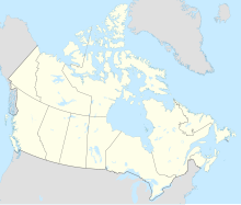
| Location | Kinngait, Nunavut | ||||||||||
| Time zone | EST (UTC−05:00) | ||||||||||
| • Summer (DST) | EDT (UTC−04:00) | ||||||||||
| Elevation AMSL | 158 ft / 48 m | ||||||||||
| Coordinates | 64°13′49″N 076°31′30″W / 64.23028°N 76.52500°W | ||||||||||
| Map | |||||||||||
 | |||||||||||
| Runways | |||||||||||
| |||||||||||
| Statistics (2010) | |||||||||||
| |||||||||||
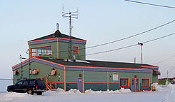
Cape Dorset Airport (IATA: YTE, ICAO: CYTE) is located at Kinngait (formerly Cape Dorset), Nunavut, Canada, and is operated by the Government of Nunavut.
Turbo-prop aircraft are used and handled at this airport due to the runway surface and length.
Airlines and destinations
[edit]| Airlines | Destinations |
|---|---|
| Canadian North | Iqaluit[4] |
References
[edit]- ^ Canada Flight Supplement. Effective 0901Z 16 July 2020 to 0901Z 10 September 2020.
- ^ Total aircraft movements by class of operation
- ^ Synoptic/Metstat Station Information Archived December 1, 2011, at the Wayback Machine
- ^ Full network schedule
External links
[edit]- Past three hours METARs, SPECI and current TAFs for Cape Dorset Airport from Nav Canada as available.
- Cape Dorset airport information


