Puerto Salina: Difference between revisions
Appearance
Content deleted Content added
No edit summary |
|||
| (19 intermediate revisions by 11 users not shown) | |||
| Line 1: | Line 1: | ||
{{Short description|Marina in La Salina, Baja California, Mexico}} |
|||
| ⚫ | |||
| ⚫ | |||
{{Infobox |
{{Infobox settlement |
||
<!--See the Table at Infobox Settlement for all fields and descriptions of usage--> |
<!--See the Table at Infobox Settlement for all fields and descriptions of usage--> |
||
<!-- Basic info ----------------> |
<!-- Basic info ----------------> |
||
|name = Puerto Salina |
| name = Puerto Salina |
||
|settlement_type = |
| settlement_type = |
||
|other_name = |
| other_name = |
||
|native_name |
| native_name = <!-- for cities whose native name is not in English --> |
||
|nickname = |
| nickname = |
||
|motto = |
| motto = |
||
<!-- images and maps -----------> |
<!-- images and maps -----------> |
||
|image_skyline = |
| image_skyline = PuertoSalina Launch.JPG |
||
|imagesize = |
| imagesize = 220px |
||
|image_caption |
| image_caption = Marina boat launch |
||
|image_flag = |
| image_flag = |
||
|flag_size = |
| flag_size = |
||
|image_seal = |
| image_seal = |
||
|seal_size = |
| seal_size = |
||
|image_shield = |
| image_shield = |
||
|shield_size = |
| shield_size = |
||
|image_blank_emblem = |
| image_blank_emblem = |
||
|blank_emblem_type = |
| blank_emblem_type = |
||
|blank_emblem_size = |
| blank_emblem_size = |
||
|image_map = |
| image_map = |
||
|mapsize = |
| mapsize = |
||
|map_caption = |
| map_caption = |
||
|image_map1 = |
| image_map1 = |
||
|mapsize1 = |
| mapsize1 = |
||
|map_caption1 = |
| map_caption1 = |
||
|image_dot_map = |
| image_dot_map = |
||
|dot_mapsize = |
| dot_mapsize = |
||
|dot_map_caption = |
| dot_map_caption = |
||
|dot_x |
| dot_x = |
||
| dot_y = |
|||
|pushpin_map = Mexico <!-- the name of a location map as per |
| pushpin_map = Mexico <!-- the name of a location map as per [[Template:Location map]] --> |
||
|pushpin_label_position =bottom |
|||
| |
| pushpin_label_position = bottom |
||
| pushpin_mapsize = 280 |
|||
|pushpin_map_caption =Location in Mexico |
| pushpin_map_caption = Location in Mexico |
||
<!-- Location ------------------> |
<!-- Location ------------------> |
||
|subdivision_type = Country |
| subdivision_type = Country |
||
|subdivision_name = {{flag|Mexico}} |
| subdivision_name = {{flag|Mexico}} |
||
|subdivision_type1 = [[Administrative divisions of Mexico|State]] |
| subdivision_type1 = [[Administrative divisions of Mexico|State]] |
||
|subdivision_name1 = [[Baja California]] |
| subdivision_name1 = [[Baja California]] |
||
|subdivision_type2 = |
| subdivision_type2 = |
||
|subdivision_name2 = |
| subdivision_name2 = |
||
|subdivision_type3 = |
| subdivision_type3 = |
||
|subdivision_name3 = |
| subdivision_name3 = |
||
|subdivision_type4 = |
| subdivision_type4 = |
||
|subdivision_name4 = |
| subdivision_name4 = |
||
<!-- Politics -----------------> |
<!-- Politics -----------------> |
||
|government_footnotes = |
| government_footnotes = |
||
|government_type = |
| government_type = |
||
|leader_title = |
| leader_title = |
||
|leader_name = |
| leader_name = |
||
|leader_title1 |
| leader_title1 = <!-- for places with, say, both a mayor and a city manager --> |
||
|leader_name1 = |
| leader_name1 = |
||
|leader_title2 = |
| leader_title2 = |
||
|leader_name2 = |
| leader_name2 = |
||
|leader_title3 = |
| leader_title3 = |
||
|leader_name3 = |
| leader_name3 = |
||
|leader_title4 = |
| leader_title4 = |
||
|leader_name4 = |
| leader_name4 = |
||
|established_title |
| established_title = <!-- Settled --> |
||
|established_date = |
| established_date = |
||
|established_title2 |
| established_title2 = <!-- Incorporated (town) --> |
||
|established_date2 = |
| established_date2 = |
||
|established_title3 |
| established_title3 = <!-- Incorporated (city) --> |
||
|established_date3 = |
| established_date3 = |
||
<!-- Area ---------------------> |
<!-- Area ---------------------> |
||
|area_magnitude = |
| area_magnitude = |
||
|unit_pref =Imperial <!--Enter: Imperial, if Imperial (metric) is desired--> |
| unit_pref = Imperial <!--Enter: Imperial, if Imperial (metric) is desired--> |
||
|area_footnotes = |
| area_footnotes = |
||
|area_total_km2 |
| area_total_km2 = <!-- ALL fields dealing with a measurements are subject to automatic unit conversion--> |
||
|area_land_km2 = <!--See table @ Template:Infobox Settlement for details on automatic unit conversion--> |
| area_land_km2 = <!--See table @ Template:Infobox Settlement for details on automatic unit conversion--> |
||
|area_water_km2 = |
| area_water_km2 = |
||
|area_total_sq_mi = |
| area_total_sq_mi = |
||
|area_land_sq_mi = |
| area_land_sq_mi = |
||
|area_water_sq_mi = |
| area_water_sq_mi = |
||
|area_water_percent = |
| area_water_percent = |
||
|area_urban_km2 = |
| area_urban_km2 = |
||
|area_urban_sq_mi = |
| area_urban_sq_mi = |
||
|area_metro_km2 = |
| area_metro_km2 = |
||
|area_metro_sq_mi = |
| area_metro_sq_mi = |
||
|area_blank1_title = |
| area_blank1_title = |
||
|area_blank1_km2 = |
| area_blank1_km2 = |
||
|area_blank1_sq_mi = |
| area_blank1_sq_mi = |
||
<!-- Population -----------------------> |
<!-- Population -----------------------> |
||
|population_as_of =2005 |
| population_as_of = 2005 |
||
|population_footnotes = |
| population_footnotes = |
||
|population_note = |
| population_note = |
||
|population_total = |
| population_total = |
||
|population_density_km2 = |
| population_density_km2 = |
||
|population_density_sq_mi = |
| population_density_sq_mi = |
||
|population_metro = |
| population_metro = |
||
|population_density_metro_km2 = |
| population_density_metro_km2 = |
||
|population_density_metro_sq_mi = |
| population_density_metro_sq_mi = |
||
|population_urban = |
| population_urban = |
||
|population_density_urban_km2 = |
| population_density_urban_km2 = |
||
|population_density_urban_sq_mi = |
| population_density_urban_sq_mi = |
||
|population_blank1_title =Ethnicities |
| population_blank1_title = Ethnicities |
||
|population_blank1 = |
| population_blank1 = |
||
|population_blank2_title =Religions |
| population_blank2_title = Religions |
||
|population_blank2 = |
| population_blank2 = |
||
|population_density_blank1_km2 |
| population_density_blank1_km2 = |
||
|population_density_blank1_sq_mi = |
| population_density_blank1_sq_mi = |
||
<!-- General information ---------------> |
<!-- General information ---------------> |
||
|timezone = |
| timezone = |
||
|utc_offset = |
| utc_offset = |
||
|timezone_DST = |
| timezone_DST = |
||
|utc_offset_DST = |
| utc_offset_DST = |
||
| coordinates = {{coord|32|3|N|116|53|W|region:MX|display=inline}} |
|||
|latd=32 |latm=3|lats= |latNS=N |
|||
| ⚫ | |||
|longd=116|longm=53|longs=|longEW=W |
|||
| elevation_m = |
|||
| ⚫ | |||
| |
| elevation_ft = |
||
|elevation_ft = |
|||
<!-- Area/postal codes & others --------> |
<!-- Area/postal codes & others --------> |
||
|postal_code_type |
| postal_code_type = <!-- enter ZIP code, Postcode, Post code, Postal code... --> |
||
|postal_code = |
| postal_code = |
||
|area_code = |
| area_code = |
||
|blank_name = |
| blank_name = |
||
|blank_info = |
| blank_info = |
||
|blank1_name = |
| blank1_name = |
||
|blank1_info = |
| blank1_info = |
||
|website = |
| website = |
||
|footnotes = |
| footnotes = |
||
}} |
}} |
||
| ⚫ | '''Marina Puerto Salina''' is a [[marina]] in the [[Mexican state]] of [[Baja California]]. It is located at 73 km south of [[Tijuana]] at 32° 3.28´N 116° 53.20´W. Puerto Salina is the first marina in [[Mexico]] south of the [[US-Mexico border|United States border]] on the Pacific Ocean. Puerto Salina is located next to [[La Salina, Baja California]], 62 km (45 mi) south of San Diego Bay. The marina has more than 250 slips and can accommodate yachts as large as 100 feet in length. |
||
== Gallery == |
|||
{{Gallery |
|||
| title = |
|||
| align = |
|||
| footer = |
|||
| style = |
|||
| state = |
|||
| height = |
|||
| width = |
|||
| cellwidth = |
|||
| captionstyle = |
|||
| File:RanchoLaSalina.jpg |
|||
| alt1= |
|||
| ⚫ | |||
| File:Puerto Salina entrance 04 03 10 photo D Ramey Logan.jpg |
|||
| alt2= |
|||
| Harbor entrance as seen on approach from the north |
|||
}} |
|||
| ⚫ | |||
| ⚫ | '''Puerto Salina''' is in the [[Mexican state]] of [[Baja California]]. It is located at 73 |
||
| ⚫ | |||
| ⚫ | |||
| ⚫ | |||
| ⚫ | |||
| ⚫ | |||
| ⚫ | |||
[[Category:Port cities and towns on the Mexican Pacific coast]] |
|||
| ⚫ | |||
| ⚫ | |||
| ⚫ | |||
[[Category:Ports and harbors of Baja California]] |
|||
| ⚫ | |||
[[Category:Buildings and structures in Baja California]] |
|||
[[Category:Seaside resorts in Baja California]] |
|||
| ⚫ | |||
| ⚫ | |||
[[Category:Port settlements in Mexico]] |
|||
| ⚫ | |||
| ⚫ | |||
{{BajaCalifornia-geo-stub}} |
{{BajaCalifornia-geo-stub}} |
||
Latest revision as of 01:54, 18 January 2023
32°03′17″N 116°53′5″W / 32.05472°N 116.88472°W
Puerto Salina | |
|---|---|
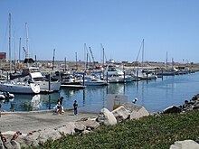
 Marina boat launch | |
| Coordinates: 32°3′N 116°53′W / 32.050°N 116.883°W | |
| Country | |
| State | Baja California |
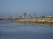
Marina Puerto Salina is a marina in the Mexican state of Baja California. It is located at 73 km south of Tijuana at 32° 3.28´N 116° 53.20´W. Puerto Salina is the first marina in Mexico south of the United States border on the Pacific Ocean. Puerto Salina is located next to La Salina, Baja California, 62 km (45 mi) south of San Diego Bay. The marina has more than 250 slips and can accommodate yachts as large as 100 feet in length.
Gallery
[edit]External links
[edit]


