Ayvacık, Çanakkale: Difference between revisions
Appearance
Content deleted Content added
Numbo3-bot (talk | contribs) m robot Adding: sw:Ayvacık, Çanakkale |
Remove hatnote: not necessary at this unambiguous title (WP:NAMB); no ambiguous title redirects here |
||
| (58 intermediate revisions by 43 users not shown) | |||
| Line 1: | Line 1: | ||
{{Short description|District in Çanakkale}} |
|||
{{Infobox Settlement <!--more fields are available for this Infobox--See Template:Infobox Settlement--> |
|||
{{Infobox Turkey place |
|||
|settlement_type = District |
|||
| type = municipality |
|||
|subdivision_type = [[Countries of the world|Country]] |
|||
| name = Ayvacık |
|||
|subdivision_name = {{TUR}} |
|||
| other_name = |
|||
|timezone=[[Eastern European Time|EET]] |
|||
| ⚫ | |||
|utc_offset=+2 |
|||
| ⚫ | |||
|map_caption = Location of Ayvacık within Turkey. |
|||
| image_shield = |
|||
|timezone_DST=[[Eastern European Summer Time|EEST]] |
|||
| ⚫ | |||
|utc_offset_DST=+3 |
|||
| province = Çanakkale |
|||
|official_name = Ayvacık |
|||
| district = [[Ayvacık District, Çanakkale|Ayvacık]] |
|||
| ⚫ | |||
| leader_party = [[Republican People's Party|CHP]] |
|||
| ⚫ | |||
| leader_name = Mensur Bayram |
|||
|image_blank_emblem = |
|||
| area_footnotes = |
|||
|blank_emblem_type = |
|||
| ⚫ | |||
|image_map = Çanakkale districts.png |
|||
| ⚫ | |||
|subdivision_type1=[[Regions of Turkey|Region]] |
|||
| ⚫ | |||
|subdivision_name1 = Marmara |
|||
| ⚫ | |||
|subdivision_type2=[[Provinces of Turkey|Province]] |
|||
| ⚫ | |||
|subdivision_name2 = Çanakkale |
|||
| ⚫ | |||
| ⚫ | |||
| ⚫ | |||
|population_urban = 6475 |
|||
| ⚫ | |||
| ⚫ | |||
| ⚫ | |||
|population_density_km2 = 34.16 |
|||
| ⚫ | |||
| ⚫ | |||
|pushpin_map = Turkey |
|||
|pushpin_label_position = <!-- the position of the pushpin label: left, right, top, bottom, none --> |
|||
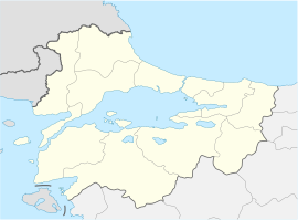
|pushpin_map_caption = Location of Ayvacık |
|||
|pushpin_mapsize = |
|||
|latd = 39 |
|||
|latm = 36 |
|||
|latNS = N |
|||
|longd = 26 |
|||
|longm = 24 |
|||
|longEW = E |
|||
|postal_code_type = [[Postal code]] |
|||
| ⚫ | |||
|blank_info = 17 |
|||
|blank_name= [[Turkish car number plates|Licence plate]] |
|||
| ⚫ | |||
|leader_name = |
|||
| ⚫ | |||
|leader_name1 = |
|||
|gwebsite = [http://www.ayvacik.gov.tr/ www.ayvacik.gov.tr] |
|||
}} |
}} |
||
'''Ayvacık''' is a town |
'''Ayvacık''' ({{IPA|tr|ˈajvadʒɯk|lang}}) is a town in [[Çanakkale Province]] in the [[Marmara Region|Marmara]] region of [[Turkey]]. It is the seat of [[Ayvacık District, Çanakkale|Ayvacık District]].<ref name=ilce>[https://www.e-icisleri.gov.tr/Anasayfa/MulkiIdariBolumleri.aspx İlçe Belediyesi], Turkey Civil Administration Departments Inventory. Retrieved 1 March 2023.</ref> Its population is 9,710 (2021).<ref name=tuik>{{Cite web |title=Address-based population registration system (ADNKS) results dated 31 December 2021|url=https://www.tuik.gov.tr/indir/duyuru/favori_raporlar.xlsx |access-date=1 March 2023|publisher=[[TÜİK]]|language=tr |format=XLS}}</ref> The town lies at an elevation of {{convert|252|m|ft|0|abbr=on}}.<ref>{{cite web|url=http://www.fallingrain.com/world/TU/17/Ayvacik.html|title=Geographical information on Ayvacık, Turkey|access-date=1 March 2023|author=Falling Rain Genomics, Inc}}</ref> During the [[Gallipoli campaign]] in [[World War I]], it was the target of several [[Allies of World War I|Allied]] attacks. |
||
Ayvacik is mostly inhabited by settled [[Yörüks]]. The classical ancient site of [[Assos]] can be found nearby.<ref>The Rough Guide to Turkey – 5th edition (2003). p. 289</ref> |
|||
==See also== |
|||
* [[Assos]] |
|||
== |
==References== |
||
{{Reflist}} |
{{Reflist}} |
||
==References== |
|||
* {{cite web|url=http://www.fallingrain.com/world/TU/17/Ayvacik.html|title=Geographical information on Ayvacık, Turkey|accessdate=2009-04-20|author=Falling Rain Genomics, Inc|language=English}} |
|||
==External links== |
==External links== |
||
* [ |
* [https://www.canakkaleayvacik.bel.tr/ Municipality's official website] {{in lang|tr}} |
||
* [http://www.canakkaleabc.com/ayvacik/ayharita.jpg Road map of Ayvacık and environs] |
* [https://web.archive.org/web/20120421091441/http://www.canakkaleabc.com/ayvacik/ayharita.jpg Road map of Ayvacık and environs] |
||
* [http://wowturkey.com/forum/viewtopic.php?t=28166 Various images of Akliman in Ayvacık, Çanakkale] |
* [http://wowturkey.com/forum/viewtopic.php?t=28166 Various images of Akliman in Ayvacık, Çanakkale] {{Webarchive|url=https://web.archive.org/web/20201113112137/http://wowturkey.com/forum/viewtopic.php?t=28166 |date=2020-11-13 }} |
||
* [http://wowturkey.com/forum/viewtopic.php?t=29796 Various images of Küçükkuyu in Ayvacık, Çanakkale] |
* [http://wowturkey.com/forum/viewtopic.php?t=29796 Various images of Küçükkuyu in Ayvacık, Çanakkale] {{Webarchive|url=https://web.archive.org/web/20201111002646/http://wowturkey.com/forum/viewtopic.php?t=29796 |date=2020-11-11 }} |
||
{{Districts of Turkey|provname=Çanakkale|image=Canakkale}} |
|||
| ⚫ | |||
| ⚫ | |||
| ⚫ | |||
{{Authority control}} |
|||
{{DEFAULTSORT:Ayvacik, Canakkale}} |
|||
| ⚫ | |||
[[Category:Ayvacık District, Çanakkale]] |
|||
[[Category:District municipalities in Turkey]] |
|||
{{Marmara-geo-stub}} |
|||
{{Çanakkale-geo-stub}} |
|||
| ⚫ | |||
Latest revision as of 07:50, 11 June 2024
Ayvacık | |
|---|---|
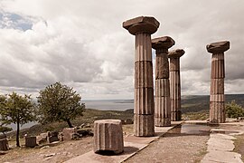
 Temple of Athena in Assos, Ayvacık | |
| Coordinates: 39°36′04″N 26°24′17″E / 39.60111°N 26.40472°E | |
| Country | Turkey |
| Province | Çanakkale |
| District | Ayvacık |
| Government | |
| • Mayor | Mensur Bayram (CHP) |
| Elevation | 251 m (823 ft) |
| Population (2021)[1] | 9,710 |
| Time zone | UTC+3 (TRT) |
| Postal code | 17860 |
| Area code | 0286 |
| Website | www |
Ayvacık (Turkish: [ˈajvadʒɯk]) is a town in Çanakkale Province in the Marmara region of Turkey. It is the seat of Ayvacık District.[2] Its population is 9,710 (2021).[1] The town lies at an elevation of 252 m (827 ft).[3] During the Gallipoli campaign in World War I, it was the target of several Allied attacks.
Ayvacik is mostly inhabited by settled Yörüks. The classical ancient site of Assos can be found nearby.[4]
References
[edit]- ^ a b "Address-based population registration system (ADNKS) results dated 31 December 2021" (XLS) (in Turkish). TÜİK. Retrieved 1 March 2023.
- ^ İlçe Belediyesi, Turkey Civil Administration Departments Inventory. Retrieved 1 March 2023.
- ^ Falling Rain Genomics, Inc. "Geographical information on Ayvacık, Turkey". Retrieved 1 March 2023.
- ^ The Rough Guide to Turkey – 5th edition (2003). p. 289
External links
[edit]- Municipality's official website (in Turkish)
- Road map of Ayvacık and environs
- Various images of Akliman in Ayvacık, Çanakkale Archived 2020-11-13 at the Wayback Machine
- Various images of Küçükkuyu in Ayvacık, Çanakkale Archived 2020-11-11 at the Wayback Machine


