Pan'an County: Difference between revisions
Appearance
Content deleted Content added
reverted. copyvio of http://frbiz.com/industry-products/f-Pan%27an-mushroom.html |
added info |
||
| (23 intermediate revisions by 21 users not shown) | |||
| Line 2: | Line 2: | ||
<!--See Template:Infobox Settlement for additional fields that may be available--> |
<!--See Template:Infobox Settlement for additional fields that may be available--> |
||
<!--See the Table at Infobox Settlement for all fields and descriptions of usage--> |
<!--See the Table at Infobox Settlement for all fields and descriptions of usage--> |
||
<!-- Basic info ----------------> |
<!-- Basic info ---------------->| name = Pan'an |
||
| official_name = |
|||
|name =Pan'an County |
|||
| |
| other_name = |
||
| native_name = {{nobold|{{lang|zh-hans|磐安县}}}} |
|||
|other_name = |
|||
| |
| nickname = |
||
| settlement_type = [[County (People's Republic of China)|County]] |
|||
|nickname = |
|||
| total_type = <!-- to set a non-standard label for total area and population rows --> |
|||
|settlement_type =[[County (China)|County]] |
|||
| |
| motto = <!-- images and maps -----------> |
||
| |
| image_skyline = Pan'an County.JPG |
||
| imagesize = 300px |
|||
|translit_lang1=[[Chinese character|Chinese]] |
|||
| image_caption = |
|||
|translit_lang1_type=[[Chinese character|Chinese]] |
|||
| image_flag = |
|||
|translit_lang1_info= |
|||
| flag_size = |
|||
|translit_lang1_type1= [[Pinyin]] |
|||
| image_seal = |
|||
|translit_lang1_info1= |
|||
| seal_size = |
|||
<!-- images and maps -----------> |
|||
| |
| image_shield = |
||
| |
| shield_size = |
||
| image_blank_emblem = |
|||
|image_caption = |
|||
| blank_emblem_type = |
|||
|image_flag = |
|||
| blank_emblem_size = |
|||
|flag_size = |
|||
| |
| image_map = ChinaJinhuaPanan.png |
||
| |
| mapsize = |
||
| map_caption = Location of Pan'an County within Jinhua |
|||
|image_shield = |
|||
| |
| image_map1 = |
||
| |
| mapsize1 = |
||
| |
| map_caption1 = |
||
| |
| image_dot_map = |
||
| |
| dot_mapsize = |
||
| dot_map_caption = |
|||
|mapsize = |
|||
| |
| dot_x = |
||
| |
| dot_y = |
||
| |
| pushpin_map = China Zhejiang |
||
| |
| pushpin_label = Pan'an |
||
| pushpin_map_caption = Location of the seat in Zhejiang |
|||
|image_dot_map = |
|||
<!-- Location ------------------>| subdivision_type = Country |
|||
|dot_mapsize = |
|||
| subdivision_name = [[China|People's Republic of China]] |
|||
|dot_map_caption = |
|||
| subdivision_type1 = [[Provinces of China|Province]] |
|||
|dot_x = |dot_y = |
|||
| subdivision_name1 = [[Zhejiang]] |
|||
|pushpin_map = <!-- the name of a location map as per http://en.wikipedia.org/wiki/Template:Location_map --> |
|||
| subdivision_type2 = [[Prefecture-level city]] |
|||
|pushpin_label_position = <!-- the position of the pushpin label: left, right, top, bottom, none --> |
|||
| subdivision_name2 = [[Jinhua]] |
|||
|pushpin_map_caption = |
|||
| |
| seat_type = |
||
| seat = |
|||
<!-- Location ------------------> |
|||
| |
| parts_type = |
||
| parts_style = <!-- =list (for list), coll (for collapsed list), para (for paragraph format) |
|||
|subdivision_name = [[People's Republic of China|China]] |
|||
|subdivision_type1 =Province |
|||
|subdivision_name1 = [[Zhejiang]] |
|||
|subdivision_type2 = Prefecture |
|||
|subdivision_name2 = [[Jinhua]] |
|||
|seat_type = |
|||
|seat = |
|||
|parts_type = |
|||
|parts_style = <!-- =list (for list), coll (for collapsed list), para (for paragraph format) |
|||
Default is list if up to 5 items, coll if more than 5--> |
Default is list if up to 5 items, coll if more than 5--> |
||
|parts |
| parts = <!-- parts text, or header for parts list --> |
||
|p1 |
| p1 = |
||
|p2 |
| p2 = <!-- etc. up to p50: for separate parts to be listed--> |
||
<!-- Politics -----------------> |
<!-- Politics ----------------->| government_footnotes = |
||
| government_type = |
|||
|government_footnotes = |
|||
| |
| leader_title = |
||
| |
| leader_name = |
||
| leader_title1 = <!-- for places with, say, both a mayor and a city manager --> |
|||
|leader_name = |
|||
| leader_name1 = |
|||
|leader_title1 = <!-- for places with, say, both a mayor and a city manager --> |
|||
| |
| leader_title2 = |
||
| |
| leader_name2 = |
||
| |
| leader_title3 = |
||
| |
| leader_name3 = |
||
| |
| leader_title4 = |
||
| |
| leader_name4 = |
||
| established_title = <!-- Settled --> |
|||
|leader_name4 = |
|||
| established_date = |
|||
|established_title = <!-- Settled --> |
|||
| established_title1 = <!-- Incorporated (town) --> |
|||
|established_date = |
|||
| established_date1 = |
|||
|established_title1 = <!-- Incorporated (town) --> |
|||
| |
| founder = |
||
| |
| named_for = <!-- Area ---------------------> |
||
| area_magnitude = <!-- use only to set a special wikilink --> |
|||
|named_for = |
|||
| unit_pref = <!--Enter: Imperial, to display imperial before metric--> |
|||
<!-- Area ---------------------> |
|||
| area_footnotes = |
|||
|area_magnitude = <!-- use only to set a special wikilink --> |
|||
| area_total_km2 = 1,194.74 |
|||
|unit_pref = <!--Enter: Imperial, to display imperial before metric--> |
|||
| area_land_km2 = <!--See table @ Template:Infobox Settlement for details on unit conversion--> |
|||
|area_footnotes = |
|||
| area_water_km2 = |
|||
|area_total_km2 = <!-- ALL fields with measurements are subject to automatic unit conversion--> |
|||
| area_total_dunam = <!--Used in Middle East articles only--> |
|||
|area_land_km2 = <!--See table @ Template:Infobox Settlement for details on unit conversion--> |
|||
| area_total_sq_mi = |
|||
|area_water_km2 = |
|||
| area_land_sq_mi = |
|||
|area_total_dunam = <!--Used in Middle East articles only--> |
|||
| area_water_sq_mi = |
|||
|area_total_sq_mi = |
|||
| area_water_percent = |
|||
|area_land_sq_mi = |
|||
| area_urban_km2 = |
|||
|area_water_sq_mi = |
|||
| area_urban_sq_mi = |
|||
|area_water_percent = |
|||
| area_metro_km2 = |
|||
|area_urban_km2 = |
|||
| area_metro_sq_mi = |
|||
|area_urban_sq_mi = |
|||
| area_blank1_title = |
|||
|area_metro_km2 = |
|||
| area_blank1_km2 = |
|||
|area_metro_sq_mi = |
|||
| area_blank1_sq_mi = <!-- Elevation --------------------------> |
|||
|area_blank1_title = |
|||
| elevation_footnotes = <!--for references: use <ref> </ref> tags--> |
|||
|area_blank1_km2 = |
|||
| |
| elevation_m = |
||
| elevation_ft = |
|||
<!-- Elevation --------------------------> |
|||
| elevation_max_m = |
|||
|elevation_footnotes = <!--for references: use <ref> </ref> tags--> |
|||
| elevation_max_ft = |
|||
|elevation_m = |
|||
| elevation_min_m = |
|||
|elevation_ft = |
|||
| elevation_min_ft = <!-- Population -----------------------> |
|||
|elevation_max_m = |
|||
| population_as_of = 2020 |
|||
|elevation_max_ft = |
|||
| population_footnotes = |
|||
|elevation_min_m = |
|||
| population_note = |
|||
|elevation_min_ft = |
|||
| population_total = 177,161 |
|||
<!-- Population -----------------------> |
|||
| population_density_km2 = <!--For automatic calculation, any density field may contain: auto --> |
|||
|population_as_of = |
|||
| population_density_sq_mi = |
|||
|population_footnotes = |
|||
| population_metro = |
|||
|population_note = |
|||
| population_density_metro_km2 = |
|||
|population_total = |
|||
| population_density_metro_sq_mi = |
|||
|population_density_km2 = <!--For automatic calculation, any density field may contain: auto --> |
|||
| population_urban = |
|||
|population_density_sq_mi = |
|||
| population_density_urban_km2 = |
|||
|population_metro = |
|||
| population_density_urban_sq_mi = |
|||
|population_density_metro_km2 = |
|||
| population_blank1_title = |
|||
|population_density_metro_sq_mi = |
|||
| population_blank1 = |
|||
|population_urban = |
|||
| population_density_blank1_km2 = |
|||
|population_density_urban_km2 = |
|||
| population_density_blank1_sq_mi = <!-- General information ---------------> |
|||
|population_density_urban_sq_mi = |
|||
| timezone = [[China Standard Time|China Standard]] |
|||
|population_blank1_title = |
|||
| |
| utc_offset = +8 |
||
| coor_type = <!-- can be used to specify what the coordinates refer to --> |
|||
|population_density_blank1_km2 = |
|||
| coordinates = {{coord|29|02|31|N|120|34|09|E|region:CN-33_type:adm3rd_source:kolossus-dewiki|display=inline,title}} |
|||
|population_density_blank1_sq_mi = |
|||
<!-- Area/postal codes & others -------->| postal_code_type = [[Postal code of China|Postal code]] |
|||
<!-- General information ---------------> |
|||
| postal_code = |
|||
|timezone = [[China Standard Time|China Standard]] |
|||
| |
| area_code = |
||
| |
| website = |
||
| |
| footnotes = |
||
}} |
|||
| coor_type = <!-- can be used to specify what the coordinates refer to --> |
|||
|latd= |latm= |lats= |latNS= |
|||
'''Pan'an County''' ({{zh|s=磐安县 |p=Pán'ān Xiàn}}) is a county of central [[Zhejiang]] province, China. It is under the administration of the [[Jinhua]] city. |
|||
|longd= |longm= |longs= |longEW= |
|||
<!-- Area/postal codes & others --------> |
|||
|postal_code_type = Postal code <!-- enter ZIP code, Postcode, Post code, Postal code... --> |
|||
|postal_code = |
|||
|area_code = |
|||
|website = |
|||
|footnotes = |
|||
}} |
|||
'''Pan'an County''' is a county of [[Zhejiang]], [[China]]. It is under the administration of the [[Jinhua]] city. |
|||
==Administrative divisions== |
|||
{{Zhejiang-geo-stub}} |
|||
Towns:<ref>{{cite web |
|||
|url = http://www.xzqh.org/html/list/126.html |
|||
|title = 金华市-行政区划网 www.xzqh.org |
|||
|publisher = XZQH |
|||
|language = zh |
|||
|access-date = 2012-05-24}}</ref> |
|||
*[[Anwen (town)|Anwen]] (安文镇), [[Shanghu, Zhejiang|Shanghu]] (尚湖镇), [[Fangqian]] (方前镇), [[Xinwo]] (新渥镇), [[Jianshan, Zhejiang|Jianshan]] (尖山镇), [[Yushan, Pan'an County|Yushan]] (玉山镇), [[Renchuan]] (仁川镇), [[Dapan]] (大盘镇), [[Lengshui]] (冷水镇) |
|||
Townships: |
|||
{{coord missing|China}} |
|||
*[[Huzhai Township]] (胡宅乡), [[Yaochuan Township]] (窈川乡), [[Shuangxi Township, Zhejiang|Shuangxi Township]] (双溪乡), [[Shenze Township]] (深泽乡), [[Shuangfeng Township, Zhejiang|Shuangfeng Township]] (双峰乡), [[Panfeng Township]] (盘峰乡), [[Weixin Township]] (维新乡), [[Gao'er Township]] (高二乡), [[Jiuhe Township, Zhejiang|Jiuhe Township]] (九和乡), [[Wancang Township]] (万苍乡) |
|||
== Transportation == |
|||
[[Pan'an South railway station]] is on the [[Jinhua–Taizhou railway]]. |
|||
==References== |
|||
{{Reflist}} |
|||
{{Jinhua}} |
|||
{{County-level divisions of Zhejiang}} |
{{County-level divisions of Zhejiang}} |
||
{{Authority control}} |
|||
[[Category:County |
[[Category:Pan'an County| ]] |
||
[[Category:County-level divisions of Zhejiang]] |
|||
[[Category:Jinhua]] |
|||
[[de:Pan'an]] |
|||
{{Zhejiang-geo-stub}} |
|||
[[fr:Xian de Pan'an]] |
|||
[[ja:磐安県]] |
|||
[[ko:판안 현]] |
|||
[[no:Pan'an]] |
|||
[[sv:Pan'an]] |
|||
[[vi:Bàn An]] |
|||
[[zh:磐安县]] |
|||
Latest revision as of 04:34, 8 November 2024
Pan'an
磐安县 | |
|---|---|
 | |
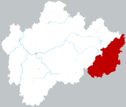
 Location of Pan'an County within Jinhua | |
| Coordinates: 29°02′31″N 120°34′09″E / 29.04194°N 120.56917°E | |
| Country | People's Republic of China |
| Province | Zhejiang |
| Prefecture-level city | Jinhua |
| Area | |
• Total | 1,194.74 km2 (461.29 sq mi) |
| Population (2020) | |
• Total | 177,161 |
| Time zone | UTC+8 (China Standard) |
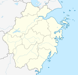
Pan'an County (Chinese: 磐安县; pinyin: Pán'ān Xiàn) is a county of central Zhejiang province, China. It is under the administration of the Jinhua city.
Administrative divisions
[edit]Towns:[1]
- Anwen (安文镇), Shanghu (尚湖镇), Fangqian (方前镇), Xinwo (新渥镇), Jianshan (尖山镇), Yushan (玉山镇), Renchuan (仁川镇), Dapan (大盘镇), Lengshui (冷水镇)
Townships:
- Huzhai Township (胡宅乡), Yaochuan Township (窈川乡), Shuangxi Township (双溪乡), Shenze Township (深泽乡), Shuangfeng Township (双峰乡), Panfeng Township (盘峰乡), Weixin Township (维新乡), Gao'er Township (高二乡), Jiuhe Township (九和乡), Wancang Township (万苍乡)
Transportation
[edit]Pan'an South railway station is on the Jinhua–Taizhou railway.
References
[edit]- ^ "金华市-行政区划网 www.xzqh.org" (in Chinese). XZQH. Retrieved 2012-05-24.

