Lövstalöt: Difference between revisions
Appearance
Content deleted Content added
+cat |
JOSIEwiki6 (talk | contribs) Updated population figures |
||
| (33 intermediate revisions by 26 users not shown) | |||
| Line 1: | Line 1: | ||
{{Infobox settlement |
|||
'''Lövstalöt''', residential district in [[Bälinge Parish]], [[Uppsala Municipality]], [[Uppsala County]], [[Uplandia]], [[Sweden]]. The population in Lövstalöt was 880 in the year [[2000]]. Lövstalöt is situated 12 km north by the city of [[Uppsala]] in the flat country that surrounds the city. Most of the houses in Lövstalöt were built during the [[1960s]], but also during the [[1980s]] quite a few houses were built. Detached houses dominate, but there are also some terraced houses. The style of [[1960s]] houses are quite [[Modernism|modernistic]], but not in any way extreme. The [[Modernism|modernistic]] style has also been reduced by the fact that most houses have been repainted and in other ways modified during the decades. That has given most houses a more traditional look. |
|||
| official_name = Lövstalöt |
|||
| image_skyline = |
|||
| image_caption = |
|||
| pushpin_map = Sweden Uppsala#Sweden |
|||
| pushpin_label_position = |
|||
| subdivision_type = [[Country]] |
|||
| subdivision_name = [[Sweden]] |
|||
| subdivision_type3 = [[Municipalities of Sweden|Municipality]] |
|||
| subdivision_name3 = [[Uppsala Municipality]] |
|||
| subdivision_type2 = [[Counties of Sweden|County]] |
|||
| subdivision_name2 = [[Uppsala County]] |
|||
| subdivision_type1 = [[Provinces of Sweden|Province]] |
|||
| subdivision_name1 = [[Uppland]] |
|||
| area_footnotes = <ref name=scb>{{cite web |url=http://www.scb.se/Statistik/MI/MI0810/2010A01/Tatorternami0810tab1_4.xls |title=Tätorternas landareal, folkmängd och invånare per km<sup>2</sup> 2005 och 2010 |date=14 December 2011 |publisher=[[Statistics Sweden]] |language=Swedish |archiveurl=https://web.archive.org/web/20120127055525/http://www.scb.se/Statistik/MI/MI0810/2010A01/Tatorternami0810tab1_4.xls |archivedate=27 January 2012 |url-status=live |accessdate=10 January 2012 }}</ref> |
|||
| area_total_km2 = 0.71 |
|||
| population_as_of = 31 December 2020 |
|||
| population_footnotes = <ref name="scb_urban_area_population_area_population_density">{{cite web | title=Statistiska tätorter 2020, befolkning, landareal, befolkningstäthet| publisher=[[Statistics Sweden]] | url=https://www.scb.se/MI0810 |date=31 December 2020 | access-date=3 June 2024}}</ref> |
|||
| population_total = 1,445 <!-- This is the official figure from Statistics Sweden (Statistiska centralbyrån). --> |
|||
| population_density_km2 = auto |
|||
| timezone = [[Central European Time|CET]] |
|||
| utc_offset = +1 |
|||
| timezone_DST = [[Central European Summer Time|CEST]] |
|||
| utc_offset_DST = +2 |
|||
| coordinates = {{coord|59|57|N|17|35|E|region:SE|display=inline,title}} |
|||
| website = |
|||
}} |
|||
'''Lövstalöt''' is a [[Urban areas in Sweden|locality]] situated in [[Uppsala Municipality]], [[Uppsala County]], [[Sweden]] with 1,046 inhabitants in 2010.<ref name=scb /> |
|||
Lövstalöt is situated 12 km north of the city of [[Uppsala]], in the flat country that surrounds the city. Until the end of the 1930s, the village consisted of a few houses and a school, built in 1892. In 1938, a [[woodworking]] factory, ''Bälinge Snickerifabrik'', was built.<ref name=wahlstr>{{cite book |last= Wahlström |first= Cristina |title= Från Siggefora till Bennebol - Nittonhundratalets Uppsala ur landsbygdsperspektiv | series= Uppsala Stadsarkivs skriftserie |volume= 14 |year= 2005 |publisher= Uppsala City Archives |location= Uppsala |language= Swedish |isbn= 91-86902-17-2}}</ref> |
|||
| ⚫ | |||
Most of the houses in Lövstalöt were built during the 1960s and 1980s. Detached houses dominate, but there are also some terraced houses. |
|||
[[category:Towns in Sweden]] |
|||
| ⚫ | |||
== References == |
|||
{{Reflist}} |
|||
{{Localities in Uppsala Municipality}} |
|||
{{authority control}} |
|||
{{DEFAULTSORT:Lovstalot}} |
|||
[[Category:Populated places in Uppsala County]] |
|||
[[Category:Populated places in Uppsala Municipality]] |
|||
{{Uppsala-geo-stub}} |
|||
Latest revision as of 11:05, 3 June 2024
Lövstalöt | |
|---|---|
| Coordinates: 59°57′N 17°35′E / 59.950°N 17.583°E | |
| Country | Sweden |
| Province | Uppland |
| County | Uppsala County |
| Municipality | Uppsala Municipality |
| Area | |
• Total | 0.71 km2 (0.27 sq mi) |
| Population (31 December 2020)[2] | |
• Total | 1,445 |
| • Density | 2,000/km2 (5,300/sq mi) |
| Time zone | UTC+1 (CET) |
| • Summer (DST) | UTC+2 (CEST) |
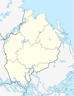
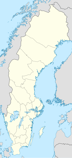
Lövstalöt is a locality situated in Uppsala Municipality, Uppsala County, Sweden with 1,046 inhabitants in 2010.[1]
Lövstalöt is situated 12 km north of the city of Uppsala, in the flat country that surrounds the city. Until the end of the 1930s, the village consisted of a few houses and a school, built in 1892. In 1938, a woodworking factory, Bälinge Snickerifabrik, was built.[3]
Most of the houses in Lövstalöt were built during the 1960s and 1980s. Detached houses dominate, but there are also some terraced houses.
In the centre of Lövstalöt there is a gravefield from the Iron Age.
References
[edit]- ^ a b "Tätorternas landareal, folkmängd och invånare per km2 2005 och 2010" (in Swedish). Statistics Sweden. 14 December 2011. Archived from the original on 27 January 2012. Retrieved 10 January 2012.
- ^ "Statistiska tätorter 2020, befolkning, landareal, befolkningstäthet". Statistics Sweden. 31 December 2020. Retrieved 3 June 2024.
- ^ Wahlström, Cristina (2005). Från Siggefora till Bennebol - Nittonhundratalets Uppsala ur landsbygdsperspektiv. Uppsala Stadsarkivs skriftserie (in Swedish). Vol. 14. Uppsala: Uppsala City Archives. ISBN 91-86902-17-2.


