Somogyhatvan: Difference between revisions
Appearance
Content deleted Content added
m Bot) Add coordinates_region and/or _display parameters (report errors? |
→top: Added image #suggestededit-add-image-top Tags: Mobile edit Mobile app edit Android app edit |
||
| (13 intermediate revisions by 11 users not shown) | |||
| Line 1: | Line 1: | ||
{{Infobox settlement <!--more fields are available for this Infobox--See Template:Infobox Settlement--> |
{{Infobox settlement <!--more fields are available for this Infobox--See Template:Infobox Settlement--> |
||
| ⚫ | |||
|coordinates_display = inline,title |
|||
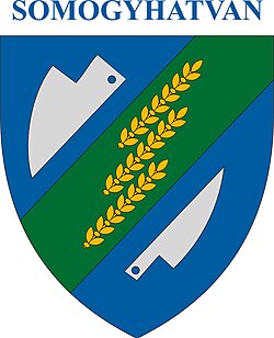
| image_caption = Coat of arms of Somogyhatvan, Hungary |
|||
|coordinates_region = HU |
|||
| image_skyline = HUN_Somogyhatvan_COA.jpg |
|||
| ⚫ | |||
| |
| image_map = BaranyaMegye.png |
||
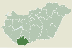
| map_caption = Location of Baranya county in Hungary |
|||
| ⚫ | |||
| pushpin_map = Hungary |
|||
| ⚫ | |||
| ⚫ | |||
| ⚫ | |||
| ⚫ | |||
|utc_offset_DST=+2 |
|||
| coordinates = {{coord|46.11195|17.71413|region:HU|display=inline,title}} |
|||
| |
|||
| ⚫ | |||
| ⚫ | |||
| subdivision_name = {{HUN}} |
|||
map=[[Image:BaranyaMegye.png|center|thumb|275px|Location of Baranya county in Hungary]]| |
|||
subdivision_type1=[[Counties of Hungary|County]] |
| subdivision_type1 = [[Counties of Hungary|County]] |
||
subdivision_name1=[[Baranya (county)|Baranya]] |
| subdivision_name1 = [[Baranya (county)|Baranya]] |
||
area_total_km2=13.52 |
| area_total_km2 = 13.52 |
||
population_total=374 |
| population_total = 374 |
||
population_as_of=2004 |
| population_as_of = 2004 |
||
population_density_km2=27.66 |
| population_density_km2 = 27.66 |
||
| ⚫ | |||
| ⚫ | |||
| ⚫ | |||
| ⚫ | |||
| ⚫ | |||
area_code=73| |
|||
| utc_offset_DST = +2 |
|||
| ⚫ | |||
| ⚫ | |||
| ⚫ | |||
| ⚫ | |||
| |
| area_code = 73 |
||
latd=46.11195| |
|||
longd=17.71413 |
|||
}} |
}} |
||
[[File:HUN_Somogyhatvan_COA.jpg|thumb|right]] |
|||
'''Somogyhatvan''' is a village in [[Baranya (county)|Baranya]] county, [[Hungary]]. |
'''Somogyhatvan''' is a village in [[Baranya (county)|Baranya]] county, [[Hungary]]. |
||
== External links == |
== External links == |
||
* [http://www.terkepcentrum.hu/index.asp?go=map&tid=25070 Street map] {{ |
* [http://www.terkepcentrum.hu/index.asp?go=map&tid=25070 Street map] {{in lang|hu}} |
||
| ⚫ | |||
| ⚫ | |||
{{authority control}} |
|||
| ⚫ | |||
| ⚫ | |||
[[eo:Somogyhatvan]] |
|||
{{Baranya-geo-stub}} |
|||
[[hr:Somogyhatvan]] |
|||
[[it:Somogyhatvan]] |
|||
[[hu:Somogyhatvan]] |
|||
[[nl:Somogyhatvan]] |
|||
[[pl:Somogyhatvan]] |
|||
[[sk:Somogyhatvan]] |
|||
Latest revision as of 03:04, 1 December 2023
Somogyhatvan | |
|---|---|
 Coat of arms of Somogyhatvan, Hungary | |
 Location of Baranya county in Hungary | |
| Coordinates: 46°06′43″N 17°42′51″E / 46.11195°N 17.71413°E | |
| Country | |
| County | Baranya |
| Area | |
• Total | 13.52 km2 (5.22 sq mi) |
| Population (2004) | |
• Total | 374 |
| • Density | 27.66/km2 (71.6/sq mi) |
| Time zone | UTC+1 (CET) |
| • Summer (DST) | UTC+2 (CEST) |
| Postal code | 7921 |
| Area code | 73 |

Somogyhatvan is a village in Baranya county, Hungary.
External links
[edit]- Street map (in Hungarian)


