Kürdmaşı: Difference between revisions
Appearance
Content deleted Content added
m Remove template per TFD outcome |
m Moving Category:Populated places in Ismailli District to Category:Populated places in Ismayilli District per Wikipedia:Categories for discussion/Log/2022 June 3#Category:Populated places in Ismailli District |
||
| (8 intermediate revisions by 8 users not shown) | |||
| Line 5: | Line 5: | ||
|pushpin_map =Azerbaijan |
|pushpin_map =Azerbaijan |
||
|pushpin_mapsize =300 |
|pushpin_mapsize =300 |
||
|coordinates_region = AZ |
|||
|subdivision_type = Country |
|subdivision_type = Country |
||
|subdivision_name = {{flag|Azerbaijan}} |
|subdivision_name = {{flag|Azerbaijan}} |
||
| Line 24: | Line 23: | ||
|timezone_DST =[[Azerbaijan Time|AZT]] |
|timezone_DST =[[Azerbaijan Time|AZT]] |
||
|utc_offset_DST = +5 |
|utc_offset_DST = +5 |
||
|coordinates = {{coord|40|40|33|N|48|02|31|E|region:AZ|display=inline,title}} |
|||
|latd=40 |latm=40 |lats=33 |latNS=N |
|||
|longd=48|longm=02 |longs=31 |longEW=E |
|||
|coordinates_display = inline,title |
|||
|elevation_m = |
|elevation_m = |
||
|area_code = |
|area_code = |
||
| Line 40: | Line 37: | ||
{{DEFAULTSORT:Kurdmasi}} |
{{DEFAULTSORT:Kurdmasi}} |
||
[[Category:Populated places in |
[[Category:Populated places in Ismayilli District]] |
||
Latest revision as of 13:19, 12 July 2022
Kürdmaşı | |
|---|---|
Municipality | |
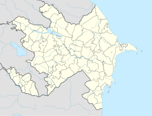
| Coordinates: 40°40′33″N 48°02′31″E / 40.67583°N 48.04194°E | |
| Country | |
| Rayon | Ismailli |
| Population | |
• Total | 2,997 |
| Time zone | UTC+4 (AZT) |
| • Summer (DST) | UTC+5 (AZT) |
Kürdmaşı (also, Kyurdmashi, Kyurdmashy, and Kyurtmashi) is a village and municipality in the Ismailli Rayon of Azerbaijan. It has a population of 2,997.
References
[edit]


