Jarmina: Difference between revisions
m Lang, WL |
m Moving Category:Populated places in Vukovar-Syrmia County to Category:Populated places in Vukovar-Srijem County per Wikipedia:Categories for discussion/Speedy |
||
| (48 intermediate revisions by 18 users not shown) | |||
| Line 1: | Line 1: | ||
{{Infobox settlement |
|||
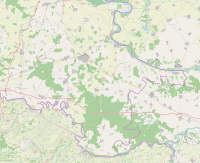
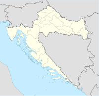
{{location map|Croatia|label=Jarmina|position=left|lat=45.32|long=18.73}} |
|||
| name = Jarmina |
|||
| ⚫ | |||
| official_name = Municipality of Jarmina<br>''Općina Jarmina'' |
|||
| native_name = |
|||
| native_name_lang = hr |
|||
| settlement_type = [[Municipalities of Croatia|Municipality]] |
|||
| image_skyline = Jarmina.JPG |
|||
| image_caption = |
|||
| image_flag = Flag of Jarmina Municipality.gif |
|||
| image_seal = Coat of Arms of Jarmina.gif |
|||
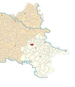
| image_map = Jarmina.png |
|||
| pushpin_map = Croatia Vukovar-Srijem County#Croatia#Europe<!-- the name of a location map as per http://en.wikipedia.org/wiki/Template:Location_map --> |
|||
| pushpin_mapsize = 200 |
|||
| pushpin_map_caption = Location in Croatia |
|||
| pushpin_label_position = bottom |
|||
| ⚫ | |||
| subdivision_type = [[List of sovereign states|Country]] |
|||
| subdivision_name = {{flag|Croatia}} |
|||
| subdivision_type1 = [[Counties of Croatia|County]] |
|||
| subdivision_name1 = {{flag|Vukovar-Srijem|name=Vukovar-Syrmia}} |
|||
| government_footnotes = <!-- for references: use <ref> tags --> |
|||
| government_type = <!-- Town --> |
|||
| leader_party = [[Croatian Democratic Union|HDZ]] |
|||
| leader_title = Mayor |
|||
| leader_name = Andrija Draganić |
|||
| area_footnotes = <ref>{{Cite Q|Q119585703|mode=cs1}}</ref> |
|||
| area_total_km2 = 13.0 |
|||
| area_urban_km2 = 13.0 |
|||
| elevation_m = |
|||
| population_footnotes = <ref name="Census 2021">{{Croatian Census 2021|S}}</ref> |
|||
| population_as_of = 2021 |
|||
| population_total = 2016 |
|||
| population_density_km2 = auto |
|||
| population_urban = 2016 |
|||
| population_density_urban_km2 = auto |
|||
| timezone = [[Central European Time|CET]] |
|||
| timezone_DST = [[Central European Summer Time|CEST]] |
|||
| utc_offset = +1 |
|||
| utc_offset_DST = +2 |
|||
| postal_code_type = Postal code |
|||
| postal_code = 32280 |
|||
| area_code_type = <!-- defaults to: Area code(s) --> |
|||
| area_code = [[Telephone numbers in Croatia|32]] |
|||
| registration_plate = [[Vehicle registration plates of Croatia|VK]] |
|||
| website = {{URL|jarmina.hr}} |
|||
| footnotes = |
|||
}} <!-- Infobox ends !--> |
|||
| ⚫ | |||
| ⚫ | |||
==Name== |
|||
| ⚫ | |||
In [[German language|German]] the village is known as ''Jahrmein'' or ''Hermann'', in [[Hungarian language|Hungarian]] as ''Járomnaszentmiklós'', and in [[Serbian Cyrillic]] as Јармина. |
|||
==Demographics== |
|||
| ⚫ | |||
First German settlers moved to the village from 1770 onwards while the school in German language was established in 1790.{{sfn|Barišić Bogišić|2022|pp=40}} Historical records indicate that increase in tax burdens in 1770 forced the entire local [[Serbs|Serb]] population as well as large majority of [[Croats]] to leave the settlement.{{sfn|Barišić Bogišić|2022|pp=42}} |
|||
| ⚫ | |||
| ⚫ | |||
According to the [[2011 Croatian census|2011 census]], there are 2,458 inhabitants,<ref name=census2011>{{Croatian Census 2011|S|16|1660}}</ref> 99.27% which are [[Croats]].<ref>{{Croatian Census 2011|E|16}}</ref> |
|||
==Characteristics== |
|||
| ⚫ | The municipality is home to a monument to defenders and civilians killed in the [[Croatian War of Independence]] which has the names of 15 deceased people.<ref>{{Cite web |url=http://www.hrv.hr/newportal/vijesti/vijest.php?clanak=3298 |title=Monument to the killed in the Homeland War unveiled in Jarmina |access-date=2008-09-09 |archive-date=2011-10-02 |archive-url=https://web.archive.org/web/20111002034032/http://www.hrv.hr/newportal/vijesti/vijest.php?clanak=3298 |url-status=dead }}</ref> |
||
| ⚫ | |||
| ⚫ | |||
==See also== |
|||
| ⚫ | |||
* [[Syrmia]] |
|||
==References== |
==References== |
||
{{reflist}} |
{{reflist}} |
||
==Sources== |
|||
| ⚫ | |||
* {{cite book |last=Barišić Bogišić |first=Lidija |chapter=Njemački jezik u Srijemskoj županiji u popisu stanovništva 1910. godine |title=O neslavenskom stanovništvu na vukovarskom području |publisher=Hrvatska sveučilišna naklada |ISBN= 978-953-169-497-1 |date=2022 }} |
|||
{{Subdivisions of Vukovar-Srijem County}} |
|||
| ⚫ | |||
{{Villages of Vukovar-Syrmia County}} |
|||
{{authority control}} |
|||
[[Category:Municipalities of Croatia]] |
[[Category:Municipalities of Croatia]] |
||
[[Category: |
[[Category:Populated places in Syrmia]] |
||
[[Category:Populated places in Vukovar-Srijem County]] |
|||
{{VukovarSyrmia-geo-stub}} |
{{VukovarSyrmia-geo-stub}} |
||
[[fr:Jarmina]] |
|||
[[hr:Jarmina]] |
|||
[[it:Jarmina]] |
|||
[[nl:Jarmina]] |
|||
[[sr:Јармина]] |
|||
[[sh:Jarmina]] |
|||
[[war:Jarmina]] |
|||
Latest revision as of 20:23, 15 September 2024
Jarmina | |
|---|---|
| Municipality of Jarmina Općina Jarmina | |
 | |
 | |
| Coordinates: 45°19′N 18°44′E / 45.317°N 18.733°E | |
| Country | |
| County | |
| Government | |
| • Mayor | Andrija Draganić (HDZ) |
| Area | |
| 13.0 km2 (5.0 sq mi) | |
| • Urban | 13.0 km2 (5.0 sq mi) |
| Population (2021)[2] | |
| 2,016 | |
| • Density | 160/km2 (400/sq mi) |
| • Urban | 2,016 |
| • Urban density | 160/km2 (400/sq mi) |
| Time zone | UTC+1 (CET) |
| • Summer (DST) | UTC+2 (CEST) |
| Postal code | 32280 |
| Area code | 32 |
| Vehicle registration | VK |
| Website | jarmina |
Jarmina is a village and municipality in the Vukovar-Syrmia County in Croatia.
Name
[edit]In German the village is known as Jahrmein or Hermann, in Hungarian as Járomnaszentmiklós, and in Serbian Cyrillic as Јармина.
Demographics
[edit]First German settlers moved to the village from 1770 onwards while the school in German language was established in 1790.[3] Historical records indicate that increase in tax burdens in 1770 forced the entire local Serb population as well as large majority of Croats to leave the settlement.[4]
Before World War II there was a substantial German-speaking Danube Swabian population here.
According to the 2011 census, there are 2,458 inhabitants,[5] 99.27% which are Croats.[6]
Characteristics
[edit]The municipality is home to a monument to defenders and civilians killed in the Croatian War of Independence which has the names of 15 deceased people.[7]
Near Borinci, a hamlet between Jarmina and Vinkovci, there is a 171 metres tall guyed mast for FM-/TV-broadcasting.
Jarmina is unofficial name of the Vinkovci Marshaling yard and freight railway station.
See also
[edit]References
[edit]- ^ Register of spatial units of the State Geodetic Administration of the Republic of Croatia. Wikidata Q119585703.
- ^ "Population by Age and Sex, by Settlements" (xlsx). Census of Population, Households and Dwellings in 2021. Zagreb: Croatian Bureau of Statistics. 2022.
- ^ Barišić Bogišić 2022, pp. 40.
- ^ Barišić Bogišić 2022, pp. 42.
- ^ "Population by Age and Sex, by Settlements, 2011 Census: Jarmina". Census of Population, Households and Dwellings 2011. Zagreb: Croatian Bureau of Statistics. December 2012.
- ^ "Population by Ethnicity, by Towns/Municipalities, 2011 Census: County of Vukovar-Sirmium". Census of Population, Households and Dwellings 2011. Zagreb: Croatian Bureau of Statistics. December 2012.
- ^ "Monument to the killed in the Homeland War unveiled in Jarmina". Archived from the original on 2011-10-02. Retrieved 2008-09-09.
Sources
[edit]- Barišić Bogišić, Lidija (2022). "Njemački jezik u Srijemskoj županiji u popisu stanovništva 1910. godine". O neslavenskom stanovništvu na vukovarskom području. Hrvatska sveučilišna naklada. ISBN 978-953-169-497-1.


