Chãs de Tavares: Difference between revisions
Appearance
Content deleted Content added
Dr. Blofeld (talk | contribs) No edit summary |
→top: Added image #suggestededit-add-image-top Tags: Mobile edit Mobile app edit Android app edit App image add top |
||
| (18 intermediate revisions by 15 users not shown) | |||
| Line 1: | Line 1: | ||
{{Infobox |
{{Infobox Portuguese subdivision |
||
|type = parish |
|||
<!-- See Template:Infobox settlement for additional fields and descriptions --> |
|||
| name = Chãs de Tavares |
| name = Chãs de Tavares |
||
| ⚫ | |||
| native_name_lang = <!-- ISO 639-2 code e.g. "fr" for French. If more than one, use {{lang}} instead --> |
|||
| settlement_type = [[Freguesia (Portugal)|Freguesia]] |
|||
| image_skyline = |
| image_skyline = |
||
| image_alt = |
|||
| image_caption = |
| image_caption = |
||
| image_flag = |
| image_flag = |
||
| flag_alt = |
|||
| image_seal = |
| image_seal = |
||
| seal_alt = |
|||
| image_shield = |
| image_shield = |
||
| |
|region = [[Centro Region, Portugal|Centro]] |
||
| |
|CIM = [[Viseu Dão Lafões]] |
||
| |
|district = [[Viseu District|Viseu]] |
||
| |
|municipality = [[Mangualde]] |
||
| |
| coordinates = {{coord|40|37|18|N|7|36|31|W|display=inline,title}} |
||
| map_alt = |
|||
| map_caption = |
|||
| pushpin_map = |
|||
| pushpin_label_position = |
|||
| pushpin_map_alt = |
|||
| pushpin_map_caption = |
|||
| latd = 40 |latm = 37 |lats = 18 |latNS = N |
|||
| longd = 7 |longm = 36 |longs = 31 |longEW = W |
|||
| coor_pinpoint = |
|||
| coordinates_type = |
|||
| coordinates_display = inline,title |
|||
| coordinates_footnotes = |
|||
| subdivision_type = Country |
|||
| subdivision_name = [[Portugal]] |
|||
| subdivision_type1 = [[Districts of Portugal|District]] |
|||
| subdivision_name1 = [[Viseu District|Viseu]] |
|||
| subdivision_type2 = [[Municipalities of Portugal|Municipality]] |
|||
| subdivision_name2 = [[Mangualde Municipality|Mangualde]] |
|||
| subdivision_type3 = |
|||
| subdivision_name3 = |
|||
| established_title = |
|||
| established_date = |
|||
| founder = |
|||
| seat_type = |
|||
| seat = |
|||
| government_footnotes = |
|||
| leader_party = |
|||
| leader_title = |
|||
| leader_name = |
|||
| unit_pref = Metric<!-- or US or UK --> |
|||
| area_footnotes = |
|||
| area_total_km2 = 22.64 |
| area_total_km2 = 22.64 |
||
| area_land_km2 = |
|||
| area_water_km2 = |
|||
| area_water_percent = |
|||
| area_note = |
|||
| elevation_footnotes = |
|||
| elevation_m = |
| elevation_m = |
||
| population_footnotes = |
|||
| population_total = 1,200 |
| population_total = 1,200 |
||
| population_as_of = 2001 |
| population_as_of = 2001 |
||
| ⚫ | |||
| population_density_km2 = auto |
|||
| population_demonym = |
|||
| population_note = |
|||
| timezone1 = |
|||
| utc_offset1 = |
|||
| timezone1_DST = |
|||
| utc_offset1_DST = |
|||
| postal_code_type = |
|||
| postal_code = |
|||
| area_code_type = |
|||
| area_code = |
|||
| iso_code = |
|||
| website = <!-- {{URL|example.com}} --> |
|||
| footnotes = |
|||
}} |
}} |
||
[[File:Vista_da_Capela_do_Bom_Sucesso_-_Chãs_de_Tavares_-_Portugal_(50869273183).jpg|thumb]] |
|||
'''Chãs de Tavares''' is a [[Freguesia (Portugal)|freguesia]] in [[Mangualde Municipality|Mangualde]], [[Portugal]].<ref>{{cite web | url=http://www.cmmangualde.pt/index.php?option=com_content&view=article&id=358&Itemid=132| title=Freguesia de Chãs de Tavares | publisher=Município de Mangualde |language= Portuguese| accessdate=2011-9-5}}</ref>It is located 36 kilometres along the A25 road east of [[Viseu]]. |
|||
'''Chãs de Tavares''' is a former [[Freguesia (Portugal)|civil parish]] in the municipality of [[Mangualde Municipality|Mangualde]], Portugal. In 2013, the parish merged into the new parish [[Tavares (Chãs, Várzea e Travanca)]].<ref>{{cite web|title=Law nr. 11-A/2013, pages 552 66-67|url=http://dre.pt/pdf1sdip/2013/01/01901/0000200147.pdf |accessdate=28 July 2014|author=[[Diário da República]]|language=Portuguese}}</ref> It is located 36 kilometres along the A25 road east of [[Viseu]]. |
|||
==References== |
==References== |
||
{{reflist}} |
{{reflist}} |
||
| ⚫ | |||
{{authority control}} |
|||
| ⚫ | |||
{{DEFAULTSORT:Chas De Tavares}} |
|||
| ⚫ | |||
[[nl:Chãs de Tavares]] |
|||
[[pt:Chãs de Tavares]] |
|||
[[ru:Шанш-де-Тавареш]] |
|||
| ⚫ | |||
Latest revision as of 16:09, 17 September 2024
Chãs de Tavares | |
|---|---|
| Coordinates: 40°37′18″N 7°36′31″W / 40.62167°N 7.60861°W | |
| Country | |
| Region | Centro |
| Intermunic. comm. | Viseu Dão Lafões |
| District | Viseu |
| Municipality | Mangualde |
| Disbanded | 2013 |
| Area | |
• Total | 22.64 km2 (8.74 sq mi) |
| Population (2001) | |
• Total | 1,200 |
| • Density | 53/km2 (140/sq mi) |
| Time zone | UTC+00:00 (WET) |
| • Summer (DST) | UTC+01:00 (WEST) |

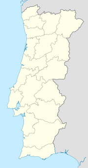
Chãs de Tavares is a former civil parish in the municipality of Mangualde, Portugal. In 2013, the parish merged into the new parish Tavares (Chãs, Várzea e Travanca).[1] It is located 36 kilometres along the A25 road east of Viseu.
References
[edit]- ^ Diário da República. "Law nr. 11-A/2013, pages 552 66-67" (PDF) (in Portuguese). Retrieved 28 July 2014.

