Bambang station: Difference between revisions
No edit summary |
Lowkeypedia (talk | contribs) Add history |
||
| (101 intermediate revisions by 59 users not shown) | |||
| Line 1: | Line 1: | ||
{{Short description|Train station in Manila, Philippines}} |
|||
{{Infobox |
{{Infobox station |
||
| name = Bambang |
|||
| type= [[Rapid transit]] |
|||
| type = |
|||
| image= WTMP Team Waka Waka E-2.JPG |
|||
| symbol = 1 | symbol_location = manila |
|||
| image_size= 300 |
|||
| map_type = Philippines City of Manila#Metro Manila#Luzon mainland#Philippines |
|||
| image_caption= Exterior of Bambang station above Bambang Street |
|||
| map_caption = Location in [[Manila]]##Location in [[Metro Manila]]##Location in [[Luzon]]##Location in the Philippines |
|||
| ⚫ | |||
| image = File:Bambang_station_02.jpg |
|||
| line=<font color="#FFCC00">█ </FONT> [[Manila LRT Yellow Line|Yellow Line]] |
|||
| image_caption = |
|||
| other= |
|||
| ⚫ | |||
| ⚫ | |||
| country = [[Philippines]] |
|||
| platform=Side platforms |
|||
| line = {{rail color box|system=Manila LRT|line=1|inline=yes}} |
|||
| ⚫ | |||
| other = |
|||
| ⚫ | |||
| ⚫ | |||
| platform = 2 (2 [[side platform|side]]) |
|||
| ⚫ | |||
| ⚫ | |||
| ⚫ | |||
| parking = |
|||
| ⚫ | |||
| ⚫ | |||
| opened=May 12, 1985 |
|||
| ⚫ | |||
| rebuilt= |
|||
| ⚫ | |||
| services= |
|||
| ⚫ | |||
{{s-rail|title=Manila LRT}} |
|||
| opened = {{start date and age|1985|05|12|mf=y}}<ref>{{cite book|last=Rimmer|first=Peter J.|url=https://books.google.com/books?id=gd9sBQAAQBAJ&pg=PA190|title=Rikisha to Rapid Transit: Urban Public Transport Systems and Policy in Southeast Asia|date=2013|publisher=[[Elsevier]]|isbn=9781483150529|pages=190–191}}</ref> |
|||
| ⚫ | |||
| rebuilt = |
|||
| ⚫ | |||
| ⚫ | |||
| accessible = |
|||
| baggage_check=Yes |
|||
| ⚫ | |||
| ⚫ | |||
| owned = [[Department of Transportation (Philippines)|Department of Transportation]]<br />[[Light Rail Manila Corporation]] |
|||
| zone = |
|||
}} |
}} |
||
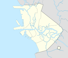
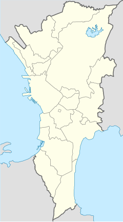
'''Bambang station''' is an elevated [[Manila Light Rail Transit System|Light Rail Transit]] (LRT) station located on the [[LRT Line 1 (Metro Manila)|LRT Line 1]] (LRT-1) system in [[Santa Cruz, Manila|Santa Cruz]], [[Manila]]. The station is situated on the intersection of [[Rizal Avenue]] and Bambang Street, where the station got its name. |
|||
Bambang station serves as the ninth station for trains headed to [[Dr. Santos station|Dr. Santos]] and the seventeenth station for trains headed to [[Fernando Poe Jr. station|Fernando Poe Jr.]] It is notable for having a commercial hub for medical and laboratory supplies within its vicinity.<ref>{{cite news|url=https://www.yelp.com/search?cflt=medicalsupplies&find_loc=Bambang+St%2C+Manila%2C+Metro+Manila|title=The Best 10 Medical Supplies near Bambang St, Manila, Metro Manila, Philippines|website=Yelp|accessdate=July 6, 2024}}</ref> |
|||
'''Bambang LRT Station''' is a station on the [[Manila Light Rail Transit System|Manila LRT]] Yellow Line (LRT-1). Like all other LRT-1 stations, Bambang station is above-ground. The station is located in [[Santa Cruz, Manila|Santa Cruz]] in [[Manila]], on Rizal Avenue. The station is named after Bambang street, the street right beside the station. |
|||
==History== |
|||
Bambang station serves as the eleventh station for trains headed to [[Baclaran LRT Station|Baclaran]] and the twelfth station for trains headed to [[North Avenue LRT Station|North Avenue]]. It is near major hospitals such as the Jose Reyes Memorial Medical Center and the San Lazaro Hospital, as well as educational institutions such as the Francisco Balagtas Elementary School, the [[Doña Teodora Alonzo High School]] and the [[University of Santo Tomas]]. |
|||
Bambang station was opened to the public on May 12, 1985, as part of the Rizal Line, which extended the LRT northward to [[Monumento station|Monumento]].<ref>{{cite journal|url=https://pssc.org.ph/wp-content/pssc-archives/Philippine%20Planning%20Journal/Vol%20XVII,%20No.%201%20(Oct%201985).pdf|title=The LRT as a Component of Metro Manila's Transport Systems|journal=Philippine Planning Journal|volume=XVII|number=1|date=October 1985|publisher=School of Urban and Regional Planning, [[University of the Philippines]]|accessdate=November 16, 2024|page=33-45}}</ref><ref>{{cite web|url=https://www.lrta.gov.ph/railway-operations/|title=Railway Operations|website=[[Light Rail Transit Authority]]|accessdate=November 16, 2024}}</ref> |
|||
==Transportation links== |
==Transportation links== |
||
Commuters can take the many jeepneys, tricycles and taxis |
Commuters can take the many [[Jeepney|jeepneys]], tricycles and taxis from Bambang station towards their destinations in the Manila, especially the districts of [[Quiapo, Manila|Quiapo]], Santa Cruz, [[Sampaloc, Manila|Sampaloc]] and [[Tondo, Manila|Tondo]]. The station is also served by buses plying Rizal Avenue.{{citation needed|date=October 2024}} |
||
==See also== |
|||
*[[List of rail transit stations in Metro Manila]] |
|||
| ⚫ | |||
==References== |
|||
{{reflist}} |
|||
{{Commons category|Bambang station}} |
|||
{{SRTS}} |
{{SRTS}} |
||
{{Coord|14|36|40|N|120|58|57|E|dim:30_type:railwaystation_region:PH|display=title}} |
|||
{{DEFAULTSORT:Bambang station}} |
|||
[[Category:Manila Light Rail Transit System stations]] |
[[Category:Manila Light Rail Transit System stations]] |
||
[[Category: |
[[Category:Buildings and structures in Santa Cruz, Manila]] |
||
[[Category:Railway stations in the Philippines opened in 1985]] |
|||
[[ceb:Estasyong Bambang (Lineyang Dalag)]] |
|||
Latest revision as of 02:18, 17 November 2024
 | |||||||||||
| General information | |||||||||||
| Location | 1367 Rizal Avenue, Santa Cruz Manila, Metro Manila, Philippines | ||||||||||
| Owned by | Department of Transportation Light Rail Manila Corporation | ||||||||||
| Line(s) | LRT Line 1 | ||||||||||
| Platforms | 2 (2 side) | ||||||||||
| Tracks | 2 | ||||||||||
| Construction | |||||||||||
| Structure type | Elevated | ||||||||||
| Other information | |||||||||||
| Station code | BM | ||||||||||
| History | |||||||||||
| Opened | May 12, 1985[1] | ||||||||||
| Services | |||||||||||
| |||||||||||
| |||||||||||
Bambang station is an elevated Light Rail Transit (LRT) station located on the LRT Line 1 (LRT-1) system in Santa Cruz, Manila. The station is situated on the intersection of Rizal Avenue and Bambang Street, where the station got its name.
Bambang station serves as the ninth station for trains headed to Dr. Santos and the seventeenth station for trains headed to Fernando Poe Jr. It is notable for having a commercial hub for medical and laboratory supplies within its vicinity.[2]
History
[edit]Bambang station was opened to the public on May 12, 1985, as part of the Rizal Line, which extended the LRT northward to Monumento.[3][4]
Transportation links
[edit]Commuters can take the many jeepneys, tricycles and taxis from Bambang station towards their destinations in the Manila, especially the districts of Quiapo, Santa Cruz, Sampaloc and Tondo. The station is also served by buses plying Rizal Avenue.[citation needed]
See also
[edit]References
[edit]- ^ Rimmer, Peter J. (2013). Rikisha to Rapid Transit: Urban Public Transport Systems and Policy in Southeast Asia. Elsevier. pp. 190–191. ISBN 9781483150529.
- ^ "The Best 10 Medical Supplies near Bambang St, Manila, Metro Manila, Philippines". Yelp. Retrieved July 6, 2024.
- ^ "The LRT as a Component of Metro Manila's Transport Systems" (PDF). Philippine Planning Journal. XVII (1). School of Urban and Regional Planning, University of the Philippines: 33-45. October 1985. Retrieved November 16, 2024.
- ^ "Railway Operations". Light Rail Transit Authority. Retrieved November 16, 2024.


