Shizuoka Prefecture: Difference between revisions
→University: fix link |
|||
| (223 intermediate revisions by more than 100 users not shown) | |||
| Line 1: | Line 1: | ||
{{ |
{{Short description|Prefecture of Japan}} |
||
{{Use dmy dates|date=October 2024}} |
|||
| Name = Shizuoka |
|||
{{Infobox settlement |
|||
| JapaneseName = {{Lang|ja|静岡県}} |
|||
| |
| name = Shizuoka Prefecture |
||
| native_name = {{nobold|{{lang|ja|{{lang|ja|静岡県}}}}}} |
|||
| Symbol = Flag of Shizuoka Prefecture.svg |
|||
| |
| official_name = |
||
| |
| settlement_type = [[Prefectures of Japan|Prefecture]] |
||
| |
| translit_lang1 = Japanese |
||
| translit_lang1_type = [[Japanese language|Japanese]] |
|||
| latd = 34|latm = 55|lats = |latNS = N |
|||
| translit_lang1_info = {{lang|ja|{{lang|ja|静岡県}}}} |
|||
| longd = 138|longm = 19|longs = |longEW = E |
|||
| translit_lang1_type1 = [[Romanization of Japanese|Rōmaji]] |
|||
| TotalArea = 7,779.63 |
|||
| translit_lang1_info1 = {{lang|ja-Latn|Shizuoka-ken}} |
|||
| AreaRank = 13th |
|||
| |
| image_flag = Flag of Shizuoka Prefecture.svg |
||
| |
| flag_size = 100px |
||
| image_blank_emblem = Emblem of Shizuoka Prefecture.svg |
|||
| Population = 3,774,471 |
|||
| |
| blank_emblem_size = 80px |
||
| |
| blank_emblem_type = Symbol |
||
| |
| image_skyline = |
||
| image_map = Map of Japan with highlight on 22 Shizuoka prefecture.svg |
|||
| Municipalities = 35 |
|||
| coordinates = {{coord|34|55|N|138|19|E|display=inline,title}} |
|||
| ISOCode = JP-22 |
|||
| |
| subdivision_type = Country |
||
| subdivision_name = [[Japan]] |
|||
| Tree = [[Sweet Osmanthus]] (''Osmanthus fragrans'' var. ''aurantiacus'') |
|||
| subdivision_type1 = [[List of regions of Japan|Region]] |
|||
| Bird = [[Japanese Paradise Flycatcher]] (''Terpsiphone atrocaudata'') |
|||
| subdivision_name1 = [[Chūbu region|Chūbu]] ([[Tōkai region|Tōkai]]) |
|||
| Fish = |
|||
| |
| subdivision_type2 = [[List of islands of Japan|Island]] |
||
| subdivision_name2 = [[Honshu]] |
|||
| Website = [http://www.pref.shizuoka.jp/a_foreign/english/ www.pref.shizuoka.jp/<br />a_foreign/english/] |
|||
| seat_type = [[List of capitals in Japan|Capital]] |
|||
| Governor = [[Heita Kawakatsu]] |
|||
| seat = [[Shizuoka, Shizuoka|Shizuoka]] |
|||
| seat1_type = Largest city |
|||
| seat1 = [[Hamamatsu]] |
|||
| parts_type = Subdivisions |
|||
| parts_style = para |
|||
| p1 = [[Districts of Japan|Districts]]: 5 |
|||
| p2 = [[Municipalities of Japan|Municipalities]]: 35 |
|||
| leader_title = [[List of prefectural governors in Japan|Governor]] |
|||
| leader_name = [[Yasutomo Suzuki]] |
|||
| area_total_km2 = 7777.42 |
|||
| area_water_percent = 2.6 |
|||
| area_rank = [[List of Japanese prefectures by area|13th]] |
|||
| elevation_max_m = 3778 |
|||
| elevation_max_point = [[Mount Fuji]] |
|||
| population_footnotes = |
|||
| population_total = 3555818 |
|||
| population_as_of = 1 September 2023 |
|||
| population_rank = [[List of Japanese prefectures by population|10th]] |
|||
| population_density_km2 = auto |
|||
| demographics_type2 = GDP |
|||
| demographics2_footnotes = <ref>{{Cite web |title=2020年度国民経済計算(2015年基準・2008SNA) : 経済社会総合研究所 - 内閣府 |url=https://www.esri.cao.go.jp/jp/sna/data/data_list/kakuhou/files/2020/2020_kaku_top.html |access-date=18 May 2023 |website=内閣府ホームページ |language=ja}}</ref> |
|||
| demographics2_title1 = Total |
|||
| demographics2_info1 = [[JP¥]] 17,866 billion<br />[[US$]] 163.9 billion (2019) |
|||
| iso_code = JP-22 |
|||
| website = {{URL|www.pref.shizuoka.jp/a_foreign/english}} |
|||
| module = {{Infobox place symbols| embedded=yes |
|||
| country = Japan |
|||
| bird = [[Japanese paradise flycatcher]] (''Terpsiphone atrocaudata'') |
|||
| fish = |
|||
| flower = [[Azalea]] (''Rhododendron'') |
|||
| tree = [[Sweet osmanthus]] (''Osmanthus fragrans'' var. ''aurantiacus'') |
|||
}} |
}} |
||
| population_blank2_title = Dialect |
|||
{{Nihongo|'''Shizuoka Prefecture'''|静岡県|Shizuoka-ken}} is a [[Prefectures of Japan|prefecture]] of [[Japan]] located in the [[Chūbu region]] on [[Honshu|Honshu island]].<ref>Nussbaum, Louis-Frédéric. (2005). "Shizuoka-ken" in {{Google books|p2QnPijAEmEC|''Japan Encyclopedia'', p. 876|page=876}}; "Chūbu" in {{Google books|p2QnPijAEmEC|p. 126|page=126}}</ref> The capital is the city of [[Shizuoka, Shizuoka|Shizuoka]].<ref>Nussbaum, "Shizuoka" at {{Google books|p2QnPijAEmEC|p. 876|page=876}}.</ref> |
|||
| population_blank2 = [[Shizuoka dialect]] |
|||
| anthem = {{ill|Shizuoka kenka|ja|静岡県歌|quote=y}} and {{ill|Fuji yo yume yo tomo yo|ja|富士よ夢よ友よ|quote=y}} |
|||
}} |
|||
{{nihongo|'''Shizuoka Prefecture'''|静岡県|Shizuoka-ken}} is a [[Prefectures of Japan|prefecture]] of [[Japan]] located in the [[Chūbu region]] of [[Honshu]].<ref>Nussbaum, Louis-Frédéric. (2005). "Shizuoka-ken" in {{Google books|p2QnPijAEmEC|''Japan Encyclopedia'', p. 876|page=876}}; "Chūbu" in {{Google books|p2QnPijAEmEC|p. 126|page=126}}</ref> {{as of|2023|9|post=,}} Shizuoka Prefecture has a population of 3,555,818 and has a geographic area of {{convert|7777.42|km2|sqmi|abbr=on}}. Shizuoka Prefecture borders [[Kanagawa Prefecture]] to the east, [[Yamanashi Prefecture]] to the northeast, [[Nagano Prefecture]] to the north, and [[Aichi Prefecture]] to the west. |
|||
[[Shizuoka (city)|Shizuoka]] is the capital and [[Hamamatsu]] is the largest city in Shizuoka Prefecture, with other major cities including [[Fuji, Shizuoka|Fuji]], [[Numazu]], and [[Iwata, Shizuoka|Iwata]].<ref>Nussbaum, "Shizuoka" at {{Google books|p2QnPijAEmEC|p. 876|page=876}}.</ref> Shizuoka Prefecture is located on Japan's [[Pacific Ocean]] coast and features [[Suruga Bay]] formed by the [[Izu Peninsula]], and [[Lake Hamana]] which is considered to be one of Japan's largest lakes. [[Mount Fuji]], the tallest [[volcano]] in Japan and [[cultural icon]] of the country, is partially located in Shizuoka Prefecture on the border with Yamanashi Prefecture. Shizuoka Prefecture has a significant [[Motor vehicle|motoring]] heritage as the founding location of [[Honda]], [[Suzuki Motor Corporation|Suzuki]], and [[Yamaha Corporation|Yamaha]], and is home to the [[Fuji International Speedway]]. |
|||
[[File:Mt.Fuji-Osezaki.jpg|thumb|View of Mt. Fuji from Numazu]] |
|||
== History == |
== History == |
||
{{See also|Historic Sites of Shizuoka Prefecture}} |
|||
Shizuoka prefecture was formed from the former [[Tōtōmi Province|Tōtōmi]], [[Suruga Province|Suruga]] and [[Izu Province|Izu]] provinces.<ref>Nussbaum, "Provinces and prefectures" at {{Google books|p2QnPijAEmEC|p. 780|page=780}}.</ref> |
|||
Shizuoka Prefecture was established from the former [[Tōtōmi Province|Tōtōmi]], [[Suruga Province|Suruga]] and [[Izu Province|Izu]] provinces.<ref>Nussbaum, "Provinces and prefectures" at {{Google books|p2QnPijAEmEC|p. 780|page=780}}.</ref> |
|||
The area was the home of the first Tokugawa |
The area was the home of the first [[Tokugawa shogunate|Tokugawa shōgun]].{{Citation needed|date=July 2010}} [[Tokugawa Ieyasu]] held the region until he conquered the lands of the [[Hōjō clan]] in the [[Kantō region]] and placed land under the stewardship of [[Toyotomi Hideyoshi]]. After becoming ''shōgun'', Tokugawa took the land back for his family and put the area around modern-day Shizuoka City under the direct supervision of the shogunate. With the creation of the Shizuoka han from the [[Sunpu Domain]] in 1868, it once again became the residence of the Tokugawa family. |
||
== Geography == |
== Geography == |
||
Shizuoka Prefecture is an elongated region following the coast of the [[Pacific Ocean]] at the [[Suruga Bay]]. In the west, the prefecture extends deep into the [[Japan Alps]]. In the east, it becomes a narrower coast bounded in the north by [[Mount Fuji]], until it comes to the [[Izu Peninsula]], a popular resort area pointing south into the Pacific.{{Citation needed|date=August 2017}} |
|||
[[File:ShizuokaMapCurrent.png|thumb|Map of Shizuoka Prefecture]] |
|||
Shizuoka prefecture is an elongated region following the coast of the [[Pacific Ocean]] at the [[Suruga Bay]]. In the west, the prefecture extends deep into the [[Japan Alps]]. In the east, it becomes a narrower coast bounded in the north by [[Mount Fuji]], until it comes to the [[Izu Peninsula]], a popular resort area pointing south into the Pacific. |
|||
{{As of|2012|04|post=,}} 11% of the total land area of the prefecture was designated as [[List of national parks of Japan#History|natural parks]], namely the [[Fuji-Hakone-Izu National Park|Fuji-Hakone-Izu]] and [[Minami Alps National Park|Minami Alps]] National Parks; [[Tenryū-Okumikawa Quasi-National Park]]; and four Prefectural Natural Parks.<ref>{{cite web |url=http://www.env.go.jp/en/nature/nps/park/doc/files/np_6.pdf |title=General overview of area figures for Natural Parks by prefecture |publisher=[[Ministry of the Environment (Japan)|Ministry of the Environment]] |date=1 April 2012 |access-date=10 August 2014}}</ref> |
|||
===Tokai earthquakes=== |
|||
Throughout history, every 100 to 150 years, an [[earthquake]] of disastrous proportions called the [[Tokai earthquakes|Tokai Earthquake]] has hit Shizuoka. On Tuesday, March 15, 2011, Shizuoka Prefecture was hit with a magnitude 6.2 earthquake approximately {{Convert|42|km|mi|abbr=on}} NNE of [[Shizuoka, Shizuoka|Shizuoka City]]. |
|||
=== |
=== Climate === |
||
In Shizuoka prefecture, the [[temperature]], over the course of the year, typically varies from 34 °F to 87 °F and is rarely below 28 °F or above 93 °F. The summers in Shizuoka are warm, oppressive, and mostly cloudy; the winters are very cold, windy, and mostly clear.<ref>[https://weatherspark.com/y/143722/Average-Weather-in-Shizuoka-Japan-Year-Round weatherspark, Shizuoka prefecture.]</ref> |
|||
Twenty-three cities are located in Shizuoka: |
|||
{| |
|||
|valign="top"| |
|||
*[[Atami, Shizuoka|Atami]] |
|||
*[[Fuji, Shizuoka|Fuji]] |
|||
*[[Fujieda, Shizuoka|Fujieda]] |
|||
*[[Fujinomiya, Shizuoka|Fujinomiya]] |
|||
*[[Fukuroi, Shizuoka|Fukuroi]] |
|||
*[[Gotemba, Shizuoka|Gotenba]] |
|||
*[[Hamamatsu, Shizuoka|Hamamatsu]] |
|||
:[[Hamakita-ku, Hamamatsu|Hamakita-ku]] |
|||
:[[Higashi-ku, Hamamatsu|Higashi-ku]] |
|||
:[[Kita-ku, Hamamatsu|Kita-ku]] |
|||
:[[Minami-ku, Hamamatsu|Minami-ku]] |
|||
:[[Naka-ku, Hamamatsu|Naka-ku]] |
|||
:[[Nishi-ku, Hamamatsu|Nishi-ku]] |
|||
:[[Tenryū-ku, Hamamatsu|Tenryū-ku]] |
|||
*[[Itō, Shizuoka|Itō]] |
|||
*[[Iwata, Shizuoka|Iwata]] |
|||
*[[Izu, Shizuoka|Izu]] |
|||
|valign="top"| |
|||
*[[Izunokuni, Shizuoka|Izunokuni]] |
|||
*[[Kakegawa, Shizuoka|Kakegawa]] |
|||
*[[Kikugawa, Shizuoka|Kikugawa]] |
|||
*[[Kosai, Shizuoka|Kosai]] |
|||
*[[Makinohara, Shizuoka|Makinohara]] |
|||
*[[Mishima, Shizuoka|Mishima]] |
|||
*[[Numazu, Shizuoka|Numazu]] |
|||
*[[Omaezaki, Shizuoka|Omaezaki]] |
|||
*[[Shimada, Shizuoka|Shimada]] |
|||
*[[Shimoda, Shizuoka|Shimoda]] |
|||
*[[Shizuoka, Shizuoka|Shizuoka]] (capital) |
|||
:[[Shimizu-ku, Shizuoka|Shimizu-ku]] |
|||
:[[Aoi-ku, Shizuoka|Aoi-ku]] |
|||
:[[Suruga-ku, Shizuoka|Suruga-ku]] |
|||
*[[Susono, Shizuoka|Susono]] |
|||
*[[Yaizu, Shizuoka|Yaizu]] |
|||
|} |
|||
=== |
=== Disaster === |
||
On 15 March 2011, Shizuoka Prefecture was hit with [[2011 Shizuoka earthquake|a magnitude 6.2 earthquake]] approximately {{Convert|42|km|mi|abbr=on}} NNE of [[Shizuoka, Shizuoka|Shizuoka City]]. It is said, that throughout history, Shizuoka area has experienced a large earthquake every 100 to 150 years. |
|||
<!-- template:Shizuoka refers to the above header --> |
|||
Towns in each [[Districts of Japan|district]]: |
|||
:{{See also|Tōkai earthquakes}} |
|||
{| |
|||
|valign="top"| |
|||
=== Demographics === |
|||
*[[Haibara District, Shizuoka|Haibara District]] |
|||
[[File:Shizuoka prefecture population pyramid in 2020.svg|thumb|Shizuoka prefecture population pyramid in 2020]] |
|||
:[[Kawanehon, Shizuoka|Kawanehon]] |
|||
3,635,220 people live in Shizuoka Prefecture, according to the 2020 census.<ref>[https://toukei.pref.shizuoka.jp/jinkoushugyouhan/data/02-010/documents/r2sokuhou.pdf Shizuoka prefecture official statistics(令和2年国勢調査 静岡県の人口(速報値))]</ref> |
|||
:[[Yoshida, Shizuoka|Yoshida]] |
|||
*[[Kamo District, Shizuoka|Kamo District]] |
|||
=== Municipalities === |
|||
:[[Higashiizu, Shizuoka|Higashiizu]] |
|||
{{See also|List of cities in Shizuoka Prefecture by population}} |
|||
:[[Kawazu, Shizuoka|Kawazu]] |
|||
Since 2010, Shizuoka has consisted of 35 [[Municipalities of Japan|municipalities]]: 23 [[Cities of Japan|cities]] and 12 [[Towns of Japan|towns]]. |
|||
:[[Matsuzaki, Shizuoka|Matsuzaki]] |
|||
:[[Minamiizu, Shizuoka|Minamiizu]] |
|||
<gallery mode="packed"> |
|||
:[[Nishiizu, Shizuoka|Nishiizu]] |
|||
File:Nihondaira from shizuoka plain.JPG|[[Shizuoka City]] |
|||
|valign="top"| |
|||
File:Hamamatsu City - panoramio (1).jpg|[[Hamamatsu]] |
|||
*[[Shūchi District, Shizuoka|Shūchi District]] |
|||
File:Numazu and Mount Fuji.jpg|[[Numazu]] and [[Mount Fuji]] |
|||
:[[Mori, Shizuoka|Mori]] |
|||
File:Fujinomiya 20120909.jpg|[[Fujinomiya]] |
|||
*[[Suntō District, Shizuoka|Suntō District]] |
|||
File:Atami 20170211-1.jpg|[[Atami]] |
|||
:[[Nagaizumi, Shizuoka|Nagaizumi]] |
|||
</gallery> |
|||
:[[Oyama, Shizuoka|Oyama]] |
|||
:[[Shimizu, Shizuoka|Shimizu]] |
|||
{{Location map+ | Japan Shizuoka Prefecture |
|||
*[[Tagata District, Shizuoka|Tagata District]] |
|||
| AlternativeMap = Map of Shizuoka Prefecture Ja.svg |
|||
:[[Kannami, Shizuoka|Kannami]] |
|||
| width = 750 |
|||
|} |
|||
| float = none |
|||
| caption = Municipalities in Shizuoka Prefecture {{legend0|#D8E|Government Ordinance Designated City}} {{legend0|#EAB|City}} {{legend0|#ED9|Town}} |
|||
| places = |
|||
{{Location map~ | Japan Shizuoka Prefecture |
|||
| label = <sup style="display:block;position:relative;top:-5px;">[[Shizuoka (city)|Shizuoka]] (capital)</sup><sub style="display:block;position:relative;top:-5px;">静岡市</sub> |
|||
| label_size = 120 |
|||
| mark = Flag of Shizuoka, Shizuoka.svg |
|||
| marksize = 25 |
|||
| lat_deg = 35.08 |
|||
| lon_deg = 138.27 |
|||
}} |
|||
{{Location map~ | Japan Shizuoka Prefecture |
|||
| label = <sup style="display:block;position:relative;top:-5px;">[[Hamamatsu]]</sup><sub style="display:block;position:relative;top:-5px;">浜松市</sub> |
|||
| label_size = 120 |
|||
| mark = Flag of Hamamatsu, Shizuoka.svg |
|||
| marksize = 25 |
|||
| lat_deg = 35.05 |
|||
| lon_deg = 137.83 |
|||
}} |
|||
{{Location map~ | Japan Shizuoka Prefecture |
|||
| label = <sup style="display:block;position:relative;top:-5px;">[[Atami]]</sup><sub style="display:block;position:relative;top:-5px;">熱海市</sub> |
|||
| label_size = 120 |
|||
| position = right |
|||
| mark = Flag of Atami, Shizuoka.svg |
|||
| marksize = 25 |
|||
| lat_deg = 35.03 |
|||
| lon_deg = 139.07 |
|||
}} |
|||
{{Location map~ | Japan Shizuoka Prefecture |
|||
| label = <sup style="display:block;position:relative;top:-5px;">[[Fuji, Shizuoka|Fuji]]</sup><sub style="display:block;position:relative;top:-5px;">富士市</sub> |
|||
| label_size = 120 |
|||
| position = right |
|||
| mark = Flag of Fuji, Shizuoka.svg |
|||
| marksize = 25 |
|||
| lat_deg = 35.2 |
|||
| lon_deg = 138.69 |
|||
}} |
|||
{{Location map~ | Japan Shizuoka Prefecture |
|||
| label = <sup style="display:block;position:relative;top:-5px;">[[Fujieda, Shizuoka|Fujieda]]</sup><sub style="display:block;position:relative;top:-5px;">藤枝市</sub> |
|||
| label_size = 120 |
|||
| mark = Flag of Fujieda, Shizuoka.svg |
|||
| marksize = 25 |
|||
| lat_deg = 34.89 |
|||
| lon_deg = 138.2 |
|||
}} |
|||
{{Location map~ | Japan Shizuoka Prefecture |
|||
| label = <sup style="display:block;position:relative;top:-5px;">[[Fujinomiya, Shizuoka|Fujinomiya]]</sup><sub style="display:block;position:relative;top:-5px;">富士宮市</sub> |
|||
| label_size = 120 |
|||
| mark = Flag of Fujinomiya, Shizuoka.svg |
|||
| marksize = 25 |
|||
| lat_deg = 35.29 |
|||
| lon_deg = 138.55 |
|||
}} |
|||
{{Location map~ | Japan Shizuoka Prefecture |
|||
| label = <sup style="display:block;position:relative;top:-5px;">[[Fukuroi, Shizuoka|Fukuroi]]</sup><sub style="display:block;position:relative;top:-5px;">袋井市</sub> |
|||
| label_size = 120 |
|||
| position = left |
|||
| mark = Flag of Fukuroi Shizuoka.svg |
|||
| marksize = 25 |
|||
| lat_deg = 34.66 |
|||
| lon_deg = 137.94 |
|||
}} |
|||
{{Location map~ | Japan Shizuoka Prefecture |
|||
| label = <sup style="display:block;position:relative;top:-5px;">[[Gotemba, Shizuoka|Gotemba]]</sup><sub style="display:block;position:relative;top:-5px;">御殿場市</sub> |
|||
| label_size = 120 |
|||
| position = right |
|||
| mark = Flag of Gotenba, Shizuoka.svg |
|||
| marksize = 25 |
|||
| lat_deg = 35.29 |
|||
| lon_deg = 138.82 |
|||
}} |
|||
{{Location map~ | Japan Shizuoka Prefecture |
|||
| label = <sup style="display:block;position:relative;top:-5px;">[[Itō, Shizuoka|Itō]]</sup><sub style="display:block;position:relative;top:-5px;">伊東市</sub> |
|||
| label_size = 120 |
|||
| position = right |
|||
| mark = Flag of Ito, Shizuoka.svg |
|||
| marksize = 25 |
|||
| lat_deg = 34.91 |
|||
| lon_deg = 139.08 |
|||
}} |
|||
{{Location map~ | Japan Shizuoka Prefecture |
|||
| label = <sup style="display:block;position:relative;top:-5px;">[[Iwata, Shizuoka|Iwata]]</sup><sub style="display:block;position:relative;top:-5px;">磐田市</sub> |
|||
| label_size = 120 |
|||
| position = left |
|||
| mark = Flag of Iwata Shizuoka.svg |
|||
| marksize = 25 |
|||
| lat_deg = 34.71 |
|||
| lon_deg = 137.86 |
|||
}} |
|||
{{Location map~ | Japan Shizuoka Prefecture |
|||
| label = <sup style="display:block;position:relative;top:-5px;">[[Izu, Shizuoka|Izu]]</sup><sub style="display:block;position:relative;top:-5px;">伊豆市</sub> |
|||
| label_size = 120 |
|||
| position = right |
|||
| mark = Flag of Izu, Shizuoka.svg |
|||
| marksize = 25 |
|||
| lat_deg = 34.89 |
|||
| lon_deg = 138.88 |
|||
}} |
|||
{{Location map~ | Japan Shizuoka Prefecture |
|||
| label = <sup style="display:block;position:relative;top:-5px;">[[Izunokuni]]</sup><sub style="display:block;position:relative;top:-5px;">伊豆の国市</sub> |
|||
| label_size = 120 |
|||
| mark = Flag of Izunokuni, Shizuoka.svg |
|||
| marksize = 25 |
|||
| lat_deg = 35.01 |
|||
| lon_deg = 138.99 |
|||
}} |
|||
{{Location map~ | Japan Shizuoka Prefecture |
|||
| label = <sup style="display:block;position:relative;top:-5px;">[[Kakegawa, Shizuoka|Kakegawa]]</sup><sub style="display:block;position:relative;top:-5px;">掛川市</sub> |
|||
| label_size = 120 |
|||
| position = left |
|||
| mark = Flag of Kakegawa, Shizuoka.svg |
|||
| marksize = 25 |
|||
| lat_deg = 34.78 |
|||
| lon_deg = 138.06 |
|||
}} |
|||
{{Location map~ | Japan Shizuoka Prefecture |
|||
| label = <sup style="display:block;position:relative;top:-5px;">[[Kikugawa]]</sup><sub style="display:block;position:relative;top:-5px;">菊川市</sub> |
|||
| label_size = 120 |
|||
| position = left |
|||
| mark = Flag of Kikugawa, Shizuoka.svg |
|||
| marksize = 25 |
|||
| lat_deg = 34.7 |
|||
| lon_deg = 138.11 |
|||
}} |
|||
{{Location map~ | Japan Shizuoka Prefecture |
|||
| label = <sup style="display:block;position:relative;top:-5px;">[[Kosai, Shizuoka|Kosai]]</sup><sub style="display:block;position:relative;top:-5px;">湖西市</sub> |
|||
| label_size = 120 |
|||
| mark = Flag of Kosai, Shizuoka.svg |
|||
| marksize = 25 |
|||
| lat_deg = 34.68 |
|||
| lon_deg = 137.52 |
|||
}} |
|||
{{Location map~ | Japan Shizuoka Prefecture |
|||
| label = <sup style="display:block;position:relative;top:-5px;">[[Makinohara]]</sup><sub style="display:block;position:relative;top:-5px;">牧之原市</sub> |
|||
| label_size = 120 |
|||
| mark = Flag of Makinohara, Shizuoka.svg |
|||
| marksize = 25 |
|||
| lat_deg = 34.68 |
|||
| lon_deg = 138.19 |
|||
}} |
|||
{{Location map~ | Japan Shizuoka Prefecture |
|||
| label = <sup style="display:block;position:relative;top:-5px;">[[Mishima, Shizuoka|Mishima]]</sup><sub style="display:block;position:relative;top:-5px;">三島市</sub> |
|||
| label_size = 120 |
|||
| position = right |
|||
| mark = Flag of Mishima, Shizuoka.svg |
|||
| marksize = 25 |
|||
| lat_deg = 35.13 |
|||
| lon_deg = 138.95 |
|||
}} |
|||
{{Location map~ | Japan Shizuoka Prefecture |
|||
| label = <sup style="display:block;position:relative;top:-5px;">[[Numazu]]</sup><sub style="display:block;position:relative;top:-5px;">沼津市</sub> |
|||
| label_size = 120 |
|||
| mark = Flag of Numazu, Shizuoka.svg |
|||
| marksize = 25 |
|||
| lat_deg = 34.95 |
|||
| lon_deg = 138.82 |
|||
}} |
|||
{{Location map~ | Japan Shizuoka Prefecture |
|||
| label = <sup style="display:block;position:relative;top:-5px;">[[Omaezaki]]</sup><sub style="display:block;position:relative;top:-5px;">御前崎市</sub> |
|||
| label_size = 120 |
|||
| mark = Flag of Omaezaki, Shizuoka.svg |
|||
| marksize = 25 |
|||
| lat_deg = 34.61 |
|||
| lon_deg = 138.13 |
|||
}} |
|||
{{Location map~ | Japan Shizuoka Prefecture |
|||
| label = <sup style="display:block;position:relative;top:-5px;">[[Shimada, Shizuoka|Shimada]]</sup><sub style="display:block;position:relative;top:-5px;">島田市</sub> |
|||
| label_size = 120 |
|||
| mark = Flag of Shimada, Shizuoka.svg |
|||
| marksize = 25 |
|||
| lat_deg = 34.83 |
|||
| lon_deg = 138.12 |
|||
}} |
|||
{{Location map~ | Japan Shizuoka Prefecture |
|||
| label = <sup style="display:block;position:relative;top:-5px;">[[Shimoda, Shizuoka|Shimoda]]</sup><sub style="display:block;position:relative;top:-5px;">下田市</sub> |
|||
| label_size = 120 |
|||
| position = right |
|||
| mark = Flag of Shimoda, Shizuoka.svg |
|||
| marksize = 25 |
|||
| lat_deg = 34.66 |
|||
| lon_deg = 138.93 |
|||
}} |
|||
{{Location map~ | Japan Shizuoka Prefecture |
|||
| label = <sup style="display:block;position:relative;top:-5px;">[[Susono, Shizuoka|Susono]]</sup><sub style="display:block;position:relative;top:-5px;">裾野市</sub> |
|||
| label_size = 120 |
|||
| position = right |
|||
| mark = Flag of Susono, Shizuoka.svg |
|||
| marksize = 25 |
|||
| lat_deg = 35.21 |
|||
| lon_deg = 138.86 |
|||
}} |
|||
{{Location map~ | Japan Shizuoka Prefecture |
|||
| label = <sup style="display:block;position:relative;top:-5px;">[[Yaizu, Shizuoka|Yaizu]]</sup><sub style="display:block;position:relative;top:-5px;">焼津市</sub> |
|||
| label_size = 120 |
|||
| mark = Flag of Yaizu, Shizuoka.svg |
|||
| marksize = 25 |
|||
| lat_deg = 34.81 |
|||
| lon_deg = 138.32 |
|||
}} |
|||
{{Location map~ | Japan Shizuoka Prefecture |
|||
| label = <sup style="display:block;position:relative;top:-5px;">[[Higashiizu]]</sup><sub style="display:block;position:relative;top:-5px;">東伊豆町</sub> |
|||
| label_size = 120 |
|||
| position = right |
|||
| mark = Flag of Higashiizu, Shizuoka.svg |
|||
| marksize = 25 |
|||
| lat_deg = 34.79 |
|||
| lon_deg = 139.03 |
|||
}} |
|||
{{Location map~ | Japan Shizuoka Prefecture |
|||
| label = <sup style="display:block;position:relative;top:-5px;">[[Kawazu, Shizuoka|Kawazu]]</sup><sub style="display:block;position:relative;top:-5px;">河津町</sub> |
|||
| label_size = 120 |
|||
| position = right |
|||
| mark = Flag of Kawazu, Shizuoka.svg |
|||
| marksize = 25 |
|||
| lat_deg = 34.74 |
|||
| lon_deg = 138.98 |
|||
}} |
|||
{{Location map~ | Japan Shizuoka Prefecture |
|||
| label = <sup style="display:block;position:relative;top:-5px;">[[Minamiizu]]</sup><sub style="display:block;position:relative;top:-5px;">南伊豆町</sub> |
|||
| label_size = 120 |
|||
| mark = Flag of Minamiizu, Shizuoka.svg |
|||
| marksize = 25 |
|||
| lat_deg = 34.62 |
|||
| lon_deg = 138.84 |
|||
}} |
|||
{{Location map~ | Japan Shizuoka Prefecture |
|||
| label = <sup style="display:block;position:relative;top:-5px;">[[Matsuzaki, Shizuoka|Matsuzaki]]</sup><sub style="display:block;position:relative;top:-5px;">松崎町</sub> |
|||
| label_size = 120 |
|||
| mark = Flag of Matsuzaki, Shizuoka.svg |
|||
| marksize = 25 |
|||
| lat_deg = 34.7 |
|||
| lon_deg = 138.83 |
|||
}} |
|||
{{Location map~ | Japan Shizuoka Prefecture |
|||
| label = <sup style="display:block;position:relative;top:-5px;">[[Nishiizu]]</sup><sub style="display:block;position:relative;top:-5px;">西伊豆町</sub> |
|||
| label_size = 120 |
|||
| mark = Flag of Nishiizu, Shizuoka.svg |
|||
| marksize = 25 |
|||
| lat_deg = 34.78 |
|||
| lon_deg = 138.83 |
|||
}} |
|||
{{Location map~ | Japan Shizuoka Prefecture |
|||
| label = <sup style="display:block;position:relative;top:-5px;">[[Kannami]]</sup><sub style="display:block;position:relative;top:-5px;">函南町</sub> |
|||
| label_size = 120 |
|||
| position = right |
|||
| mark = Flag of Kannami, Shizuoka.svg |
|||
| marksize = 25 |
|||
| lat_deg = 35.08 |
|||
| lon_deg = 139 |
|||
}} |
|||
{{Location map~ | Japan Shizuoka Prefecture |
|||
| label = <sup style="display:block;position:relative;top:-5px;">[[Kawanehon]]</sup><sub style="display:block;position:relative;top:-5px;">川根本町</sub> |
|||
| label_size = 120 |
|||
| mark = Flag of Kawanehon, Shizuoka.svg |
|||
| marksize = 25 |
|||
| lat_deg = 35.14 |
|||
| lon_deg = 138.04 |
|||
}} |
|||
{{Location map~ | Japan Shizuoka Prefecture |
|||
| label = <sup style="display:block;position:relative;top:-5px;">[[Yoshida, Shizuoka|Yoshida]]</sup><sub style="display:block;position:relative;top:-5px;">吉田町</sub> |
|||
| label_size = 120 |
|||
| mark = Flag of Yoshida, Shizuoka.svg |
|||
| marksize = 25 |
|||
| lat_deg = 34.73 |
|||
| lon_deg = 138.27 |
|||
}} |
|||
{{Location map~ | Japan Shizuoka Prefecture |
|||
| label = <sup style="display:block;position:relative;top:-5px;">[[Mori, Shizuoka|Mori]]</sup><sub style="display:block;position:relative;top:-5px;">森町</sub> |
|||
| label_size = 120 |
|||
| position = right |
|||
| mark = Flag of Mori, Shizuoka.svg |
|||
| marksize = 25 |
|||
| lat_deg = 34.87 |
|||
| lon_deg = 137.95 |
|||
}} |
|||
{{Location map~ | Japan Shizuoka Prefecture |
|||
| label = <sup style="display:block;position:relative;top:-5px;">[[Nagaizumi]]</sup><sub style="display:block;position:relative;top:-5px;">長泉町</sub> |
|||
| label_size = 120 |
|||
| mark = Flag of Nagaizumi Shizuoka.svg |
|||
| marksize = 25 |
|||
| lat_deg = 35.14 |
|||
| lon_deg = 138.88 |
|||
}} |
|||
{{Location map~ | Japan Shizuoka Prefecture |
|||
| label = <sup style="display:block;position:relative;top:-5px;">[[Oyama, Shizuoka|Oyama]]</sup><sub style="display:block;position:relative;top:-5px;">小山町</sub> |
|||
| label_size = 120 |
|||
| position = right |
|||
| mark = Flag of Oyama Shizuoka.svg |
|||
| marksize = 25 |
|||
| lat_deg = 35.35 |
|||
| lon_deg = 138.87 |
|||
}} |
|||
{{Location map~ | Japan Shizuoka Prefecture |
|||
| label = <sup style="display:block;position:relative;top:-5px;">[[Shimizu, Shizuoka|Shimizu]]</sup><sub style="display:block;position:relative;top:-5px;">清水町</sub> |
|||
| label_size = 120 |
|||
| mark = Flag of Shimizutown, Shizuoka.svg |
|||
| marksize = 25 |
|||
| lat_deg = 35.07 |
|||
| lon_deg = 138.9 |
|||
}} |
|||
}} |
|||
=== Mergers === |
=== Mergers === |
||
{{Main|List of mergers in Shizuoka Prefecture}} |
{{Main|List of mergers in Shizuoka Prefecture}} |
||
After the introduction of modern municipalities in 1889, Shizuoka consisted of 337 municipalities: 1 (by definition: district-independent) city and 23 districts with 31 towns and 305 [[Villages of Japan|villages]]. The Great Shōwa mergers of the 1950s reduced the total from 281 to 97 between 1953 and 1960, including 18 cities by then. The Great Heisei mergers of the 2000s combined the 74 remaining municipalities in the year 2000 into the current 35 by 2010. |
|||
== List of governors of Shizuoka (since 1947) == |
|||
== Sports == |
|||
The sports teams listed below are based in Shizuoka. |
|||
{| class="wikitable" style="text-align:center" |
|||
===Football (soccer)=== |
|||
|- |
|||
*[[Shimizu S-Pulse]] ([[Shimizu-ku, Shizuoka|Shimizu]], [[Shizuoka City]]) |
|||
! # |
|||
*[[Júbilo Iwata]] ([[Iwata, Shizuoka|Iwata]]) |
|||
! Name<br /><small>(Birth–Death)</small> |
|||
** Matches between the above two teams, both currently in the top flight of the [[J. League]], are known as the [[Shizuoka Derby]]. |
|||
! colspan="2" | Term of office |
|||
*[[Honda F.C.]] ([[Hamamatsu, Shizuoka|Hamamatsu]]) |
|||
! Political Party |
|||
*[[Fujieda MyFC]] ([[Fujieda, Shizuoka|Fujieda]]) |
|||
|- |
|||
! 1 |
|||
| Takeji Kobayashi (小林武治)<br /><small>(1899–1988)</small> |
|||
| 23 April 1947 |
|||
| 22 April 1951 |
|||
| Independent |
|||
|- |
|||
! 2 |
|||
| Toshio Saito (斎藤寿夫)<br /><small>(1908–1999)</small> |
|||
| 1 May 1951 |
|||
| 8 January 1967 |
|||
| [[Liberal Party (Japan, 1950)|Liberal Party]] (1951–1959)<br />[[Liberal Democratic Party (Japan)|Liberal Democratic Party]] (1959–1967) |
|||
|- |
|||
! 3 |
|||
| Yutaro Takeyama (竹山祐太郎)<br /><small>(1901–1982)</small> |
|||
| 31 January 1967 |
|||
| 24 June 1974 |
|||
| [[Liberal Democratic Party (Japan)|LDP]] |
|||
|- |
|||
! 4 |
|||
| Keizaburo Yamamoto (山本敬三郎)<br /><small>(1913–2006)</small> |
|||
| 10 June 1974 |
|||
| 6 July 1986 |
|||
| LDP |
|||
|- |
|||
! 5 |
|||
| Shigeyoshi Saito (斉藤滋与史)<br /><small>(1918–2018)</small> |
|||
| 7 July 1986 |
|||
| 23 June 1993 |
|||
| LDP |
|||
|- |
|||
! 6 |
|||
| [[Yoshinobu Ishikawa]] (石川嘉延)<br /><small>(born in 1940)</small> |
|||
| 3 August 1993 |
|||
| 17 June 2009 |
|||
| Independent |
|||
|- |
|||
! 7 |
|||
| [[Heita Kawakatsu]] (川勝平太)<br /><small>(born in 1948)</small> |
|||
| 7 July 2009 |
|||
| 9 May 2024 |
|||
| Independent |
|||
|- |
|||
! 8 |
|||
| [[Yasutomo Suzuki]] (鈴木康友)<br /><small>(born in 1957)</small> |
|||
| 28 May 2024 |
|||
| ''Incumbent'' |
|||
| Independent |
|||
|} |
|||
== |
== Industry == |
||
Home to a shogun, cherry shrimp, and Japan's green tea heartland. Situated along Suruga Bay between Tokyo and Nagoya on the historic Tokaido route, the Pacific coast city of Shizuoka is famed for supplying most of Japan's tea and maguro tuna. |
|||
*[[Toray Arrows (men's volleyball team)]] ([[Mishima, Shizuoka|Mishima city]]) |
|||
=== Motorcycles === |
|||
Shizuoka-based companies are world leaders in several major industrial sectors. '''[[Honda]]''', '''[[Yamaha Motor Company|Yamaha]]''', and '''[[Suzuki]]''' all have their roots in Shizuoka prefecture and are still manufacturing here. Thanks to this, Shizuoka pref. accounts for 28% of Japanese [[motorcycle]] [[export]]s.<ref name="Shizuoka_Pref_official_website">[http://www.pref.shizuoka.jp/a_foreign/english/glance/business.html Shizuoka Prefecture official website, Industry in Shizuoka.]</ref> |
|||
=== |
=== Musical instruments === |
||
'''Yamaha''' and '''[[Kawai Musical Instruments|Kawai]]''' are both global <u>[[piano]] brands</u>. Yamaha has the largest share in the global piano market. Kawai has the second largest share. They both got their start in Shizuoka pref. in the early twentieth century.<ref name="Shizuoka_Pref_official_website" /><ref name="Kyoto_Univ_of_Art">[http://g.kyoto-art.ac.jp/reports/1131/ (In Japanese) Kyoto University of Arts, Musical instruments industry in Hamamatsu, Shizuoka prefecture.]</ref> |
|||
*[[Yamaha Jubilo]] ([[Iwata, Shizuoka|Iwata]]) |
|||
'''Yamaha''' and '''[[Roland Corporation|Roland]]''' are major brand for [[electronic musical instrument]]s. In the [[electronic piano]] world market, Yamaha has the world's largest share. Roland and Kawai have the second and third place share. Roland and Yamaha also manufacture high-quality [[synthesizer]]s and [[drum machine]]s for professional musicians. |
|||
===Motorsport=== |
|||
*[[Fuji International Speedway]] |
|||
In addition, various instruments such as [[wind instrument]]s and [[guitar]]s are manufactured in this prefecture. There are about 200 companies that manufacture musical instruments, in this prefecture. |
|||
Most of these musical instruments are especially produced in [[Hamamatsu]] City.<ref name="Kyoto_Univ_of_Art" /> |
|||
<gallery mode="packed" widths="140"> |
|||
File:YAMAHA (headquarters 3).jpg|Yamaha headquarters |
|||
File:SUZUKI-MotorHQ.jpg|Suzuki headquarters |
|||
File:Yamaha MT-07 at Tokyo Motor Show 2013.jpg|Yamaha motorcycles |
|||
File:Suzuki GW250 2011 Tokyo Motor Show.jpg|Suzuki motorcycles |
|||
File:Yamaha Outboard Motors 001.JPG|Yamaha [[outboard motor]]s |
|||
File:SUZUKI MARINE, Engine DF90AT, Outboard motor,.jpg|Suzuki outboard motors |
|||
File:Yamaha grand piano, Piano Recital 2012.jpg|Yamaha grand piano |
|||
File:Matt Bellamy Lollapalooza 2007.jpg|Kawai grand piano |
|||
File:Yamaha P-140S top view.jpg|Yamaha electronic piano |
|||
File:Roland D-50 Front (tweaked image).jpg|[[Roland D-50]] sythesizer |
|||
File:TR-808 - MIM, Phoenix (2019-08-30 14.59.26 by Bryan Pocius) (cropped).jpg|[[Roland TR-808]]. A legendary drum machine by [[Roland Corporation|Roland]]. |
|||
File:Yamaha guitars, NAMM 2011.jpg|Yamaha [[acoustic guitar]]s |
|||
File:Yamaha SG1802, Guitar-Day 2010.jpg|Yamaha [[electric guitar]]s |
|||
File:Musical instruments on display at the MIM (14165208240).jpg|Yamaha wind instruments |
|||
</gallery> |
|||
== Transportation == |
== Transportation == |
||
=== Railroad === |
|||
*[[East Japan Railway Company|JR East]] |
|||
**[[Tokaido Line]] ([[Atami]]-[[Odawara]]) |
|||
**[[Ito Line]] |
|||
*[[Central Japan Railway Company|JR Central]] |
|||
**[[Tokaido Shinkansen]] |
|||
**[[Tokaido Line]] (Atami-[[Toyohashi]]) |
|||
**[[Gotenba Line]] |
|||
**[[Minobu Line]] |
|||
**[[Iida Line]] |
|||
*[[Izu Kyuko Line|Izukyu]] |
|||
*[[Izuhakone Railway]] |
|||
**[[Daiyuzan Line]] |
|||
**[[Sunzu Line]] |
|||
*[[Gakunan Railway Line|Gakunan Railway]] |
|||
*[[Shizuoka Railway]] |
|||
*[[Oigawa Railway]] |
|||
*[[Enshu Railway Line|Enshu Railway]] |
|||
*[[Tenryu Hamanako Railroad]] |
|||
=== |
=== Rail === |
||
[[File:Series-N700a-Mt.Fuji.jpg|thumb|Tōkaidō Shinkansen]] |
|||
====Expressways==== |
|||
[[File:Series313-3100-V13.jpg|thumb|Minobu Line]] |
|||
*[[Tomei Expressway]] |
|||
[[File:Series3000-Sunzu-Line.jpg|thumb|Izuhakone Railway]] |
|||
[[File:Gakunan-Type7000-7001.jpg|thumb|Gakunan Railway]] |
|||
[[File:JNR C11 190 20120805.jpg|thumb|[[Ōigawa Railway]]]] |
|||
* [[Enshū Railway Line|Enshū Railway]] |
|||
* [[Gakunan Railway Line|Gakunan Railway]] |
|||
* [[Izuhakone Railway]] |
|||
** [[Daiyūzan Line]] |
|||
** [[Sunzu Line]] |
|||
* [[Izu Kyūkō Line|Izukyū]] |
|||
* [[JR Central]] |
|||
** [[Tōkaidō Shinkansen]] |
|||
** [[Iida Line]] |
|||
** [[Gotenba Line]] |
|||
** [[Minobu Line]] |
|||
** [[Tōkaidō Line]] (Atami–[[Toyohashi]]) |
|||
* [[JR East]] |
|||
** [[Tōkaidō Line]] ([[Atami]]–[[Odawara]]) |
|||
** [[Itō Line]] |
|||
* [[Ōigawa Railway]] |
|||
* [[Shizuoka Railway]] |
|||
* [[Tenryū Hamanako Railroad]] |
|||
=== |
=== Roads === |
||
*Shizuoka East-West Road |
|||
*Shizuoka South-North Road |
|||
*West Fuji Road |
|||
*Fujinomiya Road |
|||
==== |
==== Expressways ==== |
||
* [[Chūbu-Ōdan Expressway]] |
|||
*Route 1 |
|||
* [[Izu-Jūkan Expressway]] |
|||
*Route 42 |
|||
* [[San-en Nanshin Expressway]] |
|||
*Route 52 |
|||
* [[Shin-Tōmei Expressway]] |
|||
*Route 135 |
|||
* [[Tōmei Expressway]] |
|||
*Route 136 |
|||
*Route 138 |
|||
*Route 139 |
|||
*Route 149 |
|||
*Route 150 |
|||
*Route 151 |
|||
*Route 152 |
|||
*Route 246 |
|||
*Route 257 |
|||
*Route 301 |
|||
*Route 302 |
|||
*Route 362 |
|||
*Route 414 |
|||
*Route 469 |
|||
*Route 473 |
|||
*Route 474 |
|||
=== |
==== Toll roads ==== |
||
* Fujinomiya Road |
|||
*[[Shizuoka Airport]] |
|||
* Nishi-Fuji Road |
|||
* Shizuoka East-West Road |
|||
* Shizuoka South-North Road |
|||
* West Fuji Road (not a toll road anymore as of 2012) |
|||
=== |
==== National highways ==== |
||
{{Div col}} |
|||
*Shimizu Port |
|||
* [[Japan National Route 1|National Route 1]] |
|||
*Atami Port and Shimoda Port - Mainly ferry route to Izu Island |
|||
* [[Japan National Route 42|National Route 42]] |
|||
* [[Japan National Route 52|National Route 52]] |
|||
* [[Japan National Route 135|National Route 135]] |
|||
* [[Japan National Route 136|National Route 136]] |
|||
* [[Japan National Route 138|National Route 138]] |
|||
* [[Japan National Route 139|National Route 139]] |
|||
* [[Japan National Route 149|National Route 149]] |
|||
* [[Japan National Route 150|National Route 150]] |
|||
* [[Japan National Route 152|National Route 152]] |
|||
* [[Japan National Route 246|National Route 246]] |
|||
* [[Japan National Route 257|National Route 257]] |
|||
* [[Japan National Route 301|National Route 301]] |
|||
* [[Japan National Route 362|National Route 362]] |
|||
* [[Japan National Route 414|National Route 414]] |
|||
* [[Japan National Route 469|National Route 469]] |
|||
* [[Japan National Route 473|National Route 473]] |
|||
* [[Japan National Route 474|National Route 474]] |
|||
{{Div col end}} |
|||
=== Airports === |
|||
<!-- Do not uncomment the sections that don't have content --> |
|||
[[File:Fujisan-Shizuoka airport,Makinohara-city,Japan.jpg|thumb|Shizuoka Airport]] |
|||
<!-- |
|||
* [[Shizuoka Airport]] |
|||
== Economy == |
|||
== Demographics == |
|||
== Culture == |
|||
== Tourism == |
|||
== Prefectural symbols == |
|||
=== Ports === |
|||
--> |
|||
* Shimizu Port |
|||
* Atami Port and Shimoda Port – Mainly ferry route to Izu Island |
|||
* Numazu Port |
|||
==Education== |
== Education == |
||
===University=== |
|||
*Mishima |
|||
**[[Juntendo University]] - Mishima Campus |
|||
**[[Nihon University]] - Mishima Campus |
|||
**The Graduate University for Advanced Studies - Mishima Campus |
|||
*Numazu |
|||
**[[Tokai University]] - Numazu Campus |
|||
*Fuji |
|||
**[[Fuji Tokoha University]] |
|||
*Shizuoka |
|||
**[[Shizuoka University]] |
|||
**[[Shizuoka Eiwa Gakuin University]] |
|||
**Tokai University - Shimizu Campus |
|||
**[[Tokoha Gakuen University]] |
|||
*Yaizu |
|||
**[[Shizuoka University of Welfare]] |
|||
*Fukuroi |
|||
**[[Shizuoka Institute of Science and Technology]] |
|||
*Kakegawa |
|||
**Tokyo Women's Medical - Kakegawa Campus |
|||
*Iwata |
|||
**[[Shizuoka Sangyo University]] |
|||
*Hamamatsu |
|||
**[[Hamamatsu University]] |
|||
**[[Hamamatsu Gakuin University]] |
|||
**[[Hamamatsu University School of Medicine]] |
|||
**[[Shizuoka University - Hamamatsu Campus]] |
|||
**[[Shizuoka University of Art and Culture]] |
|||
**[[University of Shizuoka|Shizuoka Prefectural University]] |
|||
=== |
=== Universities === |
||
'''National universities''' |
|||
*[[Shizuoka Prefectural Susono High School]] |
|||
* [[Graduate University for Advanced Studies (Japan)|Graduate University for Advanced Studies]] (Mishima Campus, [[National Institute of Genetics]]) |
|||
*Shizuoka Prefectural High School |
|||
* [[Hamamatsu University School of Medicine]] |
|||
* [[Shizuoka University]] |
|||
'''Public universities''' |
|||
==Famous festivals and events== |
|||
* [[Shizuoka University of Art and Culture]] |
|||
* [[University of Shizuoka]] |
|||
'''Private universities''' |
|||
* [[Fuji Tokoha University]] |
|||
* [[Hamamatsu University]] |
|||
* [[Hamamatsu Gakuin University]] |
|||
* [[Juntendo University]] (Mishima Campus) |
|||
* [[Nihon University]] (Mishima Campus) |
|||
* [[Seirei Christopher University]] |
|||
* [[Shizuoka Eiwa Gakuin University]] |
|||
* [[Shizuoka Institute of Science and Technology]] |
|||
* [[Shizuoka Sangyo University]] |
|||
* [[Shizuoka University of Welfare]] |
|||
* [[Tokai University]] (Shimizu and Numazu Campuses) |
|||
* [[Tokoha Gakuen University]] |
|||
* [[Tokyo Women's Medical University]] (Daito Campus) |
|||
=== Senior high schools === |
|||
{{expand section|date=October 2015}} |
|||
* [[Hiryū High School]] |
|||
* Numazu Commercial High School |
|||
* Shizuoka Prefectural High School |
|||
* [[Shizuoka Prefectural Susono High School]] |
|||
== Sports == |
|||
[[File:Nihondaira stadium20090412a.jpg|thumb|[[Shimizu S-Pulse]] playing at the [[IAI Stadium Nihondaira]] in [[Shimizu-ku, Shizuoka|Shimizu-ku]]]] |
|||
The sports teams listed below are based in Shizuoka. |
|||
=== Basketball === |
|||
* [[San-en NeoPhoenix]] |
|||
=== Motorsport === |
|||
* [[Fuji International Speedway]] |
|||
=== Rugby === |
|||
* [[Yamaha Júbilo]] ([[Iwata, Shizuoka|Iwata]]) |
|||
=== Football === |
|||
* [[Shimizu S-Pulse]] ([[Shimizu-ku, Shizuoka|Shimizu]], [[Shizuoka, Shizuoka|Shizuoka]]) |
|||
* [[Júbilo Iwata]] ([[Iwata, Shizuoka|Iwata]]) |
|||
** Matches between the above two teams, both currently in the top flight of the [[J. League]], are known as the [[Shizuoka Derby]]. |
|||
* [[Honda F.C.]] ([[Hamamatsu, Shizuoka|Hamamatsu]]) |
|||
* [[Azul Claro Numazu]] ([[Numazu, Shizuoka|Numazu]]) |
|||
* [[Fujieda MYFC]] ([[Fujieda, Shizuoka|Fujieda]]) |
|||
=== Volleyball === |
|||
* [[Toray Arrows (men's volleyball team)]] ([[Mishima, Shizuoka|Mishima city]]) |
|||
== Tourism == |
|||
{{See also|Tourism in Japan}} |
|||
=== Museums === |
|||
* {{ill|Museum of Natural and Environmental History, Shizuoka|ja|ふじのくに地球環境史ミュージアム|species|SPMN}} |
|||
* [[Shizuoka Prefectural Museum of Art]] |
|||
=== Theme parks === |
|||
* Air Park Japan Air Self-Defense Force Hamamatsu Public Information Building)<ref>{{Cite web |url=https://planetyze.com/en/japan/shizuoka/air-park-japan-air-self-defense-force-hamamatsu-public-information-building/information |title=About Air Park Japan Air Self-Defense Force Hamamatsu Public Information Building – Shizuoka Travel Guide {{!}} Planetyze|website=Planetyze|language=en|access-date=17 November 2017}}</ref> |
|||
* Shimizu Sushi Museum<ref>{{Cite web |url=https://planetyze.com/en/japan/shizuoka/shimizu-sushi-museum/information |title=About Shimizu Sushi Museum – Shizuoka Travel Guide {{!}} Planetyze|website=Planetyze|language=en|access-date=17 November 2017}}</ref> |
|||
=== Festivals and events === |
|||
[[File:Hamamatsu festival 3.JPG|thumb|A kite festival in Hamamatsu, May 2013]] |
|||
* Daidogei World Cup in central [[Shizuoka City]], held in November |
|||
* Enshu Daimyo Festival in [[Iwata, Shizuoka|Iwata]], held in April |
|||
* [[Mishima, Shizuoka|Mishima]] Festival, held in August |
|||
* [[Numazu]] Festival, held in July |
|||
* Shimizu Port Festival, held on 5 to 7 August |
|||
* Shimoda Black Ship Festival, held in May |
* Shimoda Black Ship Festival, held in May |
||
* Shimizu Port Festival, held on August 5 to 7 |
|||
* Shizuoka Festival, held in April |
* Shizuoka Festival, held in April |
||
* Daidogei World Cup in central [[Shizuoka City]], held in November |
|||
* Enshu Daimyo Festival in [[Iwata]], held in April |
|||
* Hamamatsu Festival, held on May 3 to 5 {{Citation needed|date=June 2011}} |
|||
<gallery mode="packed"> |
|||
==Notes== |
|||
File:Fujinomiya Hongu Sengen Taisha Honden.jpg|[[Fujisan Hongū Sengen Taisha]] [[Fujinomiya, Shizuoka|Fujinomiya]] |
|||
{{reflist}} |
|||
File:181124 Shuzenji Onsen Izu Shizuoka pref Japan01s3.jpg|Shuzenji Onsen [[Izu, Shizuoka|Izu]] |
|||
File:Sunpu-castle tatsumi-yagura.JPG|[[Sunpu Castle]] [[Shizuoka, Shizuoka|Shizuoka]] [[Aoi-ku, Shizuoka|Aoi-ku]] |
|||
File:Hamamatsu.JPG|[[Hamamatsu Castle]] [[Hamamatsu]] [[Naka-ku, Hamamatsu|<nowiki/>]] [[Chūō-ku, Hamamatsu|Chūō-ku]] |
|||
File:Kakegawa castle.jpg|[[Kakegawa Castle]] [[Kakegawa, Shizuoka|Kakegawa]] |
|||
File:静岡県立美術館-1.JPG|[[Shizuoka Prefectural Museum of Art]] [[Shizuoka, Shizuoka|Shizuoka]] [[Suruga-ku, Shizuoka|Suruga-ku]] |
|||
File:LakeSanaru2.JPG|Lake Sanaru [[Hamamatsu]] [[Nishi-ku, Hamamatsu|Nishi-ku]] |
|||
File:BentenjimaKaihinkoenHamamatsu1.jpg|[[Lake Hamana]] [[Hamamatsu]] [[Nishi-ku, Hamamatsu|Nishi-ku]] |
|||
File:Beach in Atami City with sea bathers.jpg|Atami Sun Beach [[Atami, Shizuoka|Atami]] |
|||
File:Prunus lannesiana cv. Kawazu-zakura 05.jpg|Kawazu Cherry blossom [[Kamo District, Shizuoka|Kamo District]] [[Kawazu, Shizuoka|Kawazu]] |
|||
File:Mt Fuji at Mihonomatsubara.jpg|[[Miho no Matsubara]] [[Shizuoka, Shizuoka|Shizuoka]] [[Shimizu-ku, Shizuoka|Shimizu-ku]] |
|||
File:富士サファリパーク ライオン2 Fuji-safari-park-Lion2.jpg|Fuji Safari Park [[Susono, Shizuoka|Susono]] |
|||
File:Hanahaku2014-4.JPG|Hamanako Garden Park [[Hamamatsu]] [[Nishi-ku, Hamamatsu|Nishi-ku]] |
|||
File:Snowtown Yeti.JPG|Snowtown Yeti & [[Mount Fuji]] [[Susono, Shizuoka|Susono]] |
|||
File:Haiden of Kunozan Toshogu.jpg|[[Kunōzan Tōshō-gū]] [[Shizuoka, Shizuoka|Shizuoka]] [[Suruga-ku, Shizuoka|Suruga-ku]] |
|||
File:Jogasaki Coast 20111016 b.jpg|Jogasaki Coast [[Itō, Shizuoka|Itō]] |
|||
</gallery> |
|||
== Notable people == |
|||
[[Motoo Kimura]] (木村 資生, 1924–1994), biologist and theoretical population geneticist, died in Shizuoka Prefecture |
|||
== Notes == |
|||
{{Reflist}} |
|||
==References== |
== References == |
||
* Nussbaum, Louis-Frédéric and Käthe Roth. (2005). [ |
* Nussbaum, Louis-Frédéric and Käthe Roth. (2005). [https://books.google.com/books?id=p2QnPijAEmEC ''Japan encyclopedia.''] Cambridge: [[Harvard University Press]]. {{ISBN|978-0-674-01753-5}}; [http://www.worldcat.org/oclc/58053128?referer=di&ht=edition OCLC 58053128] |
||
== External links == |
== External links == |
||
{{Commons category|Shizuoka prefecture}} |
{{Commons category|Shizuoka prefecture}} |
||
* [http://www.pref.shizuoka.jp/a_foreign/english/ Official Shizuoka Prefecture website] |
* [http://www.pref.shizuoka.jp/a_foreign/english/ Official Shizuoka Prefecture website] |
||
* [http://www.shizuoka-guide.com/english/index.html Official Shizuoka Guide] |
|||
{{Shizuoka}} |
{{Shizuoka}} |
||
{{Regions and administrative divisions of Japan}} |
{{Regions and administrative divisions of Japan}} |
||
{{Authority control}} |
|||
<!--Categories--> |
<!--Categories--> |
||
| Line 259: | Line 695: | ||
[[Category:Chūbu region]] |
[[Category:Chūbu region]] |
||
[[Category:Prefectures of Japan]] |
[[Category:Prefectures of Japan]] |
||
<!--Other languages--> |
|||
[[ace:Prefektur Shizuoka]] |
|||
[[ar:شيزوكا (محافظة)]] |
|||
[[az:Sidzuoka (prefektura)]] |
|||
[[zh-min-nan:Sizuoka-koān]] |
|||
[[bg:Шидзуока]] |
|||
[[ca:Prefectura de Shizuoka]] |
|||
[[cs:Prefektura Šizuoka]] |
|||
[[cy:Shizuoka (talaith)]] |
|||
[[de:Präfektur Shizuoka]] |
|||
[[et:Shizuoka prefektuur]] |
|||
[[es:Prefectura de Shizuoka]] |
|||
[[eo:Gubernio Ŝizuoka]] |
|||
[[fa:استان شیزوئوکا]] |
|||
[[fr:Préfecture de Shizuoka]] |
|||
[[gl:Prefectura de Shizuoka]] |
|||
[[ko:시즈오카 현]] |
|||
[[id:Prefektur Shizuoka]] |
|||
[[is:Shizuoka-umdæmi]] |
|||
[[it:Prefettura di Shizuoka]] |
|||
[[sw:Mkoa wa Shizuoka]] |
|||
[[lv:Sidzuokas prefektūra]] |
|||
[[lt:Šidzuokos prefektūra]] |
|||
[[hu:Sizuoka prefektúra]] |
|||
[[mr:शिझुओका (प्रभाग)]] |
|||
[[ms:Wilayah Shizuoka]] |
|||
[[nl:Shizuoka (prefectuur)]] |
|||
[[ja:静岡県]] |
|||
[[no:Shizuoka]] |
|||
[[pnb:ضلع شیزوکا]] |
|||
[[pl:Prefektura Shizuoka]] |
|||
[[pt:Shizuoka]] |
|||
[[ro:Prefectura Shizuoka]] |
|||
[[ru:Сидзуока (префектура)]] |
|||
[[simple:Shizuoka Prefecture]] |
|||
[[sk:Šizuoka (prefektúra)]] |
|||
[[sl:Prefektura Šizuoka]] |
|||
[[ckb:شیزوئۆکا (پارێزگا)]] |
|||
[[sr:Префектура Шизуока]] |
|||
[[sh:Prefektura Šizuoka]] |
|||
[[su:Préféktur Shizuoka]] |
|||
[[fi:Shizuokan prefektuuri]] |
|||
[[sv:Shizuoka prefektur]] |
|||
[[tl:Prepektura ng Shizuoka]] |
|||
[[th:จังหวัดชิซุโอะกะ]] |
|||
[[tg:Префектураи Шизуока]] |
|||
[[uk:Префектура Сідзуока]] |
|||
[[vi:Shizuoka]] |
|||
[[war:Shizuoka (prefektura)]] |
|||
[[wuu:静冈县]] |
|||
[[zh-yue:靜岡縣]] |
|||
[[zh:靜岡縣]] |
|||
Latest revision as of 05:12, 21 November 2024
Shizuoka Prefecture
静岡県 | |
|---|---|
| Japanese transcription(s) | |
| • Japanese | 静岡県 |
| • Rōmaji | Shizuoka-ken |
| Anthem: "Shizuoka kenka" and "Fuji yo yume yo tomo yo" | |
 | |
| Coordinates: 34°55′N 138°19′E / 34.917°N 138.317°E | |
| Country | Japan |
| Region | Chūbu (Tōkai) |
| Island | Honshu |
| Capital | Shizuoka |
| Largest city | Hamamatsu |
| Subdivisions | Districts: 5, Municipalities: 35 |
| Government | |
| • Governor | Yasutomo Suzuki |
| Area | |
• Total | 7,777.42 km2 (3,002.88 sq mi) |
| • Rank | 13th |
| Highest elevation | 3,778 m (12,395 ft) |
| Population (1 September 2023) | |
• Total | 3,555,818 |
| • Rank | 10th |
| • Density | 460/km2 (1,200/sq mi) |
| • Dialect | Shizuoka dialect |
| GDP | |
| • Total | JP¥ 17,866 billion US$ 163.9 billion (2019) |
| ISO 3166 code | JP-22 |
| Website | www |
| Symbols of Japan | |
| Bird | Japanese paradise flycatcher (Terpsiphone atrocaudata) |
| Flower | Azalea (Rhododendron) |
| Tree | Sweet osmanthus (Osmanthus fragrans var. aurantiacus) |
Shizuoka Prefecture (静岡県, Shizuoka-ken) is a prefecture of Japan located in the Chūbu region of Honshu.[2] As of September 2023,[update] Shizuoka Prefecture has a population of 3,555,818 and has a geographic area of 7,777.42 km2 (3,002.88 sq mi). Shizuoka Prefecture borders Kanagawa Prefecture to the east, Yamanashi Prefecture to the northeast, Nagano Prefecture to the north, and Aichi Prefecture to the west.
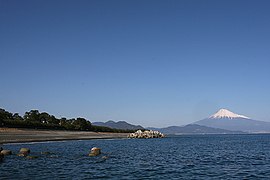
Shizuoka is the capital and Hamamatsu is the largest city in Shizuoka Prefecture, with other major cities including Fuji, Numazu, and Iwata.[3] Shizuoka Prefecture is located on Japan's Pacific Ocean coast and features Suruga Bay formed by the Izu Peninsula, and Lake Hamana which is considered to be one of Japan's largest lakes. Mount Fuji, the tallest volcano in Japan and cultural icon of the country, is partially located in Shizuoka Prefecture on the border with Yamanashi Prefecture. Shizuoka Prefecture has a significant motoring heritage as the founding location of Honda, Suzuki, and Yamaha, and is home to the Fuji International Speedway.

History
[edit]Shizuoka Prefecture was established from the former Tōtōmi, Suruga and Izu provinces.[4]
The area was the home of the first Tokugawa shōgun.[citation needed] Tokugawa Ieyasu held the region until he conquered the lands of the Hōjō clan in the Kantō region and placed land under the stewardship of Toyotomi Hideyoshi. After becoming shōgun, Tokugawa took the land back for his family and put the area around modern-day Shizuoka City under the direct supervision of the shogunate. With the creation of the Shizuoka han from the Sunpu Domain in 1868, it once again became the residence of the Tokugawa family.
Geography
[edit]Shizuoka Prefecture is an elongated region following the coast of the Pacific Ocean at the Suruga Bay. In the west, the prefecture extends deep into the Japan Alps. In the east, it becomes a narrower coast bounded in the north by Mount Fuji, until it comes to the Izu Peninsula, a popular resort area pointing south into the Pacific.[citation needed]
As of April 2012,[update] 11% of the total land area of the prefecture was designated as natural parks, namely the Fuji-Hakone-Izu and Minami Alps National Parks; Tenryū-Okumikawa Quasi-National Park; and four Prefectural Natural Parks.[5]
Climate
[edit]In Shizuoka prefecture, the temperature, over the course of the year, typically varies from 34 °F to 87 °F and is rarely below 28 °F or above 93 °F. The summers in Shizuoka are warm, oppressive, and mostly cloudy; the winters are very cold, windy, and mostly clear.[6]
Disaster
[edit]On 15 March 2011, Shizuoka Prefecture was hit with a magnitude 6.2 earthquake approximately 42 km (26 mi) NNE of Shizuoka City. It is said, that throughout history, Shizuoka area has experienced a large earthquake every 100 to 150 years.
Demographics
[edit]
3,635,220 people live in Shizuoka Prefecture, according to the 2020 census.[7]
Municipalities
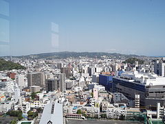
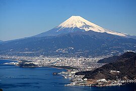
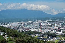
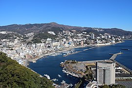
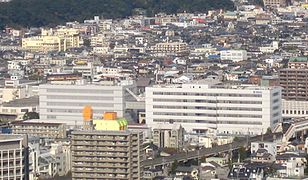
[edit]Since 2010, Shizuoka has consisted of 35 municipalities: 23 cities and 12 towns.
-
Numazu and Mount Fuji

Mergers
[edit]After the introduction of modern municipalities in 1889, Shizuoka consisted of 337 municipalities: 1 (by definition: district-independent) city and 23 districts with 31 towns and 305 villages. The Great Shōwa mergers of the 1950s reduced the total from 281 to 97 between 1953 and 1960, including 18 cities by then. The Great Heisei mergers of the 2000s combined the 74 remaining municipalities in the year 2000 into the current 35 by 2010.
List of governors of Shizuoka (since 1947)
[edit]| # | Name (Birth–Death) |
Term of office | Political Party | |
|---|---|---|---|---|
| 1 | Takeji Kobayashi (小林武治) (1899–1988) |
23 April 1947 | 22 April 1951 | Independent |
| 2 | Toshio Saito (斎藤寿夫) (1908–1999) |
1 May 1951 | 8 January 1967 | Liberal Party (1951–1959) Liberal Democratic Party (1959–1967) |
| 3 | Yutaro Takeyama (竹山祐太郎) (1901–1982) |
31 January 1967 | 24 June 1974 | LDP |
| 4 | Keizaburo Yamamoto (山本敬三郎) (1913–2006) |
10 June 1974 | 6 July 1986 | LDP |
| 5 | Shigeyoshi Saito (斉藤滋与史) (1918–2018) |
7 July 1986 | 23 June 1993 | LDP |
| 6 | Yoshinobu Ishikawa (石川嘉延) (born in 1940) |
3 August 1993 | 17 June 2009 | Independent |
| 7 | Heita Kawakatsu (川勝平太) (born in 1948) |
7 July 2009 | 9 May 2024 | Independent |
| 8 | Yasutomo Suzuki (鈴木康友) (born in 1957) |
28 May 2024 | Incumbent | Independent |
Industry
[edit]Home to a shogun, cherry shrimp, and Japan's green tea heartland. Situated along Suruga Bay between Tokyo and Nagoya on the historic Tokaido route, the Pacific coast city of Shizuoka is famed for supplying most of Japan's tea and maguro tuna.
Motorcycles
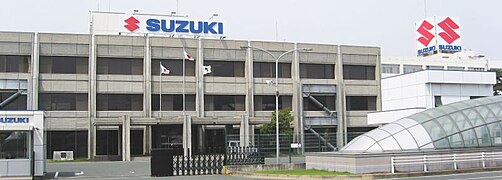
[edit]Shizuoka-based companies are world leaders in several major industrial sectors. Honda, Yamaha, and Suzuki all have their roots in Shizuoka prefecture and are still manufacturing here. Thanks to this, Shizuoka pref. accounts for 28% of Japanese motorcycle exports.[8]
Musical instruments
[edit]Yamaha and Kawai are both global piano brands. Yamaha has the largest share in the global piano market. Kawai has the second largest share. They both got their start in Shizuoka pref. in the early twentieth century.[8][9]
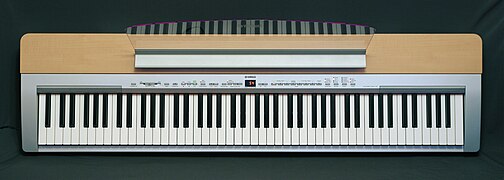
Yamaha and Roland are major brand for electronic musical instruments. In the electronic piano world market, Yamaha has the world's largest share. Roland and Kawai have the second and third place share. Roland and Yamaha also manufacture high-quality synthesizers and drum machines for professional musicians.
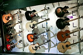
In addition, various instruments such as wind instruments and guitars are manufactured in this prefecture. There are about 200 companies that manufacture musical instruments, in this prefecture.
Most of these musical instruments are especially produced in Hamamatsu City.[9]
-
Yamaha headquarters
-
Suzuki headquarters
-
Yamaha motorcycles
-
Suzuki motorcycles
-
Yamaha outboard motors
-
Suzuki outboard motors
-
Yamaha grand piano
-
Kawai grand piano
-
Yamaha electronic piano
-
Roland D-50 sythesizer
-
Roland TR-808. A legendary drum machine by Roland.
-
Yamaha acoustic guitars
-
Yamaha electric guitars
-
Yamaha wind instruments
Transportation
[edit]Rail
[edit]


- Enshū Railway
- Gakunan Railway
- Izuhakone Railway
- Izukyū
- JR Central
- JR East
- Ōigawa Railway
- Shizuoka Railway
- Tenryū Hamanako Railroad
Roads
[edit]Expressways
[edit]- Chūbu-Ōdan Expressway
- Izu-Jūkan Expressway
- San-en Nanshin Expressway
- Shin-Tōmei Expressway
- Tōmei Expressway
Toll roads
[edit]- Fujinomiya Road
- Nishi-Fuji Road
- Shizuoka East-West Road
- Shizuoka South-North Road
- West Fuji Road (not a toll road anymore as of 2012)
National highways
[edit]- National Route 1
- National Route 42
- National Route 52
- National Route 135
- National Route 136
- National Route 138
- National Route 139
- National Route 149
- National Route 150
- National Route 152
- National Route 246
- National Route 257
- National Route 301
- National Route 362
- National Route 414
- National Route 469
- National Route 473
- National Route 474
Airports
[edit]
Ports
[edit]- Shimizu Port
- Atami Port and Shimoda Port – Mainly ferry route to Izu Island
- Numazu Port
Education
[edit]Universities
[edit]National universities
- Graduate University for Advanced Studies (Mishima Campus, National Institute of Genetics)
- Hamamatsu University School of Medicine
- Shizuoka University
Public universities
Private universities
- Fuji Tokoha University
- Hamamatsu University
- Hamamatsu Gakuin University
- Juntendo University (Mishima Campus)
- Nihon University (Mishima Campus)
- Seirei Christopher University
- Shizuoka Eiwa Gakuin University
- Shizuoka Institute of Science and Technology
- Shizuoka Sangyo University
- Shizuoka University of Welfare
- Tokai University (Shimizu and Numazu Campuses)
- Tokoha Gakuen University
- Tokyo Women's Medical University (Daito Campus)
Senior high schools
[edit]This section needs expansion. You can help by adding to it. (October 2015) |
- Hiryū High School
- Numazu Commercial High School
- Shizuoka Prefectural High School
- Shizuoka Prefectural Susono High School
Sports
[edit]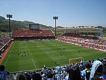
The sports teams listed below are based in Shizuoka.
Basketball
[edit]Motorsport
[edit]Rugby
[edit]Football
[edit]- Shimizu S-Pulse (Shimizu, Shizuoka)
- Júbilo Iwata (Iwata)
- Matches between the above two teams, both currently in the top flight of the J. League, are known as the Shizuoka Derby.
- Honda F.C. (Hamamatsu)
- Azul Claro Numazu (Numazu)
- Fujieda MYFC (Fujieda)
Volleyball
[edit]Tourism
[edit]Museums
[edit]Theme parks
[edit]- Air Park Japan Air Self-Defense Force Hamamatsu Public Information Building)[10]
- Shimizu Sushi Museum[11]
Festivals and events
[edit]
- Daidogei World Cup in central Shizuoka City, held in November
- Enshu Daimyo Festival in Iwata, held in April
- Mishima Festival, held in August
- Numazu Festival, held in July
- Shimizu Port Festival, held on 5 to 7 August
- Shimoda Black Ship Festival, held in May
- Shizuoka Festival, held in April
-
Shuzenji Onsen Izu
-
Atami Sun Beach Atami
-
Kawazu Cherry blossom Kamo District Kawazu
-
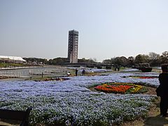
Fuji Safari Park Susono
-
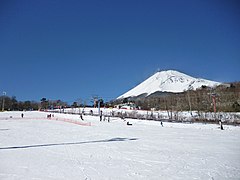
Snowtown Yeti & Mount Fuji Susono
-
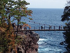
Jogasaki Coast Itō
Notable people
[edit]Motoo Kimura (木村 資生, 1924–1994), biologist and theoretical population geneticist, died in Shizuoka Prefecture
Notes
[edit]- ^ "2020年度国民経済計算(2015年基準・2008SNA) : 経済社会総合研究所 - 内閣府". 内閣府ホームページ (in Japanese). Retrieved 18 May 2023.
- ^ Nussbaum, Louis-Frédéric. (2005). "Shizuoka-ken" in Japan Encyclopedia, p. 876, p. 876, at Google Books; "Chūbu" in p. 126, p. 126, at Google Books
- ^ Nussbaum, "Shizuoka" at p. 876, p. 876, at Google Books.
- ^ Nussbaum, "Provinces and prefectures" at p. 780, p. 780, at Google Books.
- ^ "General overview of area figures for Natural Parks by prefecture" (PDF). Ministry of the Environment. 1 April 2012. Retrieved 10 August 2014.
- ^ weatherspark, Shizuoka prefecture.
- ^ Shizuoka prefecture official statistics(令和2年国勢調査 静岡県の人口(速報値))
- ^ a b Shizuoka Prefecture official website, Industry in Shizuoka.
- ^ a b (In Japanese) Kyoto University of Arts, Musical instruments industry in Hamamatsu, Shizuoka prefecture.
- ^ "About Air Park Japan Air Self-Defense Force Hamamatsu Public Information Building – Shizuoka Travel Guide | Planetyze". Planetyze. Retrieved 17 November 2017.
- ^ "About Shimizu Sushi Museum – Shizuoka Travel Guide | Planetyze". Planetyze. Retrieved 17 November 2017.
References
[edit]- Nussbaum, Louis-Frédéric and Käthe Roth. (2005). Japan encyclopedia. Cambridge: Harvard University Press. ISBN 978-0-674-01753-5; OCLC 58053128


