Pizzo di Cassimoi: Difference between revisions
Appearance
Content deleted Content added
added Category:Graubünden–Ticino border using HotCat |
No edit summary Tags: Mobile edit Mobile app edit Android app edit |
||
| (12 intermediate revisions by 10 users not shown) | |||
| Line 1: | Line 1: | ||
{{Short description|Mountain in the Lepontine Alps, Switzerland}} |
|||
{{Orphan|date=February 2009}} |
|||
{{Infobox mountain |
{{Infobox mountain |
||
| name = Pizzo di Cassimoi |
| name = Pizzo di Cassimoi |
||
| Line 9: | Line 9: | ||
| prominence_ref = <ref>Retrieved from the [[Swisstopo]] topographic maps. The key col is located south of the summit at 2,887 metres.</ref> |
| prominence_ref = <ref>Retrieved from the [[Swisstopo]] topographic maps. The key col is located south of the summit at 2,887 metres.</ref> |
||
| parent_peak = [[Rheinwaldhorn]] |
| parent_peak = [[Rheinwaldhorn]] |
||
| listing = |
|||
| ⚫ | |||
| ⚫ | |||
| location = [[Ticino]]/[[Graubünden]], [[Switzerland]] |
| location = [[Ticino]]/[[Graubünden]], [[Switzerland]] |
||
| range = [[Lepontine Alps]] |
| range = [[Lepontine Alps]] |
||
| ⚫ | |||
| lat_d = 46 | lat_m = 31 | lat_s = 44 | lat_NS = N |
|||
| ⚫ | |||
| long_d = 9 | long_m = 1 | long_s = 5.3 | long_EW = E |
|||
| coordinates = {{coord|46|31|44|N|9|01|05|E|type:mountain_region:CH_scale:100000|format=dms|display=inline,title}} |
|||
| region = CH |
|||
| coordinates_ref = |
|||
| range_coordinates = |
|||
| first_ascent = |
| first_ascent = |
||
| easiest_route = |
| easiest_route = |
||
| Line 30: | Line 31: | ||
*[http://www.summitpost.org/pizzo-di-cassimoi/460592 Pizzo di Cassimoi on Summitpost] |
*[http://www.summitpost.org/pizzo-di-cassimoi/460592 Pizzo di Cassimoi on Summitpost] |
||
*[http://www.hikr.org/dir/Pizzo_di_Cassimoi_%28cima_SE%29_847/ Pizzo di Cassimoi on Hikr] |
*[http://www.hikr.org/dir/Pizzo_di_Cassimoi_%28cima_SE%29_847/ Pizzo di Cassimoi on Hikr] |
||
*[http://map.geo.admin.ch/?crosshair=circle&zoom=5&Y=721080&X=154350 Position on map] |
|||
{{DEFAULTSORT:Cassimoi}} |
|||
[[Category:Mountains of the Alps]] |
[[Category:Mountains of the Alps]] |
||
[[Category:Alpine |
[[Category:Alpine three-thousanders]] |
||
[[Category:Mountains of Switzerland]] |
[[Category:Mountains of Switzerland]] |
||
[[Category:Mountains of Ticino]] |
[[Category:Mountains of Ticino]] |
||
[[Category:Mountains of Graubünden]] |
[[Category:Mountains of Graubünden]] |
||
[[Category:Graubünden–Ticino border]] |
[[Category:Graubünden–Ticino border]] |
||
[[Category:Lepontine Alps]] |
|||
[[Category:Vals, Switzerland]] |
|||
{{Switzerland-stub}} |
|||
{{Ticino-mountain-stub}} |
|||
[[it:Pizzo di Cassimoi]] |
|||
{{Graubünden-mountain-stub}} |
|||
[[nn:Pizzo di Cassimoi]] |
|||
[[fi:Pizzo Cassimoi]] |
|||
Latest revision as of 08:29, 26 July 2022
| Pizzo di Cassimoi | |
|---|---|
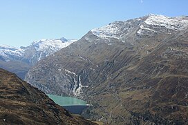
 Pizzo di Cassimoi (far left) from above Zervreilasee | |
| Highest point | |
| Elevation | 3,129 m (10,266 ft) |
| Prominence | 242 m (794 ft)[1] |
| Parent peak | Rheinwaldhorn |
| Coordinates | 46°31′44″N 9°01′05″E / 46.52889°N 9.01806°E |
| Geography | |
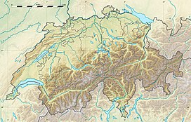
| Location | Ticino/Graubünden, Switzerland |
| Parent range | Lepontine Alps |
Pizzo di Cassimoi is a mountain of the Lepontine Alps, located on the border between the Swiss cantons of Ticino (west) and Graubünden (east). The mountain overlooks two lakes: Lago di Luzzone on its north-eastern side and Zervreilasee on its north-eastern side.
A glacier named Vadrecc di Sorda lies over the northern flanks below a secondary summit (Pizzo Cassinello, 3,103 metres) on the side of Ticino.
References
[edit]External links
[edit]

