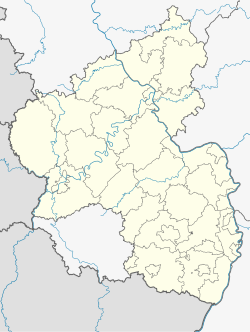
Trier-Land: Difference between revisions
Appearance
Content deleted Content added
Citation bot (talk | contribs) Removed parameters. | Use this bot. Report bugs. | Suggested by AManWithNoPlan | #UCB_CommandLine |
|||
| (10 intermediate revisions by 7 users not shown) | |||
| Line 1: | Line 1: | ||
{{ |
{{Refimprove|date=August 2013}} |
||
{{Infobox German place |
|||
{| cellpadding="2" style="float: right; width: 307px; background: #e3e3e3; margin-left: 1em; border-spacing: 1px;" |
|||
| Name = Verbandsgemeinde Trier-Land |
|||
! Arms |
|||
| Art = Verbandsgemeinde |
|||
! Map |
|||
| image_photo = |
|||
|---- bgcolor="#FFFFFF" |
|||
| image_caption = |
|||
! align="center" | [[Image:Wappen trier land.gif|140px|Arms]] |
|||
| Wappen = DEU Verbandsgemeinde Trier-Land COA.svg |
|||
! align="center" | [[Image:Karte trier in deutschland.png|140px|Map]] |
|||
| image_flag = |
|||
|- |
|||
| ⚫ | |||
! colspan="2" | |
|||
| Lageplan = Verbandsgemeinde Trier-Land in TR.svg |
|||
|---- bgcolor="#FFFFFF" |
|||
| Lageplanbeschreibung = Location of Verbandsgemeinde Trier-Land in the district |
|||
| [[Country]]: || [[Germany]] |
|||
| Bundesland = Rhineland-Palatinate |
|||
|---- bgcolor="#FFFFFF" |
|||
| ⚫ | |||
| [[States of Germany|State]]: || [[Rhineland-Palatinate]] |
|||
| Fläche = 175.5 |
|||
|---- bgcolor="#FFFFFF" |
|||
| Kfz = TR |
|||
| ⚫ | |||
| Gemeindeschlüssel = 072355007 |
|||
|---- bgcolor="#FFFFFF" |
|||
| Gliederung = 11 municipalities |
|||
| [[Verbandsgemeinde]]: || Trier-Land |
|||
| Website = {{url|https://www.trier-land.de/}} |
|||
| ⚫ | |||
| Bürgermeister = Michael Holstein<ref>[https://www.wahlen.rlp.de/de/kw/direktwahlen/wahl-der-buergermeister-der-verbandsgemeinden/ Wahl der Bürgermeister der Verbandsgemeinden], Landeswahlleiter Rheinland-Pfalz, accessed 10 August 2021.</ref> |
|||
| leader_term = 2018–26 |
|||
| Partei = FWG |
|||
| year = |
|||
| ⚫ | |||
'''Trier-Land''' is a ''[[Verbandsgemeinde]]'' ("collective municipality") in the [[Trier-Saarburg]] district, in [[Rhineland-Palatinate]], [[Germany]]. It is situated on the border with [[Luxembourg]], north and west of [[Trier]]. The seat of the municipality is in Trier, itself not part of the municipality. |
'''Trier-Land''' is a ''[[Verbandsgemeinde]]'' ("collective municipality") in the [[Trier-Saarburg]] district, in [[Rhineland-Palatinate]], [[Germany]]. It is situated on the border with [[Luxembourg]], north and west of [[Trier]]. The seat of the municipality is in Trier, itself not part of the municipality. |
||
| Line 31: | Line 36: | ||
#[[Trierweiler]] |
#[[Trierweiler]] |
||
#[[Welschbillig]] |
#[[Welschbillig]] |
||
#[[Zemmer]] |
#[[Zemmer]] |
||
==International relations== |
|||
| ⚫ | |||
{{ |
{{See also|List of twin towns and sister cities in Germany}} |
||
Trier-Land is [[Twin towns and sister cities|twinned]] with: |
|||
| ⚫ | |||
*{{flagicon|RUS}} '''[[Podolsk]]''', [[Russia]]<ref name="Podolsk twinnings">{{cite web|url=https://translate.google.com/translate?sourceid=navclient&hl=en&u=http%3a%2f%2fadmpodolsk.ru%2findex.php%3fcategoryid%3d126|title=Podolsk sister cities|date=|accessdate=2010-04-29}}</ref> |
|||
==References== |
|||
{{TrierSaarburg-geo-stub}} |
|||
{{reflist}} |
|||
{{Verbandsgemeinden in Trier-Saarburg}} |
|||
{{Authority control}} |
|||
| ⚫ | |||
Latest revision as of 03:40, 28 March 2023
This article needs additional citations for verification. (August 2013) |
Verbandsgemeinde Trier-Land | |
|---|---|
Location of Verbandsgemeinde Trier-Land in the district  | |
| Coordinates: 49°46′N 6°33′E / 49.767°N 6.550°E | |
| Country | Germany |
| State | Rhineland-Palatinate |
| District | Trier-Saarburg |
| Subdivisions | 11 municipalities |
| Government | |
| • Mayor (2018–26) | Michael Holstein[1] (FW) |
| Area | |
• Total | 175.5 km2 (67.8 sq mi) |
| Population (2022-12-31)[2] | |
• Total | 22,276 |
| • Density | 130/km2 (330/sq mi) |
| Time zone | UTC+01:00 (CET) |
| • Summer (DST) | UTC+02:00 (CEST) |
| Vehicle registration | TR |
| Website | www |
Trier-Land is a Verbandsgemeinde ("collective municipality") in the Trier-Saarburg district, in Rhineland-Palatinate, Germany. It is situated on the border with Luxembourg, north and west of Trier. The seat of the municipality is in Trier, itself not part of the municipality.
The Verbandsgemeinde Trier-Land consists of the following Ortsgemeinden ("local municipalities"):
International relations
[edit]Trier-Land is twinned with:
References
[edit]- ^ Wahl der Bürgermeister der Verbandsgemeinden, Landeswahlleiter Rheinland-Pfalz, accessed 10 August 2021.
- ^ "Bevölkerungsstand 2022, Kreise, Gemeinden, Verbandsgemeinden" (PDF) (in German). Statistisches Landesamt Rheinland-Pfalz. 2023.
- ^ "Podolsk sister cities". Retrieved 2010-04-29.


