Gaya Airport (Niger): Difference between revisions
Appearance
Content deleted Content added
WhisperToMe (talk | contribs) No edit summary |
Adding short description: "Airport in Niger", overriding automatically generated description |
||
| (13 intermediate revisions by 11 users not shown) | |||
| Line 1: | Line 1: | ||
{{ |
{{Short description|Airport in Niger}} |
||
{{Infobox airport |
|||
| name = Gaya Airport |
| name = Gaya Airport |
||
| nativename = |
|||
| nativename |
| nativename = |
||
| nativename- |
| nativename-a = |
||
| |
| nativename-r = |
||
| image |
| image = |
||
| image-width = <!-- if less than 200 --> |
|||
| caption = |
|||
| |
| caption = |
||
| |
| image2 = |
||
| image2-width = <!-- if less than 200 --> |
|||
| type = Public |
|||
| caption2 = |
|||
| ⚫ | |||
| |
| IATA = |
||
| |
| ICAO = DRRG |
||
| FAA = |
|||
| ⚫ | |||
| TC = |
|||
| ⚫ | |||
| LID = |
|||
| ⚫ | |||
| GPS = |
|||
| coordinates = |
|||
| WMO = |
|||
| ⚫ | |||
| |
| type = Public |
||
| ⚫ | |||
| ⚫ | |||
| ⚫ | |||
| ⚫ | |||
| ⚫ | |||
| ⚫ | |||
| ⚫ | |||
| ⚫ | |||
| stat2-header = |
|||
| stat2-data = |
|||
| footnotes = |
|||
}} |
|||
| owner-oper = |
|||
'''Gaya Airport''' {{airport codes||DRRG}} is an [[airport]] located in [[Gaya, Niger|Gaya]], a city located in the [[Dosso Region]] of [[Niger]]. |
|||
| ⚫ | |||
| operator = |
|||
| ⚫ | |||
| location = |
|||
It is located {{convert|2|km|mi}} west of the city centre. Its runway is {{convert|1350|m|ft}} by {{convert|30|m|ft}}.<ref>"[http://anac-niger.org/index.asp?p=134&m=188 Attributions des départements de l'ANAC]." [[Agence nationale de l'aviation civile (Niger)|Agence nationale de l'aviation civile du Niger]]. Retrieved on 4 June 2013. "Gaya : dimensions de la piste = 1 350 x 30 m ; distance 2 km à l’ouest de Gaya"</ref> |
|||
| hub = |
|||
| built = <!-- military airports --> |
|||
| used = <!-- military airports --> |
|||
| commander = <!-- military airports --> |
|||
| occupants = <!-- military airports --> |
|||
| metric-elev = |
|||
| ⚫ | |||
| ⚫ | |||
| coordinates = {{coord|11|53|20|N|3|25|40|E|display=inline,title}} |
|||
| ⚫ | |||
| image_map = |
|||
| image_mapsize = |
|||
| image_map_alt = |
|||
| image_map_caption = |
|||
| pushpin_map = Niger |
|||
| pushpin_label_position = |
|||
| pushpin_label = '''DRRG''' |
|||
| pushpin_map_alt = |
|||
| pushpin_mapsize = |
|||
| pushpin_image = |
|||
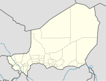
| pushpin_map_caption = Location of the airport in Niger |
|||
| r1-number = 06/24 |
|||
| r1-length-f = 4530 |
|||
| r1-length-m = 1380 |
|||
| ⚫ | |||
| ⚫ | |||
| ⚫ | |||
| ⚫ | |||
| ⚫ | |||
| h1-surface = <!-- up to h12 --> |
|||
| ⚫ | |||
| ⚫ | |||
| ⚫ | |||
| footnotes = Source: Google Maps<ref>[https://maps.google.com/?ll=11.888559,3.427176&spn=0.040273,0.029826&t=h&z=15 Google Maps - Gaya]</ref>}} |
|||
'''Gaya Airport''' {{airport codes ||DRRG|}} is an airport serving [[Gaya, Niger|Gaya]], [[Dosso Region]], [[Niger]], near the country's borders with [[Benin]] and [[Nigeria]]. It is located 2 kilometres (1.2 mi) west of the city centre. |
|||
==See also== |
|||
*[[Transport in Niger]] |
|||
*{{portal-inline|Aviation}} |
|||
==References== |
==References== |
||
{{Portal|Niger}} |
|||
{{reflist}} |
{{reflist}} |
||
* [http://ourairports.com/countries/NE/airports.html OurAirports - Niger] |
|||
* [http://www.gcmap.com/airport/DRRG Great Circle Mapper - Gaya] |
|||
* [http://www.fallingrain.com/icao/DRRG.html Gaya Airport] |
|||
{{Airports in Niger}} |
{{Airports in Niger}} |
||
{{authority control}} |
|||
| ⚫ | |||
{{Niger-airport-stub}} |
|||
{{coord|11.88300|3.43300|type:airport_region:NE-3_source:ourairports.com/data|display=title}} |
|||
[[Category:Airports in Niger]] |
[[Category:Airports in Niger]] |
||
| ⚫ | |||
Latest revision as of 21:45, 25 October 2024
Gaya Airport | |||||||||||
|---|---|---|---|---|---|---|---|---|---|---|---|
| Summary | |||||||||||
| Airport type | Public | ||||||||||
| Serves | Gaya | ||||||||||
| Elevation AMSL | 662 ft / 202 m | ||||||||||
| Coordinates | 11°53′20″N 3°25′40″E / 11.88889°N 3.42778°E | ||||||||||
| Map | |||||||||||
 | |||||||||||
| Runways | |||||||||||
| |||||||||||
Source: Google Maps[1] | |||||||||||
Gaya Airport (ICAO: DRRG) is an airport serving Gaya, Dosso Region, Niger, near the country's borders with Benin and Nigeria. It is located 2 kilometres (1.2 mi) west of the city centre.
See also
[edit]References
[edit]

