Podstenje: Difference between revisions
Appearance
Content deleted Content added
No edit summary |
|||
| (7 intermediate revisions by 5 users not shown) | |||
| Line 1: | Line 1: | ||
{{Short description|Village in Slovenia}} |
|||
{{Infobox settlement |
{{Infobox settlement |
||
|official_name = Podstenje |
|official_name = Podstenje |
||
| Line 31: | Line 32: | ||
|pushpin_label_position =top |
|pushpin_label_position =top |
||
|pushpin_map_caption =Location in Slovenia |
|pushpin_map_caption =Location in Slovenia |
||
|coordinates_display = inline,title |
|||
|coordinates_region = SI |
|||
|subdivision_type = Country |
|subdivision_type = Country |
||
|subdivision_name = [[Image:Flag of Slovenia.svg|25px]] [[Slovenia]] |
|subdivision_name = [[Image:Flag of Slovenia.svg|25px]] [[Slovenia]] |
||
| Line 38: | Line 37: | ||
|subdivision_name1 = [[Inner Carniola]] |
|subdivision_name1 = [[Inner Carniola]] |
||
|subdivision_type2 = [[Statistical regions of Slovenia|Statistical region]] |
|subdivision_type2 = [[Statistical regions of Slovenia|Statistical region]] |
||
|subdivision_name2 = [[ |
|subdivision_name2 = [[Littoral–Inner Carniola Statistical Region|Littoral–Inner Carniola]] |
||
|subdivision_type3 = [[Municipalities of Slovenia|Municipality]] |
|subdivision_type3 = [[Municipalities of Slovenia|Municipality]] |
||
|subdivision_name3 = [[Municipality of Ilirska Bistrica|Ilirska Bistrica]] |
|subdivision_name3 = [[Municipality of Ilirska Bistrica|Ilirska Bistrica]] |
||
| Line 96: | Line 95: | ||
|timezone_DST = |
|timezone_DST = |
||
|utc_offset_DST = |
|utc_offset_DST = |
||
|coordinates = {{coord|45|35|56.43|N|14|13|15.61|E|region:SI|display=inline,title}} |
|||
|latd=45|latm=35|lats=56.43 |latNS=N |
|||
|longd=14|longm=13|longs=15.61 |longEW=E |
|||
|elevation_footnotes = |
|elevation_footnotes = |
||
|elevation_m = 486.1 |
|elevation_m = 486.1 |
||
| Line 111: | Line 109: | ||
|footnotes = <ref>[http://www.stat.si/eng/index.asp Statistical Office of the Republic of Slovenia]</ref> |
|footnotes = <ref>[http://www.stat.si/eng/index.asp Statistical Office of the Republic of Slovenia]</ref> |
||
}} |
}} |
||
'''Podstenje''' ({{ |
'''Podstenje''' ({{IPA|sl|pɔtˈsteːnjɛ|pron}}; {{langx|it|Postegna}}) is a [[village]] north of [[Ilirska Bistrica]] in the [[Inner Carniola]] region of [[Slovenia]].<ref>[http://www.ilirska-bistrica.si Ilirska Bistrica municipal site]</ref> |
||
The local church in the settlement is dedicated to [[Anthony of Padua|Saint Anthony of Padua]] and belongs to the [[Parish]] of Ilirska Bistrica.<ref>[http://kp.rkc.si/dokumenti/zupnije/seznam.pdf Koper Diocese list of churches]</ref> |
The local church in the settlement is dedicated to [[Anthony of Padua|Saint Anthony of Padua]] and belongs to the [[Parish]] of Ilirska Bistrica.<ref>[http://kp.rkc.si/dokumenti/zupnije/seznam.pdf Koper Diocese list of churches] {{webarchive|url=https://web.archive.org/web/20090306055057/http://kp.rkc.si/dokumenti/zupnije/seznam.pdf |date=2009-03-06 }}</ref> |
||
==References== |
==References== |
||
| Line 119: | Line 117: | ||
==External links== |
==External links== |
||
*[ |
*[https://www.geopedia.world/#T12_L362_F2473:4718_x1583220.7413956744_y5716098.395705049_s15_b2345 Podstenje on Geopedia] |
||
{{Ilirska Bistrica}} |
{{Ilirska Bistrica}} |
||
Latest revision as of 09:01, 26 October 2024
Podstenje | |
|---|---|
| Coordinates: 45°35′56.43″N 14°13′15.61″E / 45.5990083°N 14.2210028°E | |
| Country | |
| Traditional region | Inner Carniola |
| Statistical region | Littoral–Inner Carniola |
| Municipality | Ilirska Bistrica |
| Area | |
• Total | 1.98 km2 (0.76 sq mi) |
| Elevation | 486.1 m (1,594.8 ft) |
| Population (2002) | |
• Total | 71 |
| [1] | |
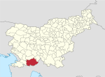
Podstenje (pronounced [pɔtˈsteːnjɛ]; Italian: Postegna) is a village north of Ilirska Bistrica in the Inner Carniola region of Slovenia.[2]
The local church in the settlement is dedicated to Saint Anthony of Padua and belongs to the Parish of Ilirska Bistrica.[3]
References
[edit]External links
[edit]


