Gossas: Difference between revisions
Appearance
Content deleted Content added
Thricecube (talk | contribs) mNo edit summary |
m Moving Category:Populated places in Fatick Region to Category:Populated places in Fatick region per Wikipedia:Categories for discussion/Speedy |
||
| (13 intermediate revisions by 7 users not shown) | |||
| Line 3: | Line 3: | ||
<!--See the Table at Infobox Settlement for all fields and descriptions of usage--> |
<!--See the Table at Infobox Settlement for all fields and descriptions of usage--> |
||
<!-- Basic info ----------------> |
<!-- Basic info ----------------> |
||
|official_name = |
|official_name = Gossas |
||
|other_name = |
|other_name = |
||
|native_name = <!-- for cities whose native name is not in English --> |
|native_name = <!-- for cities whose native name is not in English --> |
||
|nickname = |
|nickname = |
||
|settlement_type = Town<!--For Town or Village (Leave blank for the default City)--> |
|settlement_type = Town and [[Communes of Senegal|commune]]<!--For Town or Village (Leave blank for the default City)--> |
||
|total_type = Town and [[Communes of Senegal|commune]] |
|||
|motto = |
|motto = |
||
<!-- images and maps -----------> |
<!-- images and maps -----------> |
||
| Line 32: | Line 33: | ||
|dot_map_caption = |
|dot_map_caption = |
||
|dot_x = |dot_y = |
|dot_x = |dot_y = |
||
|pushpin_map =Senegal |
|pushpin_map = Senegal |
||
|pushpin_label_position = |
|pushpin_label_position = bottom |
||
|pushpin_map_caption = |
|pushpin_map_caption = |
||
|pushpin_mapsize = |
|pushpin_mapsize = |
||
<!-- Location ------------------> |
<!-- Location ------------------> |
||
|coordinates_region = SN |
|||
|subdivision_type = Country |
|subdivision_type = Country |
||
|subdivision_name = {{SEN}} |
|subdivision_name = {{SEN}} |
||
|subdivision_type1 = [[Regions of Senegal|Region]] |
|subdivision_type1 = [[Regions of Senegal|Region]] |
||
|subdivision_name1 = [[Fatick Region]] |
|subdivision_name1 = [[Fatick Region]] |
||
|subdivision_type2 = |
|subdivision_type2 = [[Departments of Senegal|Department]] |
||
|subdivision_name2 = |
|subdivision_name2 = [[Gossas Department|Gossas]] |
||
<!-- Politics -----------------> |
<!-- Politics -----------------> |
||
|government_footnotes = |
|government_footnotes = |
||
| Line 55: | Line 55: | ||
<!-- Area ---------------------> |
<!-- Area ---------------------> |
||
|area_magnitude = |
|area_magnitude = |
||
|area_footnotes = |
|area_footnotes = <ref name="pop"/> |
||
|area_total_km2 = |
|area_total_km2 = 5.601 |
||
|area_land_km2 = <!--See table @ Template:Infobox Settlement for details on automatic unit conversion--> |
|area_land_km2 = <!--See table @ Template:Infobox Settlement for details on automatic unit conversion--> |
||
|area_water_km2 = |
|area_water_km2 = |
||
| Line 64: | Line 64: | ||
|area_water_percent = |
|area_water_percent = |
||
<!-- Population -----------------------> |
<!-- Population -----------------------> |
||
|population_as_of = |
|population_as_of = 2023 census |
||
|population_footnotes = <ref name="pop">[https://www.citypopulation.de/en/senegal/mun/admin/fatick/SN03035100__gossas/ Citypopulation.de] Population and area of Gossas Commune</ref> |
|||
|population_footnotes = |
|||
|population_note = |
|population_note = |
||
|population_total = |
|population_total = 15630 |
||
|population_density_km2 = auto |
|population_density_km2 = auto |
||
|population_density_sq_mi = |
|population_density_sq_mi = |
||
| Line 75: | Line 75: | ||
|timezone_DST = |
|timezone_DST = |
||
|utc_offset_DST = |
|utc_offset_DST = |
||
|coordinates = {{coord|14|30|N|16|04|W|region:SN|display=inline}} |
|||
|latd=14|latm=30|lats= |latNS=N |
|||
|longd=16|longm=04 |longs= |longEW=W |
|||
|elevation_footnotes = <!--for references: use <ref> </ref> tags--> |
|elevation_footnotes = <!--for references: use <ref> </ref> tags--> |
||
|elevation_m = 21 |
|elevation_m = 21 |
||
| Line 86: | Line 85: | ||
|website = |
|website = |
||
|footnotes = |
|footnotes = |
||
}} |
}} |
||
'''Gossas''' is a town in western [[Senegal]] about |
'''Gossas''' is a town and urban commune in [[Fatick Region]] in western [[Senegal]], about 90 km from the capital [[Dakar]]. |
||
== Transport == |
== Transport == |
||
| Line 100: | Line 99: | ||
== References == |
== References == |
||
{{ |
{{Reflist}} |
||
{{Authority control}} |
|||
== External links == |
|||
{{ |
{{Coord|14|30|00|N| 16|04|00|W|region:SN_type:city|display=title}} |
||
| ⚫ | |||
* [http://maps.msn.com/%28kxtpsi55m0x0lm45tmxo1d45%29/map.aspx?lats1=14.5&lons1=-16.066667&alts1=14®n1=2 MSN Map] |
|||
[[Category:Communes of Senegal]] |
|||
| ⚫ | |||
| ⚫ | |||
| ⚫ | |||
Latest revision as of 23:01, 2 January 2025
Gossas | |
|---|---|
Town and commune | |
| Coordinates: 14°30′N 16°04′W / 14.500°N 16.067°W | |
| Country | |
| Region | Fatick Region |
| Department | Gossas |
| Area | |
• Town and commune | 5.601 km2 (2.163 sq mi) |
| Elevation | 21 m (69 ft) |
| Population (2023 census)[1] | |
• Town and commune | 15,630 |
| • Density | 2,800/km2 (7,200/sq mi) |
| Time zone | UTC+0 (GMT) |
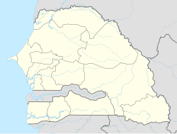
Gossas is a town and urban commune in Fatick Region in western Senegal, about 90 km from the capital Dakar.
Transport
[edit]The town is served by a station on the Dakar-Niger Railway.
See also
[edit]References
[edit]- ^ a b Citypopulation.de Population and area of Gossas Commune
14°30′00″N 16°04′00″W / 14.50000°N 16.06667°W

