Kahal: Difference between revisions
Appearance
Content deleted Content added
m Adding further more explanation about this topic |
|||
| (10 intermediate revisions by 10 users not shown) | |||
| Line 1: | Line 1: | ||
{{ |
{{About||other uses of Kahal and similar spellings|Kahal (disambiguation)}} |
||
{{Refimprove|date=October 2013}} |
|||
{{Infobox Israel village |
{{Infobox Israel village |
||
| name = Kahal |
| name = Kahal |
||
| image = |
| image = File:KahalApr2023_04.jpg |
||
| caption = |
| caption = |
||
| imgsize = |
| imgsize = |
||
| founded = 1980 |
| founded = 1980 |
||
| founded_by = |
| founded_by = |
||
| district = north |
|||
| region = [[Galilee]] |
|||
| council |
| council = [[Mevo'ot HaHermon Regional Council|Mevo'ot HaHermon]] |
||
| ⚫ | |||
| industry = |
|||
| popyear = {{Israel populations|Year}} |
|||
| ⚫ | |||
| population = {{Israel populations|Kahal}} |
|||
| population = 304<ref name="cbs-loc">{{cite web|title=Locality File|year=2012|url=http://www.cbs.gov.il/ishuvim/ishuv2012/bycode.xls|publisher=[[Israel Central Bureau of Statistics]]|format=XLS|accessdate=October 30, 2013}}</ref> |
|||
| population_footnotes={{Israel populations|reference}} |
|||
| popyear = 2012 |
|||
|pushpin_map=Israel northeast |pushpin_mapsize=250 |
| pushpin_map=Israel northeast |pushpin_mapsize=250 |
||
| coordinates = {{coord|32|53|30|N|35|30|35|E|display=inline,title}} |
|||
|latd=32 |latm=53 |lats=30.48 |
|||
|longd=35 |longm=30 |longs=34.55 |
|||
| website = |
| website = |
||
}} |
}} |
||
| ⚫ | '''Kahal''' ({{ |
||
==The Kahal system== |
|||
The kahal was a form of local ethnic administration of Russian Jews in Russia. Jews were governed by the kahal system - a system of Jewish laws and traditions. This meant that Jews were not governed by Russian laws in civil matters but by Jewish religious and traditional laws. Just like Muslims were governed by Muslim law, and highlanders in the Caucasus mountains were governed by mountain law, Jews were governed by their own law, not Russian general law. |
|||
| ⚫ | '''Kahal''' ({{langx|he|כָּחָל}}) is a [[moshav]] in the [[Galilee]] near [[Highway 85 (Israel)|Highway 85]] in northern [[Israel]]. Located on the border of the [[Upper Galilee]] and [[Lower Galilee]], north of Lake [[Sea of Galilee|Kinneret]] and just northwest of [[Tabgha]], it falls under the jurisdiction of [[Mevo'ot HaHermon Regional Council]]. In {{Israel populations|Year}} it had a population of {{Israel populations|Kahal}}.{{Israel populations|reference}} |
||
==References== |
|||
{{reflist}} |
|||
== |
==References== |
||
{{Reflist}} |
|||
*[http://www.israelimages.com/see_image_details.php?description=Kahal--overlooking-the-sea-of-galilee&idi=8461 Photograph] |
|||
{{Mevo'ot HaHermon Regional Council}} |
{{Mevo'ot HaHermon Regional Council}} |
||
{{Authority control}} |
|||
[[Category:Moshavim]] |
[[Category:Moshavim]] |
||
[[Category:Populated places in Northern District (Israel)]] |
[[Category:Populated places in Northern District (Israel)]] |
||
[[Category:1980 establishments in Israel]] |
|||
[[Category:Populated places established in 1980]] |
|||
Latest revision as of 01:29, 1 November 2024
Kahal | |
|---|---|
 | |
| Coordinates: 32°53′30″N 35°30′35″E / 32.89167°N 35.50972°E | |
| Country | Israel |
| District | Northern |
| Council | Mevo'ot HaHermon |
| Affiliation | Moshavim Movement |
| Founded | 1980 |
| Population (2022)[1] | 475 |
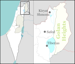
Kahal (Hebrew: כָּחָל) is a moshav in the Galilee near Highway 85 in northern Israel. Located on the border of the Upper Galilee and Lower Galilee, north of Lake Kinneret and just northwest of Tabgha, it falls under the jurisdiction of Mevo'ot HaHermon Regional Council. In 2022 it had a population of 475.[1]
References
[edit]- ^ a b "Regional Statistics". Israel Central Bureau of Statistics. Retrieved 21 March 2024.

