Podskrajnik: Difference between revisions
image |
Tom.Reding (talk | contribs) |
||
| (3 intermediate revisions by 2 users not shown) | |||
| Line 72: | Line 72: | ||
|area_blank1_km2 = |
|area_blank1_km2 = |
||
|area_blank1_sq_mi = |
|area_blank1_sq_mi = |
||
|population_as_of = |
|population_as_of =2020 |
||
|population_footnotes = |
|population_footnotes = |
||
|population_note = |
|population_note = |
||
|population_total = |
|population_total =90 |
||
|population_density_km2 = |
|population_density_km2 =auto |
||
|population_density_sq_mi = |
|population_density_sq_mi = |
||
|population_metro = |
|population_metro = |
||
| Line 108: | Line 108: | ||
|footnotes = <ref>[http://www.stat.si/eng/index.asp Statistical Office of the Republic of Slovenia]</ref> |
|footnotes = <ref>[http://www.stat.si/eng/index.asp Statistical Office of the Republic of Slovenia]</ref> |
||
}} |
}} |
||
'''Podskrajnik''' ({{IPA |
'''Podskrajnik''' ({{IPA|sl|pɔtˈskɾaːi̯nik|pron}}) is a settlement on the western outskirts of [[Cerknica]] in the [[Inner Carniola]] region of [[Slovenia]].<ref>[http://www.cerknica.si/ Cerknica municipal site]</ref> |
||
==Geography== |
==Geography== |
||
| Line 117: | Line 117: | ||
==History== |
==History== |
||
[[File:Podskrajnik Slovenia - Krive Doli.jpg|thumb|left|The Krive Doli site in Podskrajnik]] |
|||
The village arose in the mid-19th century in the vicinity of three springs. Villagers from neighboring [[Zelše]] also walked to Podskrajnik to draw water until water mains were installed in Zelše in 1911, and during droughts water was also drawn from the Cerkniščica River in nearby [[Dolenja Vas, Cerknica|Dolenja Vas]]. A pump and a water tower were installed west of the village in 1854; the tower was dismantled in 1938, but is recalled by the microtoponym ''Pri Turnu'' (literally, 'at the tower') at the site.<ref name="Savnik"/> |
The village arose in the mid-19th century in the vicinity of three springs. Villagers from neighboring [[Zelše]] also walked to Podskrajnik to draw water until water mains were installed in Zelše in 1911, and during droughts water was also drawn from the Cerkniščica River in nearby [[Dolenja Vas, Cerknica|Dolenja Vas]]. A pump and a water tower were installed west of the village in 1854; the tower was dismantled in 1938, but is recalled by the microtoponym ''Pri Turnu'' (literally, 'at the tower') at the site.<ref name="Savnik"/> |
||
| Line 128: | Line 129: | ||
==External links== |
==External links== |
||
*{{commons category-inline|Podskrajnik}} |
*{{commons category-inline|Podskrajnik}} |
||
*[ |
*[https://www.geopedia.world/#T12_L362_F2473:859_x1595641.3112187996_y5747803.291763904_s15_b2345 Podskrajnik on Geopedia] |
||
{{Cerknica}} |
{{Cerknica}} |
||
Latest revision as of 13:41, 22 August 2024
Podskrajnik | |
|---|---|
 | |
| Coordinates: 45°47′43.07″N 14°20′30.36″E / 45.7952972°N 14.3417667°E | |
| Country | |
| Traditional region | Inner Carniola |
| Statistical region | Littoral–Inner Carniola |
| Municipality | Cerknica |
| Area | |
• Total | 0.94 km2 (0.36 sq mi) |
| Elevation | 560.2 m (1,837.9 ft) |
| Population (2020) | |
• Total | 90 |
| • Density | 96/km2 (250/sq mi) |
| [1] | |
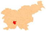
Podskrajnik (pronounced [pɔtˈskɾaːi̯nik]) is a settlement on the western outskirts of Cerknica in the Inner Carniola region of Slovenia.[2]
Geography
[edit]Podskrajnik lies along the road between Rakek and Cerknica.[3][4] It lies below the south slope of the Skrajnik Ridge (elevation 652 meters or 2,139 feet). The soil in the area is gravelly and rocky, and it is damp in the area known as Na Brodcu to the south, where the water table lies just below the surface.[4]
Name
[edit]The name Podskrajnik is a fused prepositional phrase that has lost case inflection, from pod 'below' + Skrajnik, referring to the Skrajnik Ridge.[5]
History
[edit]
The village arose in the mid-19th century in the vicinity of three springs. Villagers from neighboring Zelše also walked to Podskrajnik to draw water until water mains were installed in Zelše in 1911, and during droughts water was also drawn from the Cerkniščica River in nearby Dolenja Vas. A pump and a water tower were installed west of the village in 1854; the tower was dismantled in 1938, but is recalled by the microtoponym Pri Turnu (literally, 'at the tower') at the site.[4]
The Gornik Brickworks operated at Na Brodcu until the First World War, employing workers from Friuli. There are several gravel pits in Podskrajnik, which were used to supply a local industry manufacturing concrete products.[4]
After the Second World War, there was a military installation immediately northwest of Podskrajnik at a site called Krive Doli.[6] The area has been developed into a retail center today. During the immediate postwar years, the site was used by the Yugoslav secret police (OZNA) to liquidate political opponents.[7][8]
References
[edit]- ^ Statistical Office of the Republic of Slovenia
- ^ Cerknica municipal site
- ^ Krajevni leksikon Dravske Banovine. Ljubljana: Zveza za tujski promet za Slovenijo. 1937. p. 399.
- ^ a b c d Savnik, Roman (1968). Krajevni leksikon Slovenije, vol. 1. Ljubljana: Državna založba Slovenije. p. 52.
- ^ Snoj, Marko (2009). Etimološki slovar slovenskih zemljepisnih imen. Ljubljana: Modrijan. p. 378.
- ^ Hrvatin, Mauro; et al. (2013). Kras. Trajnostni razvoj kraške pokrajine. Ljubljana: Založba ZRC. p. 178.
- ^ Okoliš, Stane (1996). Žrtve druge svetovne vojne na ožjem Notranjskem: gradivo Komisije za raziskavo povojnih množičnih pobojev, pravnodvomljivih procesov in drugih nepravilnosti občine Cerknica. Cerknica: Partner graf. p. 79.
- ^ Šturm, Lovro (2000). Brez milosti: ranjeni, invalidni in bolni povojni ujetniki na Slovenskem. Ljubljana: Nova revija. p. 132.
External links
[edit] Media related to Podskrajnik at Wikimedia Commons
- Podskrajnik on Geopedia


