Carrazedo (Amares): Difference between revisions
Appearance
Content deleted Content added
mNo edit summary |
m Fixed typo (via WP:JWB) |
||
| (5 intermediate revisions by 5 users not shown) | |||
| Line 1: | Line 1: | ||
{{Infobox |
{{Infobox Portuguese subdivision |
||
|type = parish |
|||
|official_name = Carrazedo |
|official_name = Carrazedo |
||
|image_shield = |
|image_shield = |
||
| Line 8: | Line 9: | ||
|area_total = 2.71 |
|area_total = 2.71 |
||
|population_total = 732 |
|population_total = 732 |
||
| |
|population_as_of = 2011 |
||
|coordinates = {{coord|41.629|-8.387|type:adm1st_region:PT_dim:50000|display=inline,title}} |
|coordinates = {{coord|41.629|-8.387|type:adm1st_region:PT_dim:50000|display=inline,title}} |
||
|postal_code = |
|postal_code = |
||
|website = |
|website = |
||
}} |
}} |
||
'''Carrazedo''' is a civil parish in the municipality of [[Amares Municipality|Amares]], Portugal. The population in 2011 was 732,<ref>[http://www.ine.pt/xportal/xmain?xlang=en&xpid=INE&xpgid=ine_indicadores&indOcorrCod=0005889&contexto=pi&selTab=tab0 Instituto Nacional de Estatística]</ref> in an area of 2.71 km |
'''Carrazedo''' is a civil parish in the municipality of [[Amares Municipality|Amares]], Portugal. The population in 2011 was 732,<ref>[http://www.ine.pt/xportal/xmain?xlang=en&xpid=INE&xpgid=ine_indicadores&indOcorrCod=0005889&contexto=pi&selTab=tab0 Instituto Nacional de Estatística]</ref> in an area of 2.71 km<sup>2</sup>.<ref>[http://epp.eurostat.ec.europa.eu/portal/page/portal/nuts_nomenclature/documents/PT-LAU.xls Eurostat] {{webarchive |url=https://web.archive.org/web/20121007042623/http://epp.eurostat.ec.europa.eu/portal/page/portal/nuts_nomenclature/documents/PT-LAU.xls |date=October 7, 2012 }}</ref> |
||
==References== |
==References== |
||
{{Reflist}} |
{{Reflist}} |
||
{{Parishes of Amares}} |
|||
{{authority control}} |
|||
| ⚫ | |||
| ⚫ | |||
Latest revision as of 07:24, 17 April 2024
Carrazedo | |
|---|---|
| Coordinates: 41°37′44″N 8°23′13″W / 41.629°N 8.387°W | |
| Country | |
| Region | Norte |
| Intermunic. comm. | Cávado |
| District | Braga |
| Municipality | Amares |
| Area | |
• Total | 2.71 km2 (1.05 sq mi) |
| Population (2011) | |
• Total | 732 |
| • Density | 270/km2 (700/sq mi) |
| Time zone | UTC+00:00 (WET) |
| • Summer (DST) | UTC+01:00 (WEST) |
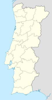
Carrazedo is a civil parish in the municipality of Amares, Portugal. The population in 2011 was 732,[1] in an area of 2.71 km2.[2]
References
[edit]- ^ Instituto Nacional de Estatística
- ^ Eurostat Archived October 7, 2012, at the Wayback Machine

