Pacasmayo District: Difference between revisions
Appearance
Content deleted Content added
m fix image params |
|||
| Line 6: | Line 6: | ||
| settlement_type = [[Districts of Peru|District]] |
| settlement_type = [[Districts of Peru|District]] |
||
| image_skyline =Pacasmayo 4.JPG |
| image_skyline =Pacasmayo 4.JPG |
||
| image_alt = |
| image_alt = |
||
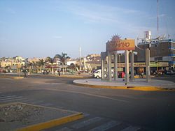
| image_caption = Pacasmayo |
| image_caption = Pacasmayo |
||
| image_flag = Bandera de pacasmayo.png |
| image_flag = Bandera de pacasmayo.png |
||
Latest revision as of 17:28, 2 March 2021
Pacasmayo | |
|---|---|
 Pacasmayo | |
 | |
| Coordinates: 7°24′1″S 79°34′12″W / 7.40028°S 79.57000°W | |
| Country | |
| Region | La Libertad |
| Province | Pacasmayo |
| Founded | November 23, 1864 |
| Capital | Pacasmayo |
| Government | |
| • Mayor | Cesar Rodolfo Milla Manay |
| Area | |
• Total | 30.84 km2 (11.91 sq mi) |
| Elevation | 8 m (26 ft) |
| Population (2017) | |
• Total | 28,959 |
| • Density | 940/km2 (2,400/sq mi) |
| Time zone | UTC-5 (PET) |
| UBIGEO | 130704 |
Pacasmayo District is one of five districts of the province Pacasmayo in Peru.[1] It lies just over 100 km north of Trujillo, in km number 681 from the Panamerican Highway, is located in the coast beside to the Pacific Ocean. The city is visited commonly for surfers. [2]
References
[edit]- ^ (in Spanish) Instituto Nacional de Estadística e Informática. Banco de Información Distrital Archived 2008-04-23 at the Wayback Machine. Retrieved April 11, 2008.
- ^ http://www.perusurfguides.com/peru-surf-guides/surfing_peru_surf_peru_playas_pacasmayo.php Peru Surfing


