Ayun Pa: Difference between revisions
Appearance
Content deleted Content added
m comma |
No edit summary Tags: Mobile edit Mobile web edit |
||
| (12 intermediate revisions by 10 users not shown) | |||
| Line 19: | Line 19: | ||
|image_blank_emblem = |
|image_blank_emblem = |
||
|blank_emblem_size = |
|blank_emblem_size = |
||
|image_map = |
|||
|mapsize = |
|mapsize = |
||
|map_caption = |
|||
|image_map1 = |
|image_map1 = |
||
|mapsize1 = |
|mapsize1 = |
||
|map_caption1 = |
|map_caption1 = |
||
| image_map = {{maplink|frame=yes|plain=yes|type=shape|frame-width=280|frame-align=center|stroke-width=3}} |
|||
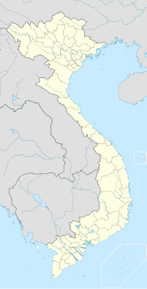
|pushpin_map = Vietnam |
|||
| map_caption = Interactive map outlining Ayun Pa |
|||
| pushpin_map_caption = Location within Vietnam##Location within Southeast Asia##Location within Asia |
|||
| pushpin_map = Vietnam#Southeast Asia#Asia |
|||
|pushpin_label_position = |
|pushpin_label_position = |
||
|pushpin_mapsize=300 |
|pushpin_mapsize=300 |
||
| Line 82: | Line 83: | ||
}} |
}} |
||
'''Ayun Pa''' is a district-level town (''thị xã'') in [[Gia Lai Province]], in the [[Central Highlands (Vietnam)|Central Highlands]] of [[Vietnam]]. It used to be known as '''Cheo Reo''' after 1975. Ayun Pa covers an area of 287 km |
'''Ayun Pa''' is a district-level town (''thị xã'') in [[Gia Lai Province]], in the [[Central Highlands (Vietnam)|Central Highlands]] of [[Vietnam]]. It used to be known as '''Cheo Reo''' after 1975. Ayun Pa covers an area of 287 km<sup>2</sup>, with a population of 35,058 (2007). The town is situated in the south-eastern part of Gia Lai Province. To the east and north-east is [[Ia Pa District]], to the south-east is [[Krông Pa District]], to the south is [[Ea H'leo District]] in [[Đắk Lắk Province]] and to the west is [[Phú Thiện District]]. |
||
Ayun Pa town has 8 subdivisions, including 4 urban wards (phường): Cheo Reo, Hòa Bình, Đoàn Kết, Sông Bờ, and 4 communes (xã): Ia RTô, Chư Băh, Ia RBol and Ia Sao. |
Ayun Pa town has 8 subdivisions, including 4 urban wards (phường): Cheo Reo, Hòa Bình, Đoàn Kết, Sông Bờ, and 4 communes (xã): Ia RTô, Chư Băh, Ia RBol and Ia Sao. |
||
==Climate== |
|||
{{Weather box|width=auto |
|||
|metric first=y |
|||
|single line=y |
|||
|location = Ayun Pa |
|||
|Jan high C = 28.7 |
|||
|Feb high C = 31.0 |
|||
|Mar high C = 33.8 |
|||
|Apr high C = 35.7 |
|||
|May high C = 34.6 |
|||
|Jun high C = 32.9 |
|||
|Jul high C = 32.3 |
|||
|Aug high C = 31.9 |
|||
|Sep high C = 31.6 |
|||
|Oct high C = 30.4 |
|||
|Nov high C = 29.1 |
|||
|Dec high C = 27.7 |
|||
|year high C = 31.7 |
|||
|Jan mean C = 22.5 |
|||
|Feb mean C = 24.1 |
|||
|Mar mean C = 26.5 |
|||
|Apr mean C = 28.5 |
|||
|May mean C = 28.5 |
|||
|Jun mean C = 27.8 |
|||
|Jul mean C = 27.2 |
|||
|Aug mean C = 26.9 |
|||
|Sep mean C = 26.4 |
|||
|Oct mean C = 25.5 |
|||
|Nov mean C = 24.3 |
|||
|Dec mean C = 22.8 |
|||
|year mean C = 25.9 |
|||
|Jan low C = 18.1 |
|||
|Feb low C = 19.1 |
|||
|Mar low C = 21.3 |
|||
|Apr low C = 23.6 |
|||
|May low C = 24.5 |
|||
|Jun low C = 24.4 |
|||
|Jul low C = 24.0 |
|||
|Aug low C = 23.9 |
|||
|Sep low C = 23.5 |
|||
|Oct low C = 22.6 |
|||
|Nov low C = 21.2 |
|||
|Dec low C = 19.3 |
|||
|year low C = 22.1 |
|||
|Jan record high C = 36.1 |Jan record low C = 10.3 |
|||
|Feb record high C = 38.5 |Feb record low C = 10.2 |
|||
|Mar record high C = 40.2 |Mar record low C = 11.3 |
|||
|Apr record high C = 41.3 |Apr record low C = 18.9 |
|||
|May record high C = 40.5 |May record low C = 21.0 |
|||
|Jun record high C = 38.7 |Jun record low C = 21.5 |
|||
|Jul record high C = 37.5 |Jul record low C = 20.6 |
|||
|Aug record high C = 36.6 |Aug record low C = 20.9 |
|||
|Sep record high C = 36.1 |Sep record low C = 20.3 |
|||
|Oct record high C = 34.9 |Oct record low C = 16.4 |
|||
|Nov record high C = 34.3 |Nov record low C = 13.6 |
|||
|Dec record high C = 33.3 |Dec record low C = 10.4 |
|||
|year record high C = |year record low C = |
|||
|precipitation colour = green |
|||
|Jan precipitation mm = 2.2 |
|||
|Feb precipitation mm = 3.7 |
|||
|Mar precipitation mm = 13.8 |
|||
|Apr precipitation mm = 58.6 |
|||
|May precipitation mm = 164.8 |
|||
|Jun precipitation mm = 131.7 |
|||
|Jul precipitation mm = 126.0 |
|||
|Aug precipitation mm = 159.2 |
|||
|Sep precipitation mm = 220.8 |
|||
|Oct precipitation mm = 215.1 |
|||
|Nov precipitation mm = 149.2 |
|||
|Dec precipitation mm = 29.0 |
|||
|year precipitation mm = 1274.1 |
|||
|Jan rain days = 1.7 |
|||
|Feb rain days = 1.5 |
|||
|Mar rain days = 2.4 |
|||
|Apr rain days = 6.8 |
|||
|May rain days = 15.4 |
|||
|Jun rain days = 15.3 |
|||
|Jul rain days = 17.3 |
|||
|Aug rain days = 20.4 |
|||
|Sep rain days = 20.4 |
|||
|Oct rain days = 17.9 |
|||
|Nov rain days = 13.3 |
|||
|Dec rain days = 6.7 |
|||
|year rain days = 139.2 |
|||
|Jan humidity = 78.0 |
|||
|Feb humidity = 74.8 |
|||
|Mar humidity = 71.1 |
|||
|Apr humidity = 70.8 |
|||
|May humidity = 75.5 |
|||
|Jun humidity = 78.2 |
|||
|Jul humidity = 79.7 |
|||
|Aug humidity = 81.9 |
|||
|Sep humidity = 84.4 |
|||
|Oct humidity = 85.7 |
|||
|Nov humidity = 84.1 |
|||
|Dec humidity = 81.2 |
|||
|year humidity = 78.8 |
|||
|Jan sun = 188.7 |
|||
|Feb sun = 223.2 |
|||
|Mar sun = 252.8 |
|||
|Apr sun = 257.4 |
|||
|May sun = 248.9 |
|||
|Jun sun = 209.8 |
|||
|Jul sun = 207.5 |
|||
|Aug sun = 190.2 |
|||
|Sep sun = 169.5 |
|||
|Oct sun = 163.2 |
|||
|Nov sun = 149.6 |
|||
|Dec sun = 143.3 |
|||
|year sun = 2406.5 |
|||
|source 1 = Vietnam Institute for Building Science and Technology<ref name=IBST>{{cite web|title=Vietnam Institute for Building Science and Technology|url=https://datafiles.chinhphu.vn/cpp/files/vbpq/2022/10/02-bxd.pdf | access-date =16 August 2023}}</ref> |
|||
}} |
|||
==References== |
|||
{{Reflist}} |
|||
{{Cities in Vietnam}} |
{{Cities in Vietnam}} |
||
{{Districts of Central Highlands}} |
{{Districts of Central Highlands}} |
||
[[Category:Populated places in Gia Lai |
[[Category:Populated places in Gia Lai province]] |
||
[[Category:Districts of Gia Lai |
[[Category:Districts of Gia Lai province]] |
||
[[Category:County-level towns in Vietnam]] |
[[Category:County-level towns in Vietnam]] |
||
Latest revision as of 12:18, 26 August 2024
You can help expand this article with text translated from the corresponding article in Vietnamese. (March 2009) Click [show] for important translation instructions.
|
Ayun Pa
Thị xã Ayun Pa | |
|---|---|
| Ayun Pa Town | |
 Interactive map outlining Ayun Pa | |
| Coordinates: 13°23′38″N 108°26′27″E / 13.39389°N 108.44083°E | |
| Country | |
| Region | Central Highlands |
| Province | Gia Lai |
| Area | |
• Total | 111 sq mi (287 km2) |
| Population (2019) | |
• Total | 53,720 |
| • Density | 480/sq mi (187/km2) |
| Time zone | UTC+07:00 (Indochina Time) |
Ayun Pa is a district-level town (thị xã) in Gia Lai Province, in the Central Highlands of Vietnam. It used to be known as Cheo Reo after 1975. Ayun Pa covers an area of 287 km2, with a population of 35,058 (2007). The town is situated in the south-eastern part of Gia Lai Province. To the east and north-east is Ia Pa District, to the south-east is Krông Pa District, to the south is Ea H'leo District in Đắk Lắk Province and to the west is Phú Thiện District.
Ayun Pa town has 8 subdivisions, including 4 urban wards (phường): Cheo Reo, Hòa Bình, Đoàn Kết, Sông Bờ, and 4 communes (xã): Ia RTô, Chư Băh, Ia RBol and Ia Sao.
Climate
[edit]| Climate data for Ayun Pa | |||||||||||||
|---|---|---|---|---|---|---|---|---|---|---|---|---|---|
| Month | Jan | Feb | Mar | Apr | May | Jun | Jul | Aug | Sep | Oct | Nov | Dec | Year |
| Record high °C (°F) | 36.1 (97.0) |
38.5 (101.3) |
40.2 (104.4) |
41.3 (106.3) |
40.5 (104.9) |
38.7 (101.7) |
37.5 (99.5) |
36.6 (97.9) |
36.1 (97.0) |
34.9 (94.8) |
34.3 (93.7) |
33.3 (91.9) |
41.3 (106.3) |
| Mean daily maximum °C (°F) | 28.7 (83.7) |
31.0 (87.8) |
33.8 (92.8) |
35.7 (96.3) |
34.6 (94.3) |
32.9 (91.2) |
32.3 (90.1) |
31.9 (89.4) |
31.6 (88.9) |
30.4 (86.7) |
29.1 (84.4) |
27.7 (81.9) |
31.7 (89.1) |
| Daily mean °C (°F) | 22.5 (72.5) |
24.1 (75.4) |
26.5 (79.7) |
28.5 (83.3) |
28.5 (83.3) |
27.8 (82.0) |
27.2 (81.0) |
26.9 (80.4) |
26.4 (79.5) |
25.5 (77.9) |
24.3 (75.7) |
22.8 (73.0) |
25.9 (78.6) |
| Mean daily minimum °C (°F) | 18.1 (64.6) |
19.1 (66.4) |
21.3 (70.3) |
23.6 (74.5) |
24.5 (76.1) |
24.4 (75.9) |
24.0 (75.2) |
23.9 (75.0) |
23.5 (74.3) |
22.6 (72.7) |
21.2 (70.2) |
19.3 (66.7) |
22.1 (71.8) |
| Record low °C (°F) | 10.3 (50.5) |
10.2 (50.4) |
11.3 (52.3) |
18.9 (66.0) |
21.0 (69.8) |
21.5 (70.7) |
20.6 (69.1) |
20.9 (69.6) |
20.3 (68.5) |
16.4 (61.5) |
13.6 (56.5) |
10.4 (50.7) |
10.2 (50.4) |
| Average precipitation mm (inches) | 2.2 (0.09) |
3.7 (0.15) |
13.8 (0.54) |
58.6 (2.31) |
164.8 (6.49) |
131.7 (5.19) |
126.0 (4.96) |
159.2 (6.27) |
220.8 (8.69) |
215.1 (8.47) |
149.2 (5.87) |
29.0 (1.14) |
1,274.1 (50.16) |
| Average rainy days | 1.7 | 1.5 | 2.4 | 6.8 | 15.4 | 15.3 | 17.3 | 20.4 | 20.4 | 17.9 | 13.3 | 6.7 | 139.2 |
| Average relative humidity (%) | 78.0 | 74.8 | 71.1 | 70.8 | 75.5 | 78.2 | 79.7 | 81.9 | 84.4 | 85.7 | 84.1 | 81.2 | 78.8 |
| Mean monthly sunshine hours | 188.7 | 223.2 | 252.8 | 257.4 | 248.9 | 209.8 | 207.5 | 190.2 | 169.5 | 163.2 | 149.6 | 143.3 | 2,406.5 |
| Source: Vietnam Institute for Building Science and Technology[1] | |||||||||||||
References
[edit]- ^ "Vietnam Institute for Building Science and Technology" (PDF). Retrieved 16 August 2023.


