Probiy: Difference between revisions
Appearance
Content deleted Content added
m fixed |
|||
| (3 intermediate revisions by 3 users not shown) | |||
| Line 1: | Line 1: | ||
{{Multiple issues| |
|||
| ⚫ | |||
{{Orphan|date=June 2024}} |
|||
| ⚫ | |||
}} |
|||
{{Infobox waterfall |
{{Infobox waterfall |
||
| Line 6: | Line 9: | ||
| photo_width = |
| photo_width = |
||
| photo_caption = |
| photo_caption = |
||
| map = |
| map = Ukraine Ivano-Frankivsk Oblast#Ukraine |
||
| map_width = |
| map_width = |
||
| region = |
|||
| coordinates = {{coord|48|27|37|N|24|33|31|E|type:waterbody_scale:50000|format=dms|display=inline,title}} |
|||
| source = |
|||
| coordinates = {{WikidataCoord|display=it}} |
|||
| coords_ref = |
| coords_ref = |
||
| location = [[Yaremche]], [[Ivano-Frankivsk Oblast]], [[Ukraine]] |
| location = [[Yaremche]], [[Ivano-Frankivsk Oblast]], [[Ukraine]] |
||
| Line 23: | Line 28: | ||
}} |
}} |
||
'''Probiy''' ({{ |
'''Probiy''' ({{langx|uk|Пробій}}; also called, '''Yaremche''') is a waterfall on the [[Prut]] River, in [[Yaremche]] City, [[Ivano-Frankivsk Oblast]], [[Ukraine]]. Probiy is {{convert|8|m|ft}} high and is one of the most powerful waterfalls in the Ukrainian [[Carpathians]]. |
||
==History== |
==History== |
||
The waterfall was significantly higher during the 19th century. The waterfall lost its height as the channel leading up to it |
The waterfall was significantly higher during the 19th century. The waterfall lost its height as the channel leading up to it deepened.<ref>{{cite web|title=Waterfall "Break" Yaremche|url=http://www.karpaty.ua/ua/vyznachni-mistsya/pryrodni-atraktsii/vodospady-i-ozera/item/1210-vodospad-probiy.html|publisher=Karparty.ua|accessdate=January 16, 2014}}</ref> There have been fatalities from people falling into the water onto rocks near the waterfall. The Probiy waterfall is a popular local place for kayakers and rafters. |
||
==Gallery== |
==Gallery== |
||
| Line 40: | Line 45: | ||
==References== |
==References== |
||
{{ |
{{Reflist}} |
||
[[Category:Waterfalls of Ukraine]] |
[[Category:Waterfalls of Ukraine]] |
||
Latest revision as of 21:30, 2 November 2024
This article has multiple issues. Please help improve it or discuss these issues on the talk page. (Learn how and when to remove these messages)
|
| Probiy | |
|---|---|
 | |
 | |
| Location | Yaremche, Ivano-Frankivsk Oblast, Ukraine |
| Coordinates | 48°26′N 24°35′E / 48.433°N 24.583°E |
| Total height | 8 metres (26 ft) |
| Watercourse | Prut river |
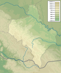
Probiy (Ukrainian: Пробій; also called, Yaremche) is a waterfall on the Prut River, in Yaremche City, Ivano-Frankivsk Oblast, Ukraine. Probiy is 8 metres (26 ft) high and is one of the most powerful waterfalls in the Ukrainian Carpathians.
History
[edit]The waterfall was significantly higher during the 19th century. The waterfall lost its height as the channel leading up to it deepened.[1] There have been fatalities from people falling into the water onto rocks near the waterfall. The Probiy waterfall is a popular local place for kayakers and rafters.
Gallery
[edit]See also
[edit]References
[edit]- ^ "Waterfall "Break" Yaremche". Karparty.ua. Retrieved January 16, 2014.


