Hardy, Virginia: Difference between revisions
Appearance
Content deleted Content added
Those counties? It would have to encompass several miles in area, but it's nowhere near that large |
Photo |
||
| Line 6: | Line 6: | ||
<!-- Images --> |
<!-- Images --> |
||
|image_skyline = |
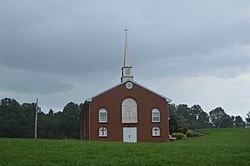
|image_skyline = Gravel Hill Baptist Church.jpg |
||
|imagesize = |
|imagesize = 250px |
||
|image_caption = |
|image_caption = Gravel Hill Baptist Church |
||
|image_flag = |
|image_flag = |
||
|image_seal = |
|image_seal = |
||
Revision as of 18:40, 21 January 2021
Hardy, Virginia | |
|---|---|
Unincorporated community | |
 Gravel Hill Baptist Church | |
| Coordinates: 37°13′55″N 79°48′38″W / 37.23194°N 79.81056°W | |
| Country | United States |
| State | Virginia |
| County | Bedford |
| Elevation | 997 ft (304 m) |
| Time zone | UTC-5 (Eastern (EST)) |
| • Summer (DST) | UTC-4 (EDT) |
| GNIS feature ID | 1477396[1] |
Hardy is an unincorporated community in Bedford County, Virginia, United States, about twenty miles southeast of Roanoke. The community is near the Booker T. Washington National Monument, which commemorates where Booker T. Washington was born in 1856. It is also the home place of Jubal Anderson Early, who was born near the bottom of Windy Gap Mountain.
The Booth-Lovelace House was listed on the National Register of Historic Places in 2002.[2]


