Mississippi Highway 315: Difference between revisions
Tags: Mobile edit Mobile web edit Advanced mobile edit |
No edit summary Tags: Mobile edit Mobile web edit Advanced mobile edit |
||
| Line 17: | Line 17: | ||
|length_ref=<ref name=MDOT>{{cite web|title=Mississippi Public Roads Selected Statistics|publisher=[[Mississippi Department of Transportation]]|year=2008|url=http://sp.mdot.ms.gov/Office%20of%20Highways/Planning/Programs/MDOT%20Public%20Roads%20Statistics%20Extent,%20Travel,%20and%20Designation.pdf|format=PDF|accessdate=June 14, 2013}}</ref> |
|length_ref=<ref name=MDOT>{{cite web|title=Mississippi Public Roads Selected Statistics|publisher=[[Mississippi Department of Transportation]]|year=2008|url=http://sp.mdot.ms.gov/Office%20of%20Highways/Planning/Programs/MDOT%20Public%20Roads%20Statistics%20Extent,%20Travel,%20and%20Designation.pdf|format=PDF|accessdate=June 14, 2013}}</ref> |
||
|length_notes= |
|length_notes= |
||
|established= |
|established=1953 |
||
|decommissioned= |
|decommissioned= |
||
|direction_a=West |
|direction_a=West |
||
Revision as of 13:34, 11 April 2021
| Route information | ||||
|---|---|---|---|---|
| Maintained by MDOT | ||||
| Length | 78.174 mi[1] (125.809 km) | |||
| Existed | 1953–present | |||
| Major junctions | ||||
| West end | ||||
| ||||
| East end | ||||
| Location | ||||
| Country | United States | |||
| State | Mississippi | |||
| Counties | Coahoma, Quitman, Panola, Yalobusha, Lafayette | |||
| Highway system | ||||
| ||||
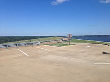
Mississippi Highway 315 (MS 315) is a 78.174-mile (125.809 km) long state highway located in northern Mississippi. The western terminus of the route is at US 49/US 61 near Rich in Coahoma County while the eastern terminus is at MS 9W near Paris in Lafayette County. Along the way, the highway passes over Sardis Dam east of the town of Sardis. It is a very rare east-west odd-numbered state highway, but it is signed north-south. [2]
Route description
MS 315 begins Mississippi Delta region at an intersection with US 49/US 61 near Rich in Coahoma County. The route heads east through flat farmland to cross into neighboring Quitman County, and it winds its way northeast have an intersection with MS 716 (Six Mile Lake Road) before crossing the Tallahatchie River and passing through the town of Sledge, intersecting MS 714 (Quitman Street) and MS 3.
The highway now enters Panola County and climbs some Loess bluffs out of the delta and into the North Central Hills. MS 315 travels through mostly wooded areas for the next several miles to enter the town of [Sardis, Mississippi|Sardis]], where it has an intersection with US 51 before passing through downtown along Lee Street and having interchange with I-55 (Exit 252) shortly thereafter. The route leaves Sardis and winds its way east through woodlands for several miles to have its first intersection with MS 315 Scenic before passing alongside Sardis Dam through John W. Kyle State Park. MS 315 has an intersection with MS 35 to become concurrent (overlapped) with MS 315 Scenic for a short distance before passing along a short portion of the dam and traveling by some marinas. The highway now heads southeast through woodlands to become concurrent with westbound traffic on MS 6/US 278 for a few miles before turning southeast to enter Lafayette County.
The portion of the highway between Sardis Dam and the end of the concurrency with MS 6/US 278 is poorly signed.
MS 315 travels through a mix of farmland and wooded areas for several miles to have an intersection with MS 328 and crosses the Yocona River (at the northernmost reaches of Enid Lake) before entering neighboring Yalobusha County. The highway enters the Water Valley city limits, immediately becoming concurrent with MS 7 south, bypassing the majority of the town along its western side. MS 315 breaks off and follows MS 32 east for a short distance before following S Main Street back into town, where it makes a right onto Blackmur Drive at the southern edge of the historic downtown area. The highway now leaves Water Valley and- heads east up a narrow valley along the banks of Otoucalofa Creek for several miles to re-enter Lafayette County and come to an end shortly thereafter at an intersection with MS 9W in the community Paris.
The entire route of MS 315, excluding the concurrencies with MS 6/US 278 and MS 7 (which are both divided four-lane highways), is a rural two-lane.[3]
Major intersections

| County | Location | mi[3] | km | Destinations | Notes |
|---|---|---|---|---|---|
| Coahoma | | 0.0 | 0.0 | Western (signed southern) terminus | |
| Quitman | | 13.0 | 20.9 | Eastern terminus of MS 716 | |
| Sledge | 15.9 | 25.6 | Western terminus of MS 714 | ||
| 16.6 | 26.7 | ||||
| Panola | Sardis | 33.6 | 54.1 | ||
| 35.2 | 56.6 | I-55 exit 252 | |||
| | 43.6 | 70.2 | Northern terminus of MS 35 | ||
| | 50.2 | 80.8 | Western end of US 278/MS 6 concurrency | ||
| | 52.6 | 84.7 | Interchange; eastern end of US 278/MS 6 concurrency | ||
| Lafayette | | 60.3 | 97.0 | Western terminus of MS 328 | |
| Yalobusha | Water Valley | 65.6 | 105.6 | Western end of MS 7 concurrency | |
| | 68.4 | 110.1 | Eastern end of MS 7 concurrency; Western end of MS 32 concurrency | ||
| Water Valley | 69.0 | 111.0 | Eastern end of MS 32 concurrency | ||
| Lafayette | Paris | 82.3 | 132.4 | Eastern (signed northern) terminus; western terminus of MS 812 | |
1.000 mi = 1.609 km; 1.000 km = 0.621 mi
| |||||
References
- ^ "Mississippi Public Roads Selected Statistics" (PDF). Mississippi Department of Transportation. 2008. Retrieved June 14, 2013.
- ^ http://azfoo.net/gdt/babs/images/US-Hwy61SignUS-Hwy49Sign.jpg
- ^ a b Microsoft; Nokia. "Mississippi Highway 315" (Map). Bing Maps. Microsoft. Retrieved December 25, 2014.

