Nána, Slovakia: Difference between revisions
Appearance
Content deleted Content added
Norden1990 (talk | contribs) |
Citation bot (talk | contribs) Add: title. Changed bare reference to CS1/2. | Use this bot. Report bugs. | Suggested by BrownHairedGirl | Linked from User:BrownHairedGirl/Articles_with_bare_links | #UCB_webform_linked 2061/2196 |
||
| Line 26: | Line 26: | ||
<!-- government type, leaders --> |
<!-- government type, leaders --> |
||
| leader_title = Mayor |
| leader_title = Mayor |
||
| leader_name = Dezider Molnár<ref>https://volby.statistics.sk/oso/oso2018/</ref> |
| leader_name = Dezider Molnár<ref>{{Cite web|url=https://volby.statistics.sk/oso/oso2018/|title = Voľby do orgánov samosprávy obcí 2018 - OSO 2018}}</ref> |
||
<!-- established --> |
<!-- established --> |
||
| established_title = First mentioned |
| established_title = First mentioned |
||
| Line 55: | Line 55: | ||
==Geography== |
==Geography== |
||
The municipality lies at an [[elevation]] of 110 metres (360 ft) and covers an [[area]] of 17.947 km² (6.929 mi²).<ref>http://www.skgeodesy.sk/sk/ugkk/kataster-nehnutelnosti/registre-obnovenej-evidencie-pozemkov/</ref> |
The municipality lies at an [[elevation]] of 110 metres (360 ft) and covers an [[area]] of 17.947 km² (6.929 mi²).<ref>{{Cite web|url=http://www.skgeodesy.sk/sk/ugkk/kataster-nehnutelnosti/registre-obnovenej-evidencie-pozemkov/|title=Úrad geodézie, kartografie a katastra Slovenskej republiky - Registre obnovenej evidencie pozemkov}}</ref> |
||
==Demographics== |
==Demographics== |
||
In 2011, the municipality had a population of 1223 people.<ref>http://www.sodbtn.sk/obce/obec.php?kod_obce=556092</ref> 70% of the population identified as [[Hungarian people|Hungarian]] and 24% as [[Slovaks|Slovak]]. It has a small [[Romani people|Romani]] minority. |
In 2011, the municipality had a population of 1223 people.<ref>{{Cite web|url=http://www.sodbtn.sk/obce/obec.php?kod_obce=556092|title = Obce Sr}}</ref> 70% of the population identified as [[Hungarian people|Hungarian]] and 24% as [[Slovaks|Slovak]]. It has a small [[Romani people|Romani]] minority. |
||
==Facilities== |
==Facilities== |
||
Revision as of 04:54, 12 January 2022
This article has multiple issues. Please help improve it or discuss these issues on the talk page. (Learn how and when to remove these messages)
|
Nána | |
|---|---|
Municipality | |
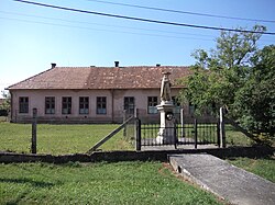
 Statue of Saint Wendelin | |
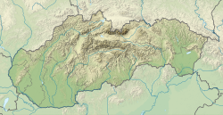
Location of Nána in the Nitra Region | |
| Coordinates: 47°49′N 18°43′E / 47.817°N 18.717°E | |
| Country | Slovakia |
| Region | Nitra |
| District | Nové Zámky |
| First mentioned | 1157 |
| Government | |
| • Mayor | Dezider Molnár[1] |
| Area | |
• Total | 17.947 km2 (6.929 sq mi) |
| Elevation | 110 m (360 ft) |
| Population (2019) | |
• Total | 1,223 |
| • Density | 68/km2 (180/sq mi) |
| Postal code | 943 60 |
| Car plate | NZ |
Nána (Template:Lang-hu) is a village and municipality in the Nové Zámky District in the Nitra Region of south-west Slovakia, near the border with Hungary.
History
In historical records the village was first mentioned in 1157.[2] It was the ancient estate of the Nánabeszter kindred in the 13th-century Hungary.
Geography
The municipality lies at an elevation of 110 metres (360 ft) and covers an area of 17.947 km² (6.929 mi²).[3]
Demographics
In 2011, the municipality had a population of 1223 people.[4] 70% of the population identified as Hungarian and 24% as Slovak. It has a small Romani minority.
Facilities
The village has a small public library and a football pitch.
References
External links


