Mopipi: Difference between revisions
I explained the economic changes since 2001 .Currently its 2021. |
i added the latitude of the village |
||
| Line 28: | Line 28: | ||
}} |
}} |
||
'''Mopipi''' is a village in [[Central District (Botswana)|Central District]] of [[Botswana]]. It is located close to [[Makgadikgadi Pan]]. The population was 3,066 in 2001 census.This village was named after a tree called Mopipi,which is commonly found in the region..<ref>{{cite web |
'''Mopipi''' is a village in [[Central District (Botswana)|Central District]] of [[Botswana]]. It is located close to [[Makgadikgadi Pan]].It lies at the latitude 21.2001° S, 24.8656° E. The population was 3,066 in 2001 census.This village was named after a tree called Mopipi,which is commonly found in the region..<ref>{{cite web |
||
| url=http://www.cso.gov.bw/html/census/dist52_53.html |
| url=http://www.cso.gov.bw/html/census/dist52_53.html |
||
| title=Distribution of population by sex by villages and their associated localities: 2001 population and housing census |
| title=Distribution of population by sex by villages and their associated localities: 2001 population and housing census |
||
| access-date = 2008-01-06 |archive-url = https://web.archive.org/web/20071124145541/http://www.cso.gov.bw/html/census/dist52_53.html <!-- Bot retrieved archive --> |archive-date = 2007-11-24}}</ref> This area has witnessed steady aridification and [[desertfication]] since the [[Pleistocene]], but perhaps most dramatically since the 19th century.<ref name="Main">Michael Main (2001) ''African Adventurer's Guide to Botswana'', Published by Struik, {{ISBN|978-1-86872-576-2}}. 304 pages</ref> In particular, the [[Boteti River]] used to flow year around in this area<ref name="Main"/> on its way to discharge to the [[Makgadikgadi Pans]],<ref>C. Michael Hogan (2008) [http://www.megalithic.co.uk/article.php?sid=22373&mode=&order=0''Makgadikgadi'', The Megalithic Portal, ed. A. Burnham]</ref> but presently this flow is only in the rainy season. |
| access-date = 2008-01-06 |archive-url = https://web.archive.org/web/20071124145541/http://www.cso.gov.bw/html/census/dist52_53.html <!-- Bot retrieved archive --> |archive-date = 2007-11-24}}</ref> This area has witnessed steady aridification and [[desertfication]] since the [[Pleistocene]], but perhaps most dramatically since the 19th century.<ref name="Main">Michael Main (2001) ''African Adventurer's Guide to Botswana'', Published by Struik, {{ISBN|978-1-86872-576-2}}. 304 pages</ref> In particular, the [[Boteti River]] used to flow year around in this area<ref name="Main"/> on its way to discharge to the [[Makgadikgadi Pans]],<ref>C. Michael Hogan (2008) [http://www.megalithic.co.uk/article.php?sid=22373&mode=&order=0''Makgadikgadi'', The Megalithic Portal, ed. A. Burnham]</ref> but presently this flow is only in the rainy season. |
||
The village has grown since 2001 ,nowdays there are more services and it is the investment hotspot of Boteti West.Companies like Super Power Complex have take the village by storm as of 2021 and other bigger companies are taking interest there as the toursim indutry and agricultural industry are boomming with more people starting commercial farming. |
The village has grown since 2001 ,nowdays there are more services and it is the investment hotspot of Boteti West.Companies like [[Super Power Complex]] have take the village by storm as of 2021 and other bigger companies are taking interest there as the toursim indutry and agricultural industry are boomming with more people starting commercial farming. |
||
==References== |
==References== |
||
Revision as of 18:16, 30 May 2021
Mopipi | |
|---|---|
| Coordinates: 21°12′7″S 24°52′6″E / 21.20194°S 24.86833°E | |
| Country | Botswana |
| District | Central District |
| Population (2001)[1] | |
• Total | 3,066 |
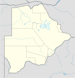
Mopipi is a village in Central District of Botswana. It is located close to Makgadikgadi Pan.It lies at the latitude 21.2001° S, 24.8656° E. The population was 3,066 in 2001 census.This village was named after a tree called Mopipi,which is commonly found in the region..[2] This area has witnessed steady aridification and desertfication since the Pleistocene, but perhaps most dramatically since the 19th century.[3] In particular, the Boteti River used to flow year around in this area[3] on its way to discharge to the Makgadikgadi Pans,[4] but presently this flow is only in the rainy season.
The village has grown since 2001 ,nowdays there are more services and it is the investment hotspot of Boteti West.Companies like Super Power Complex have take the village by storm as of 2021 and other bigger companies are taking interest there as the toursim indutry and agricultural industry are boomming with more people starting commercial farming.
References
- ^ "Distribution of population by sex by villages and their associated localities: 2001 population and housing census". Archived from the original on 2007-11-24. Retrieved 2008-01-06.
- ^ "Distribution of population by sex by villages and their associated localities: 2001 population and housing census". Archived from the original on 2007-11-24. Retrieved 2008-01-06.
- ^ a b Michael Main (2001) African Adventurer's Guide to Botswana, Published by Struik, ISBN 978-1-86872-576-2. 304 pages
- ^ C. Michael Hogan (2008) Makgadikgadi, The Megalithic Portal, ed. A. Burnham

