Tsundi: Difference between revisions
Appearance
Content deleted Content added
No edit summary |
Tom.Reding (talk | contribs) m WP:STUBSPACING followup |
||
| Line 47: | Line 47: | ||
[[Category:Rural localities in Gumbetovsky District]] |
[[Category:Rural localities in Gumbetovsky District]] |
||
{{Dagestan-geo-stub}} |
{{Dagestan-geo-stub}} |
||
Revision as of 15:24, 4 November 2024
Tsundi
Цунди | |
|---|---|
Selo | |
| Coordinates: 42°44′N 46°26′E / 42.733°N 46.433°E[1] | |
| Country | Russia |
| Region | Republic of Dagestan |
| District | Gumbetovsky District |
| Time zone | UTC+3:00 |
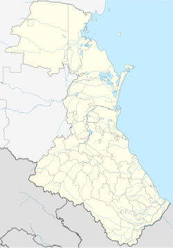
Tsundi (Template:Lang-ru) is a rural locality (a selo) in Tsudni-Shabdukhsky Selsoviet, Gumbetovsky District, Republic of Dagestan, Russia. The population was 368 as of 2010.[2]
Geography
Tsundi is located 14 km southwest of Mekhelta (the district's administrative centre) by road. Shabdukh and Kizhani are the nearest rural localities.[3]
References


