Ambouli: Difference between revisions
Appearance
Content deleted Content added
No edit summary |
mNo edit summary |
||
| Line 1: | Line 1: | ||
{{Infobox settlement |
{{Infobox settlement |
||
|official_name |
| official_name = Ambouli<br>أمبولي |
||
|other_name |
| other_name = |
||
|native_name |
| native_name = |
||
|nickname |
| nickname = |
||
|settlement_type |
| settlement_type = Town |
||
|motto |
| motto = |
||
|image_skyline |
| image_skyline = Ambouli Water Seller.png |
||
|imagesize |
| imagesize = |
||
|image_caption |
| image_caption = |
||
|image_flag |
| image_flag = |
||
|flag_size |
| flag_size = |
||
|image_seal |
| image_seal = |
||
|seal_size |
| seal_size = |
||
|image_map |
| image_map = |
||
|mapsize |
| mapsize = |
||
|map_caption |
| map_caption = |
||
|pushpin_map |
| pushpin_map = Djibouti |
||
|pushpin_label_position =bottom |
| pushpin_label_position = bottom |
||
|pushpin_mapsize |
| pushpin_mapsize = |
||
|pushpin_map_caption |
| pushpin_map_caption = Location in Djibouti. |
||
|subdivision_type |
| subdivision_type = Country |
||
|subdivision_name |
| subdivision_name = {{flag|Djibouti}} |
||
|subdivision_type1 |
| subdivision_type1 = [[Regions of Djibouti|Region]] |
||
|subdivision_name1 |
| subdivision_name1 = [[Djibouti Region|Djibouti]] |
||
|subdivision_type2 |
| subdivision_type2 = |
||
|subdivision_name2 |
| subdivision_name2 = |
||
|government_footnotes |
| government_footnotes = |
||
|government_type |
| government_type = |
||
|leader_title |
| leader_title = |
||
|leader_name |
| leader_name = |
||
|established_title |
| established_title = |
||
|established_date |
| established_date = |
||
|area_magnitude |
| area_magnitude = |
||
|unit_pref |
| unit_pref = Metric |
||
|area_footnotes |
| area_footnotes = |
||
|area_total_km2 |
| area_total_km2 = |
||
|area_land_km2 |
| area_land_km2 = |
||
|population_as_of |
| population_as_of = |
||
|population_footnotes |
| population_footnotes = |
||
|population_note |
| population_note = |
||
|population_total |
| population_total = |
||
|population_density_km2 = |
| population_density_km2 = |
||
|timezone |
| timezone = [[East Africa Time|EAT]] |
||
|utc_offset |
| utc_offset = +3 |
||
|timezone_DST |
| timezone_DST = |
||
|utc_offset_DST |
| utc_offset_DST = |
||
|coordinates |
| coordinates = {{coord|11|35|24|N|43|07|21|E|region:DJ-DJ|display=inline,title}} |
||
|elevation_footnotes |
| elevation_footnotes = |
||
|elevation_m |
| elevation_m = 13 |
||
|postal_code_type |
| postal_code_type = |
||
|postal_code |
| postal_code = |
||
|area_code |
| area_code = |
||
|blank_name |
| blank_name = |
||
|blank_info |
| blank_info = |
||
|website |
| website = |
||
|footnotes |
| footnotes = |
||
}} |
}} |
||
Revision as of 10:21, 6 April 2024
Ambouli أمبولي | |
|---|---|
Town | |
 | |
| Coordinates: 11°35′24″N 43°07′21″E / 11.59000°N 43.12250°E | |
| Country | |
| Region | Djibouti |
| Elevation | 13 m (43 ft) |
| Time zone | UTC+3 (EAT) |
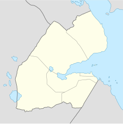
Ambouli (Template:Lang-ar) is a southern suburb of Djibouti, Djibouti.
Overview
Located in the Djibouti region, O.G.S. Crawford identifies the city with Canbala. Canbala appears in Muhammad al-Idrisi's map of 1192 on the coast of the Horn of Africa, southeast of the straits of Bab-el-Mandeb, and with Cambaleh, a town where the Venetian traveler Bragadino, a thirteenth-century European visitor to Ethiopia, resided for eight years.[1]
Transportation
Since 1948 the town has been the site of Djibouti–Ambouli International Airport.
Notes
- ^ O.G.S. Crawford, "Some Medieval Theories about the Nile", Geographical Journal, 114 (1949), p. 8
References

