Mandi Bahauddin Tehsil: Difference between revisions
Appearance
Content deleted Content added
m Unnecessary things are removed Tags: Visual edit Mobile edit Mobile web edit |
|||
| Line 71: | Line 71: | ||
*U.C. No.8 [[Rasul, Punjab|Rasul]] |
*U.C. No.8 [[Rasul, Punjab|Rasul]] |
||
*U.C. No.9 [[Chillianwala]] |
*U.C. No.9 [[Chillianwala]] |
||
* U.C. 10 Mojianwala: A 14k se encuentra una de las minas de sal más grandes del mundo; a 7 km se encentra una cadena de ríos que conforman el mejor sistema agrario de país. |
|||
* U.C. 10 Mojianwala |
|||
* U.C. 11 [[Dhok Kasib]] |
* U.C. 11 [[Dhok Kasib]] |
||
* U.C. 12 [[Murala]] |
* U.C. 12 [[Murala]] |
||
Revision as of 19:54, 15 December 2022
This article needs additional citations for verification. (July 2013) |
Mandi Bahauddin Tehsil
تحصیل منڈی بہاؤالدین | |
|---|---|
| Coordinates: 32°26′N 73°35′E / 32.433°N 73.583°E | |
| Country | |
| Region | |
| District | Mandi Bahauddin |
| Capital | Mandi Bahauddin |
| Towns | 1 |
| Union councils | 27 |
| Population | |
• Tehsil | 668,007 |
| • Urban | 217,207 |
| • Rural | 450,800 |
| Time zone | UTC+5 (PST) |
| • Summer (DST) | UTC+6 (PDT) |
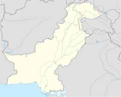
Mandi Bahauddin (Template:Lang-ur) is a tehsil located in Mandi Bahauddin District, Punjab, Pakistan.[2] The city of Mandi Bahauddin is the headquarters of the tehsil. Tehsil has total population of 668,007 according to census of 2017.
Administration
The tehsil of Mandi Bahauddin is administratively subdivided into 28 Union Councils, five of which form the capital - these are:[2]
- Uc.No.1 M.B.Din
- Uc. N0.2 M.B.Din
- U.C. No.3 M.B.Din
- U.C. No.4 M.B.Din
- Uc. N0.5.M.B.Din
- U.C. No.6 Ahla
- U.C. No.7 Mong
- U.C. No.8 Rasul
- U.C. No.9 Chillianwala
- U.C. 10 Mojianwala: A 14k se encuentra una de las minas de sal más grandes del mundo; a 7 km se encentra una cadena de ríos que conforman el mejor sistema agrario de país.
- U.C. 11 Dhok Kasib
- U.C. 12 Murala
- U.C. 13 Chakbasawa
- U.C. 14 Wasu
- U.C. 15 Shaheedanwali
- U.C. 16 Pindi Bahauddin
- U.C. 17 Sahna
- Uc 18 Chhimmon
- Uc. 19 Sohawa Bulani
- Uc.20 Sohawa Dillowana
- Uc. 21 Mangat
- Uc.22 Kadhar
- Uc.23 Mianwal Ranjha
- Uc.24 Nain Ranjha
- Uc25 Kuthiala Sheikhan
- Uc.26 Chak No 40
- Uc. 27 Bhikhi
- Uc. 28 Chak Raib
References
- ^ "DISTRICT AND TEHSIL LEVEL POPULATION SUMMARY WITH REGION BREAKUP: PUNJAB" (PDF). Pakistan Bureau of Statistics. 2018-01-03. Retrieved 2018-04-27.
- ^ a b Tehsils & Unions in the District of Mandi Bahauddin - Government of Pakistan


