Omuma Local Government: Difference between revisions
Appearance
Content deleted Content added
m Added a citation Tags: Reverted Visual edit |
|||
| Line 1: | Line 1: | ||
{{about|a local government area|the town in [[Oru East]]|Omuma town}} |
|||
| ⚫ | Its headquarters are in the town of '''Eberi'''. |
||
{{Use Nigerian English|date=January 2023}} |
|||
{{Infobox settlement |
|||
|official_name = Omuma |
|||
|other_name = |
|||
|native_name = |
|||
|nickname = |
|||
|settlement_type = [[Local Government Areas of Nigeria|LGA]] |
|||
|motto = |
|||
|image_skyline = |
|||
|image_caption = |
|||
|image_flag = |
|||
|flag_size = |
|||
|image_seal = |
|||
|seal_size = |
|||
|image_map = |
|||
|map_caption = |
|||
| coordinates = {{WikidataCoord|display=it}} |
|||
| pushpin_map = Nigeria#Africa |
|||
|pushpin_mapsize = |
|||
|pushpin_map_caption = |
|||
|subdivision_type = Country |
|||
|subdivision_name = [[Nigeria]] |
|||
|subdivision_type1 = [[States of Nigeria|State]] |
|||
|subdivision_name1 = [[Rivers State]] |
|||
|subdivision_type2 = |
|||
|subdivision_name2 = |
|||
|seat = Eberi |
|||
|government_footnotes = |
|||
|government_type = |
|||
|leader_title1 = Local Government Chairman |
|||
|leader_name1 = Nwaiwu Chisorom ([[Peoples Democratic Party (Nigeria)|PDP]]) |
|||
|leader_title2 = Deputy Local Government Chairman |
|||
|leader_name2 = Ubani Mary ([[Peoples Democratic Party (Nigeria)|PDP]]) |
|||
|leader_title3 = Local Government Council |
|||
|leader_name3 = Ward 1: Umesi Obioma ([[Peoples Democratic Party (Nigeria)|PDP]])<br/>Ward 2: Promise Reginald ([[Peoples Democratic Party (Nigeria)|PDP]])<br/>Ward 3: Ekpendu Prince Eze ([[Peoples Democratic Party (Nigeria)|PDP]])<br/>Ward 4: Elike Nwaobia Samuel ([[Peoples Democratic Party (Nigeria)|PDP]])<br/>Ward 5: Henry Okechukwu ([[Peoples Democratic Party (Nigeria)|PDP]])<br/>Ward 6: Ugochukwu Orji ([[Peoples Democratic Party (Nigeria)|PDP]])<br/>Ward 7: Cyril Oluo ([[Peoples Democratic Party (Nigeria)|PDP]])<br/>Ward 8: Nwaodu Nnanyibu ([[Peoples Democratic Party (Nigeria)|PDP]])<br/>Ward 9: Onyebuchi Onyeche ([[Peoples Democratic Party (Nigeria)|PDP]])<br/>Ward 10: Okpoko Lucky ([[Peoples Democratic Party (Nigeria)|PDP]]) |
|||
|established_title = Date created |
|||
|established_date = October 1, 1996{{citation needed|date=September 2020}} |
|||
|unit_pref = Imperial |
|||
|area_footnotes = |
|||
|area_total_km2 = 170 |
|||
|area_land_km2 = |
|||
|population_as_of = 2006 |
|||
|population_footnotes = |
|||
|population_note = |
|||
|population_total = |
|||
|population_density_km2 = |
|||
|timezone = [[West Africa Time|WAT]] |
|||
|utc_offset = +1 |
|||
|timezone_DST = |
|||
|utc_offset_DST = |
|||
|elevation_footnotes = |
|||
|elevation_m = |
|||
|postal_code_type = |
|||
|postal_code = |
|||
|area_code = |
|||
|website = |
|||
|footnotes = |
|||
}} |
|||
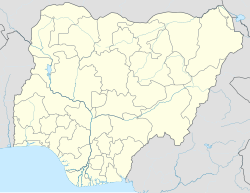
| ⚫ | '''Omuma''' is a [[Local Government Areas of Nigeria|Local Government Area]] in [[Rivers State]], [[Nigeria]]. Its headquarters are in the town of '''Eberi'''. Its people are Igbo .<ref name="NImaps">{{cite web | title = State map | publisher = Nigerian National Bureau of Statistics | url = http://www.nigerianstat.gov.ng/index.php/pages/nigerianMap | access-date = 2010-05-19 | url-status = dead | archive-url = https://web.archive.org/web/20100501135814/http://www.nigerianstat.gov.ng/index.php/pages/nigerianMap | archive-date = 2010-05-01 }}</ref> |
||
It has an area of {{cvt|170|km2}} and a population of 100,366 at the 2006 census. |
It has an area of {{cvt|170|km2}} and a population of 100,366 at the 2006 census. |
||
Revision as of 12:52, 25 April 2023
Omuma | |
|---|---|
| Coordinates: 5°5′12″N 7°13′59″E / 5.08667°N 7.23306°E | |
| Country | Nigeria |
| State | Rivers State |
| Date created | October 1, 1996[citation needed] |
| Seat | Eberi |
| Government | |
| • Local Government Chairman | Nwaiwu Chisorom (PDP) |
| • Deputy Local Government Chairman | Ubani Mary (PDP) |
| • Local Government Council | Ward 1: Umesi Obioma (PDP) Ward 2: Promise Reginald (PDP) Ward 3: Ekpendu Prince Eze (PDP) Ward 4: Elike Nwaobia Samuel (PDP) Ward 5: Henry Okechukwu (PDP) Ward 6: Ugochukwu Orji (PDP) Ward 7: Cyril Oluo (PDP) Ward 8: Nwaodu Nnanyibu (PDP) Ward 9: Onyebuchi Onyeche (PDP) Ward 10: Okpoko Lucky (PDP) |
| Area | |
• Total | 70 sq mi (170 km2) |
| Time zone | UTC+1 (WAT) |
Omuma is a Local Government Area in Rivers State, Nigeria. Its headquarters are in the town of Eberi. Its people are Igbo .[1]
It has an area of 170 km2 (66 sq mi) and a population of 100,366 at the 2006 census.
The postal code of the area is 512.[2][3]
References
- ^ "State map". Nigerian National Bureau of Statistics. Archived from the original on 2010-05-01. Retrieved 2010-05-19.
- ^ "Post Offices- with map of LGA". NIPOST. Archived from the original on 2012-11-26. Retrieved 2009-10-20.
- ^ "Omuma Local Government Area".


