Nakhon Ratchasima Airport: Difference between revisions
Appearance
Content deleted Content added
Undid revision 1195811244 by Natt1985 (talk) Unsourced |
No edit summary |
||
| Line 3: | Line 3: | ||
{{more citations needed|date=November 2022}} |
{{more citations needed|date=November 2022}} |
||
{{Infobox airport |
{{Infobox airport |
||
| name = Nakhon Ratchasima Airport |
| name = {{nowrap|Nakhon Ratchasima Airport}} |
||
| nativename = |
| nativename = |
||
| nativename-a = {{lang|th|ท่าอากาศยานนครราชสีมา}} |
| nativename-a = {{lang|th|ท่าอากาศยานนครราชสีมา}} |
||
| Line 16: | Line 16: | ||
| mapframe = yes |
| mapframe = yes |
||
| image_map = {{maplink|frame=yes|plain=yes|type=shape|stroke-width=2|stroke-color=#000000|zoom=12|frame-latitude=14.949444|frame-longitude=102.3125}} |
| image_map = {{maplink|frame=yes|plain=yes|type=shape|stroke-width=2|stroke-color=#000000|zoom=12|frame-latitude=14.949444|frame-longitude=102.3125}} |
||
| pushpin_label = NAK |
| pushpin_label = '''NAK'''/VTUQ |
||
| pushpin_label_position = right |
| pushpin_label_position = right |
||
| type = Public |
| type = Public |
||
| Line 43: | Line 43: | ||
}} |
}} |
||
'''Nakhon Ratchasima Airport''' |
'''Nakhon Ratchasima Airport''' {{airport codes|NAK|VTUQ}}, is in [[Tha Chang, Nakhon Ratchasima|Tha Chang subdistrict]], [[Chaloem Phra Kiat district, Nakhon Ratchasima|Chaloem Phra Kiat district]], [[Nakhon Ratchasima province]] in [[Isan|northeastern]] [[Thailand]], approximately 26 kilometers east of downtown [[Nakhon Ratchasima]].<ref>{{cite web|title=(NAK) Nakhon Ratchasima Airport Overview|url=http://www.flightstats.com/go/Airport/airportDetails.do?airportCode=NAK|website=FlightStats|accessdate=1 July 2015}}</ref> |
||
==Airlines and destinations== |
==Airlines and destinations== |
||
Revision as of 05:32, 2 April 2024
This article needs additional citations for verification. (November 2022) |
Nakhon Ratchasima Airport ท่าอากาศยานนครราชสีมา | |||||||||||
|---|---|---|---|---|---|---|---|---|---|---|---|
| Summary | |||||||||||
| Airport type | Public | ||||||||||
| Operator | Department of Airports | ||||||||||
| Serves | Nakhon Ratchasima | ||||||||||
| Location | Tha Chang, Chaloem Phra Kiat, Nakhon Ratchasima, Thailand | ||||||||||
| Opened | 5 December 1997 | ||||||||||
| Elevation AMSL | 765 ft / 233 m | ||||||||||
| Coordinates | 14°56′58″N 102°18′45″E / 14.94944°N 102.31250°E | ||||||||||
| Maps | |||||||||||
 | |||||||||||
 | |||||||||||
| Runways | |||||||||||
| |||||||||||
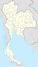
Nakhon Ratchasima Airport (IATA: NAK, ICAO: VTUQ), is in Tha Chang subdistrict, Chaloem Phra Kiat district, Nakhon Ratchasima province in northeastern Thailand, approximately 26 kilometers east of downtown Nakhon Ratchasima.[1]
Airlines and destinations
Notes
References
- ^ "(NAK) Nakhon Ratchasima Airport Overview". FlightStats. Retrieved 1 July 2015.
External links
 Nakhon Ratchasima travel guide from Wikivoyage


