Christ Church Meadow, Oxford: Difference between revisions
mNo edit summary |
Mateus2019 (talk | contribs) m (GR) File renamed: File:Oxford Skyline from Chirst Church Meadow, July 24, 2023.jpg → File:Oxford Skyline from Christ Church Meadow, July 24, 2023.jpg Criterion 3 (obvious error) |
||
| Line 17: | Line 17: | ||
Postwar development planned for central Oxford included a [[bypass (road)|relief road]] passing through the meadow and joining the district of [[St Ebbe's]].<ref>{{cite news|url=http://www.oxfordmail.co.uk/news/10758096.Fifty_years_later_and_Christ_Church_Meadow_relief_road_is_unthinkable/|title=Fifty years later and Christ Church Meadow relief road is unthinkable|first=Damian|last=Fantato|newspaper=[[Oxford Mail]]|date=24 October 2013|accessdate=3 June 2014}}</ref><ref>{{cite news|url=http://www.oxfordmail.co.uk/news/10758096.Fifty_years_later_and_Christ_Church_Meadow_relief_road_is_unthinkable/|title=The road that never was|first=Damian|last=Fantato|newspaper=[[The Oxford Times]]|date=25 October 2013|accessdate=3 June 2014}}</ref> The proposal was finally defeated in 1971 after vigorous opposition. |
Postwar development planned for central Oxford included a [[bypass (road)|relief road]] passing through the meadow and joining the district of [[St Ebbe's]].<ref>{{cite news|url=http://www.oxfordmail.co.uk/news/10758096.Fifty_years_later_and_Christ_Church_Meadow_relief_road_is_unthinkable/|title=Fifty years later and Christ Church Meadow relief road is unthinkable|first=Damian|last=Fantato|newspaper=[[Oxford Mail]]|date=24 October 2013|accessdate=3 June 2014}}</ref><ref>{{cite news|url=http://www.oxfordmail.co.uk/news/10758096.Fifty_years_later_and_Christ_Church_Meadow_relief_road_is_unthinkable/|title=The road that never was|first=Damian|last=Fantato|newspaper=[[The Oxford Times]]|date=25 October 2013|accessdate=3 June 2014}}</ref> The proposal was finally defeated in 1971 after vigorous opposition. |
||
{{Wide image|Oxford Skyline from |
{{Wide image|Oxford Skyline from Christ Church Meadow, July 24, 2023.jpg|800px|[[Oxford]] skyline seen from Christ Church Meadow}} |
||
{{clear}} |
{{clear}} |
||
Latest revision as of 12:12, 14 October 2024


Christ Church Meadow is a flood-meadow and popular walking and picnic spot in Oxford, England.[1]
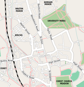
Roughly triangular in shape, it is bounded by the River Thames (the stretch through Oxford being known as "The Isis"), the River Cherwell, and Christ Church. The meadow provides access to many of the college boathouses, which are on an island at the confluence of the two rivers. The lower sections of the meadow, close to the Thames, are grazed by cattle (including Longhorn cows[2]) while the upper sections have sports fields. Broad Walk is at the northern edge with Merton Field to the north and Merton College, dominated by the tower of Merton College Chapel, beyond that.
Christ Church Meadow is owned by Christ Church, and is thus the private property of the college; however, access is allowed during the day. Access starts very early to allow rowers to go to the boathouses. Eights Week and Torpids, Oxford University's two main rowing events, and Christ Church Regatta are held on the Thames here. In past times, ornamental wooden barges were moored on the river here to store boats and house spectators. However, these have all now been replaced by boathouses.
The meadow can be accessed from St Aldate's to the northwest via Broad Walk through the Christ Church War Memorial Garden, from the north in Merton Street via Grove Walk and Merton Walk, and from the eastern end of the High Street via Rose Lane near the Oxford Botanic Garden to the northeast. There is also less-used access from near the Head of the River public house by Folly Bridge on the River Thames to the southwest, connecting to Poplar Walk (created by Henry Liddell in 1872) and the path by the river. All entrances are via railinged gates that are locked at night.
James Sadler made the first ascent in a balloon by an Englishman from the Meadow on 4 October 1784.[3] The balloon rose to a height of around 3,600 feet and landed six miles away near the village of Wood Eaton near Islip to the northeast of Oxford. A plaque notes the event. The Meadow was also the location where the medieval royal pretender John Deydras claimed to have been persuaded by the devil to impersonate Edward II in 1318.[4]
Postwar development planned for central Oxford included a relief road passing through the meadow and joining the district of St Ebbe's.[5][6] The proposal was finally defeated in 1971 after vigorous opposition.
Gallery
[edit]-
The Meadow Building[7] of Christ Church as seen from Broad Walk on the far northwestern corner of the Christ Church Meadow
-
Rowing on the Isis at Christ Church Meadow
-
A view of the Great Tower, Magdalen College, from the north eastern edge of the Christ Church Meadow, near its border with the Oxford Botanic Garden
-
A view from the Christ Church Meadow looking north east towards the Great Tower of Magdalen College
-
View north of Merton College from Christ Church Meadow across Merton Field
-
View north of Merton College from across Merton Field north of Christ Church Meadow
References
[edit]- ^ "Christ Church Meadow Walk at Christ Church". [Visit Oxfordshire]. Retrieved 7 June 2014.
- ^ "A Brief Guide to the Meadow | Christ Church, Oxford University". www.chch.ox.ac.uk. Retrieved 7 November 2021.
- ^ "Inscriptions: James Sadler's balloon flight". [Oxford History]. UK. Retrieved 27 May 2014.
- ^ Doherty, Paul (2003). Isabella and the Strange Death of Edward II. London: Robinson. p. 61.
- ^ Fantato, Damian (24 October 2013). "Fifty years later and Christ Church Meadow relief road is unthinkable". Oxford Mail. Retrieved 3 June 2014.
- ^ Fantato, Damian (25 October 2013). "The road that never was". The Oxford Times. Retrieved 3 June 2014.
- ^ Fuller, Richard (2004). "Photographs: Oxford".
Further reading
[edit]- Bill, E. G. W. (1965). Christ Church Meadow. Oxford: Oxford University Press.
External links
[edit]- Christ Church Meadow information from Christ Church, Oxford


![The Meadow Building[7] of Christ Church as seen from Broad Walk on the far northwestern corner of the Christ Church Meadow](/upwiki/wikipedia/commons/thumb/6/63/The_Christ_Church_Meadow_adjacent_to_the_Meadow_Building.jpg/120px-The_Christ_Church_Meadow_adjacent_to_the_Meadow_Building.jpg)


