Jasen, Ilirska Bistrica: Difference between revisions
Appearance
Content deleted Content added
m Bot) Add coordinates_region and/or _display parameters (report errors? |
m Disperse category and/or GFs using AWB |
||
| Line 3: | Line 3: | ||
|other_name = |
|other_name = |
||
|native_name = <!-- for cities whose native name is not in English --> |
|native_name = <!-- for cities whose native name is not in English --> |
||
|nickname = |
|nickname = |
||
|settlement_type = <!--For Town or Village (Leave blank for the default City)--> |
|settlement_type = <!--For Town or Village (Leave blank for the default City)--> |
||
|motto = |
|motto = |
||
|image_skyline = |
|image_skyline = |
||
|imagesize = 250px |
|imagesize = 250px |
||
|image_caption = |
|image_caption = |
||
|image_flag = |
|image_flag = |
||
|flag_size = |
|flag_size = |
||
|image_seal = |
|image_seal = |
||
|seal_size = |
|seal_size = |
||
|image_shield = |
|image_shield = |
||
|shield_size = |
|shield_size = |
||
|image_blank_emblem = |
|image_blank_emblem = |
||
|blank_emblem_type = |
|blank_emblem_type = |
||
|blank_emblem_size = |
|blank_emblem_size = |
||
|image_map = |
|image_map = |
||
|mapsize = |
|mapsize = |
||
|map_caption = |
|map_caption = |
||
|image_map1 = |
|image_map1 = |
||
|mapsize1 = |
|mapsize1 = |
||
|map_caption1 = |
|map_caption1 = |
||
|image_dot_map = |
|image_dot_map = |
||
|dot_mapsize = |
|dot_mapsize = |
||
| Line 35: | Line 35: | ||
|subdivision_type = Country |
|subdivision_type = Country |
||
|subdivision_name = [[Image:Flag of Slovenia.svg|25px]] [[Slovenia]] |
|subdivision_name = [[Image:Flag of Slovenia.svg|25px]] [[Slovenia]] |
||
|subdivision_type1 = Region |
|subdivision_type1 = Region |
||
|subdivision_name1 = [[Inner Carniola]] |
|subdivision_name1 = [[Inner Carniola]] |
||
|subdivision_type2 = [[Municipalities of Slovenia|Municipality]] |
|subdivision_type2 = [[Municipalities of Slovenia|Municipality]] |
||
|subdivision_name2 = [[Ilirska Bistrica]] |
|subdivision_name2 = [[Ilirska Bistrica]] |
||
|subdivision_type3 = |
|subdivision_type3 = |
||
|subdivision_name3 = |
|subdivision_name3 = |
||
|subdivision_type4 = |
|subdivision_type4 = |
||
|subdivision_name4 = |
|subdivision_name4 = |
||
|leader_name = |
|leader_name = |
||
| Line 52: | Line 52: | ||
|leader_title4 = |
|leader_title4 = |
||
|leader_name4 = |
|leader_name4 = |
||
|established_title = |
|established_title = |
||
|established_date = |
|established_date = |
||
|established_title2 = |
|established_title2 = |
||
|established_date2 = |
|established_date2 = |
||
|established_title3 = |
|established_title3 = |
||
|established_date3 = |
|established_date3 = |
||
|area_magnitude = |
|area_magnitude = |
||
|area_footnotes = |
|area_footnotes = |
||
|area_total_km2 =2.26 |
|area_total_km2 =2.26 |
||
| Line 90: | Line 90: | ||
|population_blank2_title =Religions |
|population_blank2_title =Religions |
||
|population_blank2 = |
|population_blank2 = |
||
|population_density_blank1_km2 = |
|population_density_blank1_km2 = |
||
|population_density_blank1_sq_mi = |
|population_density_blank1_sq_mi = |
||
|timezone = |
|timezone = |
||
|utc_offset = |
|utc_offset = |
||
|timezone_DST = |
|timezone_DST = |
||
|utc_offset_DST = |
|utc_offset_DST = |
||
|latd=45|latm=33|lats=27.4 |latNS=N |
|latd=45|latm=33|lats=27.4 |latNS=N |
||
|longd=14|longm=15|longs=38.77 |longEW=E |
|longd=14|longm=15|longs=38.77 |longEW=E |
||
| Line 108: | Line 108: | ||
|blank1_name = |
|blank1_name = |
||
|blank1_info = |
|blank1_info = |
||
|website = |
|website = |
||
|footnotes = <ref>[http://www.stat.si/eng/index.asp Statistical Office of the Republic of Slovenia]</ref> |
|footnotes = <ref>[http://www.stat.si/eng/index.asp Statistical Office of the Republic of Slovenia]</ref> |
||
}} |
}} |
||
'''Jasen''' is a settlement immediately to the south east of [[Ilirska Bistrica]] in the [[Inner Carniola]] region of [[Slovenia]].<ref>[http://www.ilirska-bistrica.si Ilirska Bistrica Municipality site]</ref> |
'''Jasen''' is a settlement immediately to the south east of [[Ilirska Bistrica]] in the [[Inner Carniola]] region of [[Slovenia]].<ref>[http://www.ilirska-bistrica.si Ilirska Bistrica Municipality site]</ref> |
||
The small church in the settlement is dedicated to [[Joachim|Saint Joachim]] and belongs to the Ilirska Bistrica [[Parish]].<ref>[http://kp.rkc.si/dokumenti/zupnije/seznam.pdf Koper Diocese list of churches]</ref> |
The small church in the settlement is dedicated to [[Joachim|Saint Joachim]] and belongs to the Ilirska Bistrica [[Parish]].<ref>[http://kp.rkc.si/dokumenti/zupnije/seznam.pdf Koper Diocese list of churches]</ref> |
||
== |
==References== |
||
{{Reflist}} |
{{Reflist}} |
||
== |
==External links== |
||
*[http://www.geopedia.si/Geopedia_en.html#L5567_F10090920_T1193_vF_b4_x474446.5_y115698.5_s16 Jasen on Geopedia] |
*[http://www.geopedia.si/Geopedia_en.html#L5567_F10090920_T1193_vF_b4_x474446.5_y115698.5_s16 Jasen on Geopedia] |
||
{{Ilirska Bistrica}} |
{{Ilirska Bistrica}} |
||
| ⚫ | |||
[[Category:Populated places in Slovenia]] |
[[Category:Populated places in Slovenia]] |
||
| ⚫ | |||
[[nl:Jasen (Ilirska Bistrica)]] |
[[nl:Jasen (Ilirska Bistrica)]] |
||
Revision as of 21:44, 3 September 2010
Jasen | |
|---|---|
| Country | |
| Region | Inner Carniola |
| Municipality | Ilirska Bistrica |
| Area | |
• Total | 2.26 km2 (0.87 sq mi) |
| Elevation | 412.5 m (1,353.3 ft) |
| Population (2002) | |
• Total | 259 |
| [1] | |
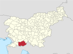
Jasen is a settlement immediately to the south east of Ilirska Bistrica in the Inner Carniola region of Slovenia.[2]
The small church in the settlement is dedicated to Saint Joachim and belongs to the Ilirska Bistrica Parish.[3]
References
External links

