Czerwieniec, Pomeranian Voivodeship: Difference between revisions
Appearance
Content deleted Content added
No edit summary |
Hmainsbot1 (talk | contribs) m AWB general fixes and delink dates per WP:DATELINK, WP:YEARLINK and MOS:UNLINKYEARS using AWB (8097) |
||
| Line 34: | Line 34: | ||
'''Czerwieniec''' {{IPAc-pl|cz|e|r|'|w|j|e|ń|e|c}} is a [[village]] in the administrative district of [[Gmina Potęgowo]], within [[Słupsk County]], [[Pomeranian Voivodeship]], in northern [[Poland]].<ref name="TERYT">{{cite web |url=http://www.stat.gov.pl/broker/access/prefile/listPreFiles.jspa |title=Central Statistical Office (GUS) - TERYT (National Register of Territorial Land Apportionment Journal) |date=2008-06-01 |language=Polish}}</ref> It lies approximately {{convert|6|km|mi|0}} north-east of [[Potęgowo, Słupsk County|Potęgowo]], {{convert|35|km|mi|0|abbr=on}} east of [[Słupsk]], and {{convert|72|km|mi|0|abbr=on}} west of the regional capital [[Gdańsk]]. |
'''Czerwieniec''' {{IPAc-pl|cz|e|r|'|w|j|e|ń|e|c}} is a [[village]] in the administrative district of [[Gmina Potęgowo]], within [[Słupsk County]], [[Pomeranian Voivodeship]], in northern [[Poland]].<ref name="TERYT">{{cite web |url=http://www.stat.gov.pl/broker/access/prefile/listPreFiles.jspa |title=Central Statistical Office (GUS) - TERYT (National Register of Territorial Land Apportionment Journal) |date=2008-06-01 |language=Polish}}</ref> It lies approximately {{convert|6|km|mi|0}} north-east of [[Potęgowo, Słupsk County|Potęgowo]], {{convert|35|km|mi|0|abbr=on}} east of [[Słupsk]], and {{convert|72|km|mi|0|abbr=on}} west of the regional capital [[Gdańsk]]. |
||
Before |
Before 1648 the area was part of Duchy of Pomerania, 1648-1945 Prussia and Germany. For the history of the region, see ''[[History of Pomerania]]''. |
||
The village has a population of 138. |
The village has a population of 138. |
||
Revision as of 22:29, 3 August 2012
Czerwieniec | |
|---|---|
Village | |
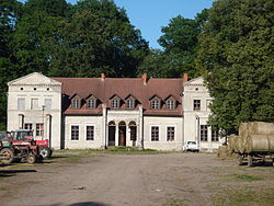
 Manor house in Czerwieniec | |
| Country | |
| Voivodeship | Pomeranian |
| County | Słupsk County |
| Gmina | Potęgowo |
| Population | 138 |
Wikimedia Commons has media related to Czerwieniec (Pomeranian Voivodeship).
Czerwieniec [t͡ʂɛrˈvjɛɲɛt͡s] is a village in the administrative district of Gmina Potęgowo, within Słupsk County, Pomeranian Voivodeship, in northern Poland.[1] It lies approximately 6 kilometres (4 mi) north-east of Potęgowo, 35 km (22 mi) east of Słupsk, and 72 km (45 mi) west of the regional capital Gdańsk.
Before 1648 the area was part of Duchy of Pomerania, 1648-1945 Prussia and Germany. For the history of the region, see History of Pomerania.
The village has a population of 138.
References

