Sarso Island: Difference between revisions
Appearance
Content deleted Content added
No edit summary |
No edit summary |
||
| Line 1: | Line 1: | ||
{{Location map|Saudi Arabia|caption=Approximate location of Farasan Islands|lat_deg=16.50|lon_deg=41.35}} |
{{Location map|Saudi Arabia|caption=Approximate location of Farasan Islands|lat_deg=16.50|lon_deg=41.35}} |
||
'''Saso Island''' is an island off the coast of [[Saudi Arabia]]. It is part of the [[Farasan Islands]]. It is located in the [[Red Sea]] at {{coord|16.50|N|41.35|E|type:isle}}. In the 15th century, there was a recognised [[navigation route]] to the west of the island. |
'''Saso Island''' is an island off the coast of [[Saudi Arabia]]. It is part of the [[Farasan Islands]]. It is located in the [[Red Sea]] at {{coord|16.50|N|41.35|E|type:isle}}. In the 15th century, there was a recognised [[navigation route]] to the west of the island. its size is about 22.6 sq km. |
||
==References== |
==References== |
||
Revision as of 22:29, 9 February 2016
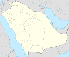
Approximate location of Farasan Islands
Saso Island is an island off the coast of Saudi Arabia. It is part of the Farasan Islands. It is located in the Red Sea at 16°30′N 41°21′E / 16.50°N 41.35°E. In the 15th century, there was a recognised navigation route to the west of the island. its size is about 22.6 sq km.
References
- http://paleodb.org/cgi-bin/bridge.pl?action=displayCollectionDetails&collection_no=55374
- G. R. Tibbetts (1961). "Arab Navigation in the Red Sea". The Geographical Journal. 127 (3). Blackwell Publishing: 322–334. doi:10.2307/1794953. JSTOR 1794953.

