Gillette–Campbell County Airport: Difference between revisions
Zhayden123 (talk | contribs) No edit summary |
Zhayden123 (talk | contribs) |
||
| Line 59: | Line 59: | ||
== Facilities== |
== Facilities== |
||
The airport covers 759 [[acre]]s (307 [[hectare|ha]]) at an [[elevation]] of 4,364 feet (1,330 m). It has two concrete [[runway]]s: 16/34 is 7, |
The airport covers 759 [[acre]]s (307 [[hectare|ha]]) at an [[elevation]] of 4,364 feet (1,330 m). It has two concrete [[runway]]s: 16/34 is 7,500 by 150 feet (2,286 x 46 m) and 3/21 is 5,803 by 75 feet (1,769 x 23 m).<ref name="FAA" /> |
||
In 2011 the airport had 23,082 aircraft operations, average 63 per day: 69% [[general aviation]], 31% [[air taxi]], and <1% airline. 52 aircraft were then based at the airport: 87% single-engine, 12% multi-engine, and 2% jet.<ref name="FAA" /> |
In 2011 the airport had 23,082 aircraft operations, average 63 per day: 69% [[general aviation]], 31% [[air taxi]], and <1% airline. 52 aircraft were then based at the airport: 87% single-engine, 12% multi-engine, and 2% jet.<ref name="FAA" /> |
||
Revision as of 02:46, 1 April 2015
Gillette–Campbell County Airport | |||||||||||||||
|---|---|---|---|---|---|---|---|---|---|---|---|---|---|---|---|
| Summary | |||||||||||||||
| Airport type | Public | ||||||||||||||
| Owner | Campbell County | ||||||||||||||
| Serves | Gillette, Wyoming | ||||||||||||||
| Elevation AMSL | 4,364 ft / 1,330 m | ||||||||||||||
| Website | www | ||||||||||||||
| Map | |||||||||||||||
 | |||||||||||||||
| Runways | |||||||||||||||
| |||||||||||||||
| Statistics (2011) | |||||||||||||||
| |||||||||||||||
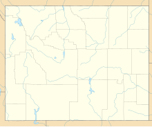
Gillette–Campbell County Airport (IATA: GCC, ICAO: KGCC, FAA LID: GCC) is five miles northwest of Gillette in Campbell County, Wyoming.[1] It has scheduled airline flights.
Federal Aviation Administration records say the airport had 28,232 passenger boardings (enplanements) in calendar year 2008,[2] 26,869 in 2009 and 29,230 in 2010.[3] The National Plan of Integrated Airport Systems for 2011–2015 categorized it as a primary commercial service airport (more than 10,000 enplanements per year).[4]
Facilities
The airport covers 759 acres (307 ha) at an elevation of 4,364 feet (1,330 m). It has two concrete runways: 16/34 is 7,500 by 150 feet (2,286 x 46 m) and 3/21 is 5,803 by 75 feet (1,769 x 23 m).[1]
In 2011 the airport had 23,082 aircraft operations, average 63 per day: 69% general aviation, 31% air taxi, and <1% airline. 52 aircraft were then based at the airport: 87% single-engine, 12% multi-engine, and 2% jet.[1]
Airlines and destinations
Scheduled passenger service:
| Airlines | Destinations |
|---|---|
| Delta Connection | Rock Springs, Salt Lake City |
| United Express | Denver |
Charter carriers
References
- ^ a b c d FAA Airport Form 5010 for GCC PDF. Federal Aviation Administration. Effective April 5, 2012.
- ^
"Enplanements for CY 2008" (PDF, 1.0 MB). CY 2008 Passenger Boarding and All-Cargo Data. Federal Aviation Administration. December 18, 2009.
{{cite web}}: External link in|work= - ^
"Enplanements for CY 2010" (PDF, 189 KB). CY 2010 Passenger Boarding and All-Cargo Data. Federal Aviation Administration. October 4, 2011.
{{cite web}}: External link in|work= - ^
"2011–2015 NPIAS Report, Appendix A" (PDF, 2.03 MB). National Plan of Integrated Airport Systems. Federal Aviation Administration. October 4, 2010.
{{cite web}}: External link in|work=
External links
- Gillette–Campbell County Airport, official site
- Flightline, Inc., the fixed base operator (FBO)
- Aerial image as of June 1994 from USGS The National Map
- FAA Airport Diagram (PDF), effective December 26, 2024
- FAA Terminal Procedures for GCC, effective December 26, 2024
- Resources for this airport:
- FAA airport information for GCC
- AirNav airport information for KGCC
- ASN accident history for GCC
- FlightAware airport information and live flight tracker
- NOAA/NWS weather observations: current, past three days
- SkyVector aeronautical chart, Terminal Procedures

