Yaté: Difference between revisions
Appearance
Content deleted Content added
No edit summary |
Thricecube (talk | contribs) No edit summary |
||
| Line 18: | Line 18: | ||
|elevation max m = 1501 |
|elevation max m = 1501 |
||
|area km2 = 1338.4 |
|area km2 = 1338.4 |
||
|population = |
|population = 1747 |
||
|population date = |
|population date = 2014 census |
||
|ethnic = [[Kanak people|Kanak]]s 95.5%<br>[[European ethnic groups|European]]s 3.8%<br>[[Polynesia]]ns 0.1%<br>Other 0.6% |
|ethnic = [[Kanak people|Kanak]]s 95.5%<br>[[European ethnic groups|European]]s 3.8%<br>[[Polynesia]]ns 0.1%<br>Other 0.6% |
||
|ethnic date = 1996 census |
|ethnic date = 1996 census |
||
Revision as of 16:08, 21 December 2015
Yaté | |
|---|---|
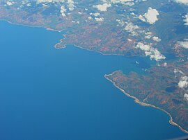
 Ouinné, a mining site in the commune of Yaté | |
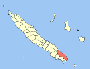
 Location of the commune (in red) within New Caledonia | |
| Country | France |
| Sui generis collectivity | New Caledonia |
| Province | South Province |
| Government | |
| • Mayor | Adolphe Kamébo Digoué |
Area 1 | 1,338.4 km2 (516.8 sq mi) |
| Population (2014 census) | 1,747 |
| • Density | 1.3/km2 (3.4/sq mi) |
| Ethnic distribution | |
| • 1996 census | Kanaks 95.5% Europeans 3.8% Polynesians 0.1% Other 0.6% |
| Time zone | UTC+11:00 |
| INSEE/Postal code | 98832 /98834 |
| Elevation | 0–1,501 m (0–4,925 ft) (avg. 20 m or 66 ft) |
| 1 New Caledonia Land Register (DITTT) data, which exclude lakes and ponds larger than 1 km² (0.386 sq mi or 247 acres) as well as the estuaries of rivers. | |
Yaté is a commune in the South Province of New Caledonia, an overseas territory of France in the Pacific Ocean. The Yaté Dam and Blue River Provincial Park are located within the commune.
Wikimedia Commons has media related to Yaté.

